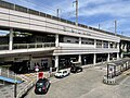
Kyu Jozo Shikenjo Daiichi Kojo, Kita Ward
Article

13117 / きたく

Tokyo

Kita Ward

Beer-brewing plants adapted in brick.

Kyu Jozo Shikenjo Daiichi Kojo

Photo by 柏木村民 (CC0)

01 / Shell mound

A pit inferred to be a facility for opening shellswas found alongside a shell layer 4 m thick.

Nakazato Shell Mound is a National Historic Site. The Agency for Cultural Affairs infers that a pit found in the 1996 (Heisei 8) survey was a facility where shellfish were put in water, boiled with heated stones and opened, and records the mound as left by people who processed shellfish together on a beach away from the settlements. The dugout canoe from the Nakazato site is Tokyo-designated.

  • September 6, 2000: National Historic Site
  • Shell layer up to 4.5 m or more thick (100 m or more north-south, 500 m or more east-west)
  • 1996 (Heisei 8) survey: 2 pits
  • Dugout canoe from the Nakazato site: Tokyo-designated (579 cm long)

02 / Monument

To mark Yoshimune opening Asukayama to the public,a monument was erected in 1737 (Genbun 2).

Monument in Kita Ward
Photo by 遠枝 (CC BY-SA 4.0)

The Asukayama Monument is a Tokyo Metropolitan Tangible Cultural Property. According to the Tokyo Metropolitan Board of Education, the head priest of Kinrin-ji, the administering temple of Oji Gongen Shrine, erected it to commemorate the eighth shogun Yoshimune developing Asukayama and opening it to ordinary people as a pleasure ground. The stone was presented from Kishu and had stood at Takimi-tei inside Edo Castle.

  • Erected 1737 (Genbun 2)
  • 218.5 cm high, 215 cm wide, 34.5 cm thick
  • Stone presented from Kishu, from Takimi-tei inside Edo Castle

03 / Garden

Conder designed the house on the plateau;Ogawa Jihei's Japanese garden lies on the slope below.

Garden in Kita Ward
Photo by Suikotei (CC BY-SA 4.0)

Kyu-Furukawa Gardens is a National Place of Scenic Beauty. The Agency for Cultural Affairs, which lists it as Kyu-Furukawa-shi Teien, records that the Western-style house and the formal garden around it were designed by Josiah Conder and completed in 1917 (Taisho 6), and that the strolling Japanese garden from the slope below the plateau to the low ground was completed in 1919 (Taisho 8) by Ogawa Jihei VII (Ueji).

  • January 26, 2006: National Place of Scenic Beauty
  • Western-style house completed 1917 (Taisho 6)
  • Japanese garden completed 1919 (Taisho 8)

Kita Ward from the sky

Now and 1974–78. Tap a photo to zoom in.

Wide (about 6 km across)

Close (about 1.5 km across)

Now (shot June–November 2019)Shot 1974–78

Source: Geospatial Information Authority of Japan (GSI) GSI Tiles(全国最新写真(シームレス)/国土画像情報(第一期:1974〜1978年撮影))

Open in GSI Maps (now)Open in GSI Maps (1974–78)

Living here

17 minutes from Tokyo to Oji by the Keihin-Tohoku Line rapid.

  • about 360,000 people
  • 30 min to a city centre

By the JR Keihin-Tohoku Line rapid service, it takes as little as 16 minutes from Tokyo Station to Oji Station (JR East timetable, October 2026). The Ward's guide gives directions to Kita Ward Office Building No. 1 from JR Oji Station.

People living here
355,213people
19952020

+4.1% since 2015

334,127 → 355,213

Area
20.61km²

20.61km² of it habitable

2024

Households
189,700households

1.9 people per household

2020

Rent (average for rentals)
78,963yen

National average 60,630 yen

2023

Healthcare
19 hospitals / 294 clinics

8.8 per 10,000 people

2023

Almost entirely flat.Almost all of it is habitable land (100.0%)
Area and habitable land at the same scalee-Stat B1101 / B1103
Children waiting for childcare
—73 nurseries and similar
Home purchase subsidy
—
Average annual temperature
—

These 3 items are waiting on a nationwide data source. We do not fill them with estimates.

ACCESS

Where you can go from here.

Kita Ward in Japan35.753°N 139.734°E
OsakaKita Ward
Oji Station
王子駅2023
  • to TokyoJR Keihin-Tohoku Line16min

Travel times follow JR東日本の駅の時刻表(東京駅・京浜東北線・根岸線 上野・赤羽方面〈北行〉の平日・土曜休日)の列車ページ254本から、東京の発→王子の着を列車ごとに数えた (checked 2026-10-23). They vary by time of day.

Shape

Borders 7 municipalities across 1 prefectures.

Territory of Kita Ward
Boundaries: National Land Numerical Information (Administrative Area Data), MLIT. Processed by Machigatari.

Kita Ward isthis kind of town.

  1. 01Kyu Jozo Shikenjo Daiichi Kojo is a brick building in Takinogawa 2-chome. The Jozo Shikenjo was a research institution set up by the Meiji government to study sake and improve brewing techniques and quality, and its First Plant was completed in Meiji 37. The Agency for Cultural Affairs records that Tsumaki Yorinaka designed it by adapting German beer-brewing facilities. It is a National Important Cultural Property
  2. 02Nakazato Shell Mound is a National Historic Site, the Asukayama Monument is a Tokyo Metropolitan Tangible Cultural Property, and Kyu-Furukawa Gardens is a National Place of Scenic Beauty. The ward also holds Nishigahara Ichirizuka, a National Historic Site, and the Ginkgo Tree at Oji Shrine, a Tokyo Metropolitan Natural Monument
  3. 03At the Ukimagahara Primrose Field, the Ward writes, local farmers began cultivating primroses left in old family homes in 1955 (Showa 30) and succeeded in 1962 (Showa 37). Oji Station is 17 minutes from Tokyo Station by the Keihin-Tohoku Line rapid

See the town as it is now.

Source: Wikidata (P2002, P2003, P2013, P2397)

If something caught your eye, ask the town itself.