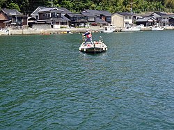
Omijima Whale Grave.jpg
Article

35211 / ながとし

Yamaguchi Prefecture

Nagato City

A grave was built for whale fetuses.

Ōmijima Whale Grave

Photo by MChew (CC BY-SA 4.0)

01 / Akasaki Shrine Gaku-sajiki

The right to occupy the seatswas bought and sold at high prices.
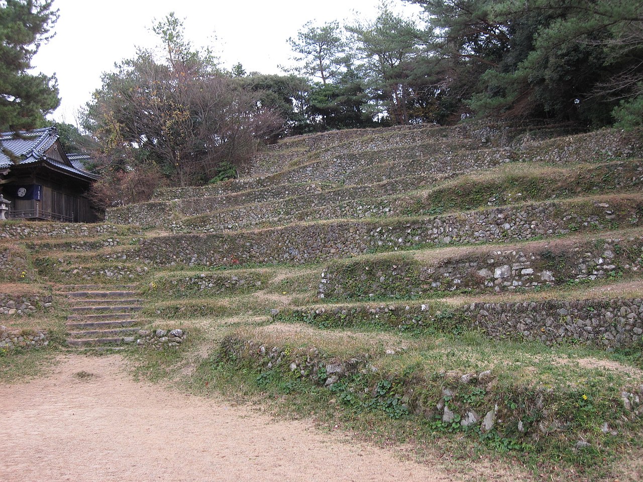
Gakusajiki d 02.jpg
Photo by 茂林寺たぬき (CC BY-SA 4.0)

Southwest of Akasaki Shrine, terraced seating (takasajiki and hirasajiki) lines a bowl-shaped hollow in a horseshoe. The occupancy rights of about 130 high and 70 flat seats were traded, and when the site was designated in 1963 every rights-holder offered their rights to the shrine.

  • About 130 high and 70 flat seats
  • Occupancy rights were traded
  • Nationally designated Important Tangible Folk Cultural Property (1963)

02 / Ōmijima

The rocks painted in the great muralof the Imperial Palace are modeled on Ōmijima's.

青海島海上アルプス.jpg
Photo by 吉田宅浪 (CC BY-SA 3.0)

The rocks in Higashiyama Kaii's mural "Asaake no Ushio" (1968) are modeled on those of Ōmijima. Sea cliffs, caves and rock pillars line its east and north coasts, and in 1930 Yokoyama Kendō described the scenery as the "Alps of the sea" (Kaijō Arupusu). It became a national Place of Scenic Beauty and Natural Monument in 1926.

  • Mural "Asaake no Ushio" dates from 1968
  • Sea cliffs exceed 100 meters
  • National Place of Scenic Beauty and Natural Monument (designated 1926)

03 / Kunichika Kyūsuke's Rock Tunnel

He cut a tunnel for irrigation waterthrough a great rock, in five years with chisel and mallet.

In the Anei era (1772–1780), a great rock stood along a waterway of about 1 km that carried water to southern Higashi-Fukawa, and villagers struggled each year to repair the wooden flume that detoured around it. Kunichika Kyūsuke of Era opened a hole 1 m in diameter and 13 m long, and was praised as "Iwaana Oniemon" (Rock-Tunnel Oniemon).

  • 1 m in diameter, 13 m long
  • Praised as "Iwaana Oniemon"
  • Municipal Historic Site (1984)

Living here

Facing the Sea of Japan, with five hot-spring districts.

  • about 30,000 people

Nagato lies in northwestern Yamaguchi, bordering Hagi to the east and Shimonoseki and Mine to the south. The city covers 357.31 km² and has five hot-spring districts: Yumoto, Tawarayama, Yumen, Kiwado and Yuyawan. The JR Mine Line remains suspended after storm damage, and replacement buses run instead.

People living here
32,519people
20052020

−8.2% since 2015

41,127 → 32,519

Area
357.31km²

88.63km² of it habitable

2024

Households
14,135households

2.3 people per household

2020

Rent (average for rentals)
36,057yen

National average 60,630 yen

2023

Healthcare
5 hospitals / 25 clinics

9.2 per 10,000 people

2023

Area357.31km²Habitable land88.63km² / 25%
Area and habitable land at the same scalee-Stat B1101 / B1103

Population from 2005 onward (municipal boundary changed).2005-03-22 に合併。2005年調査から市域が変わっている。

Children waiting for childcare
—9 nurseries and similar
Home purchase subsidy
—
Average annual temperature
—

These 3 items are waiting on a nationwide data source. We do not fill them with estimates.

Shape

Borders 3 municipalities.

Nagato City in Japan34.370°N 131.183°E
TokyoOsakaNagato City
Territory of Nagato City
Boundaries: National Land Numerical Information (N03)

North to south

20.0km

下関市, 美祢市, 萩市

Travel times per leg are not published by the municipality, so they are not shown.

Nagato City isthis kind of town.

  1. 01In Kayoi on Ōmijima stands the Ōmijima Whale Grave, a grave for whale fetuses built by the whaling-crew leaders. Over more than 200 years up to the Meiji era, more than 70 whale fetuses were buried behind it.
  2. 02Akasaki Shrine in Higashi-Fukawa has the Gaku-sajiki seating, and Ōmijima's rocks are the model for those in a great mural in the Imperial Palace. In Era, a rock tunnel for irrigation water was cut by Kunichika Kyūsuke.
  3. 03In Senzaki, the Kaneko Misuzu Memorial Museum stands on the site of the bookshop where she spent her childhood. The city faces the Sea of Japan and has five hot-spring districts including Yumoto and Tawarayama.

See the town as it is now.

Source: Wikidata (P2002, P2003, P2013, P2397)

If something caught your eye, ask the town itself.