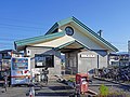
Medical office of Dr. Sugiura.JPG
Article

19384 / しょうわちょう

Yamanashi Prefecture 中巨摩郡

Showa Town

English and kanji signs flank the door.

Sugiura House, former clinic

Photo by さかおり (CC BY-SA 3.0)

01 / Genji fireflies

A stone in Oshikoshi stands for firefliesonce a national natural monument.
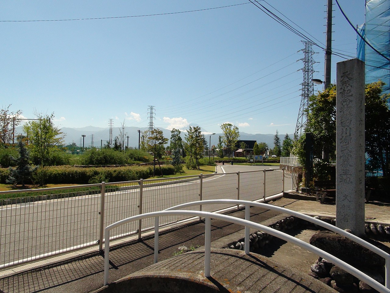
Kamata river habitat Luciola cruciata natural monument stone tablets.JPG
Photo by Sakaori (CC BY-SA 3.0)

By the town's account, the fireflies of the Kamata River basin were designated a national natural monument in October 1930 (Showa 5). Later they were hardly seen, and the designation was lifted in March 1976 (Showa 51). A stone stands in a park in Oshikoshi, and fireflies are designed into the emblems of the town's elementary and junior high schools.

  • National natural monument, October 1930
  • Designation lifted, March 1976
  • Fireflies on school emblems

02 / Place names

The town reads the Kamanashi River'sold course from two names, Kasai and Kato.

霞堤 - panoramio.jpg
Photo by 浅野ます道 (CC BY 3.0)

The town's page on place names says Kasai was a village west of the Kamanashi River, and that Kamigato is said to take its name from lying east of it. Its Kasai entry sets the name against Kato and reads it as showing that, before the levee was built, the river ran south between the two districts. Kasai has a park named for the Kasumi levee.

  • Kasai: a village west of the river
  • Kamigato: named for lying east of it
  • Before the levee, the river ran between

03 / Kamisukiawara

Kamisukiawara, a hamlet said to have madepaper with its spring water.

The town's page says awara is a word for a place with water, and that a papermaking trade is said to have begun there using abundant spring water. The name also appears in a seal-stamped order of Tokugawa Ieyasu dated Tensho 11 (1583). The town's list of cultural properties includes a double-figure dosojin, a roadside stone carved with an affectionate man and woman.

  • Named in a 1583 (Tensho 11) order
  • Papermaking from spring water, it is said
  • Dosojin of a man and woman

Living here

17 minutes from Kofu Station on the Minobu Line.

  • about 20,000 people
  • Rural district town

By the town's guidance, the town office is a 20-minute walk from Kokubo or Joei Station on the JR Central Minobu Line, or a 3-minute walk from the Showa Town Office stop on a bus from Kofu Station bound for Yamanashi University Hospital. JR Central's station timetable guides about 17 minutes by local train from Kofu Station to Joei Station.

People living here
20,909people
19952020

+7.2% since 2015

14,590 → 20,909

Area
9.08km²

9.08km² of it habitable

2024

Households
9,117households

2.3 people per household

2020

Rent (average for rentals)
52,857yen

National average 60,630 yen

2023

Healthcare
1 hospital / 35 clinics

17.2 per 10,000 people

2023

Almost entirely flat.Almost all of it is habitable land (100.0%)
Area and habitable land at the same scalee-Stat B1101 / B1103
Children waiting for childcare
—8 nurseries and similar
Home purchase subsidy
—
Average annual temperature
—

These 3 items are waiting on a nationwide data source. We do not fill them with estimates.

ACCESS

Where you can go from here.

Showa Town in Japan35.628°N 138.535°E
OsakaShowa Town
Joei Station
常永駅2022
  • to KofuJR17min

Travel times follow JR東海『各駅の時刻表』甲府駅(身延線・身延・富士方面。2026年3月14日改正の駅時刻表PDF。右端『停車駅のご案内』。※数字は所要時間の目安で列車により異なります) (checked 2026-10-08). They vary by time of day.

Shape

Borders 4 municipalities.

Territory of Showa Town
Boundaries: National Land Numerical Information (N03)Lakes: National Land Numerical Information (Lake Data), MLIT. Processed by Machigatari. Prepared with the approval of the Director-General of the Geospatial Information Authority of Japan, using its Digital Map 25000 (Spatial Data Framework) and Digital Map 25000 (Place Names and Public Facilities). (承認番号 平27情使、第585号)

North to south

4.8km

甲府市, 中央市, 甲斐市, 南アルプス市

Showa Town isthis kind of town.

  1. 01The former clinic of the Sugiura House, on the grounds of the town's Fudo Denshokan Sugiura Iin museum, is one of five buildings registered as national Registered Tangible Cultural Properties in 2012; an English sign and the nameplate Sugiura Iin are set on either side of its door
  2. 02A stone in Oshikoshi marks fireflies that were once a national natural monument, and the town explains the origins of the names Kasai, Kamigato and Kamisukiawara
  3. 03At 9.08 km², the smallest area in the prefecture (Geospatial Information Authority of Japan); the town's environmental plan describes its terrain as flat, the only place in the prefecture without mountains

If something caught your eye, ask the town itself.