Manjumori Kofun, entrance.jpg
Article

19201 / こうふし

Yamanashi Prefecture

Kofu City

A kofun on record as a gunpowder store.

Manjumori Kofun

Photo by Saigen Jiro (CC0)

01 / Folk performance

Nine life-size puppetshave danced in Kose.

Tenzushi-mai Osasara-Sama A.JPG
Photo by Sakaori (CC BY-SA 3.0)

The Tenzushi-mai of Kose is a nationally designated Important Intangible Folk Cultural Property. Local people handle nine life-size puppets that dance to flute and wooden-drum music. The prefecture dates its origin to the medieval period and also records a myth that there were once twelve: two rose to heaven and one sank in Kagami Pond.

  • Important Intangible Folk Cultural Property (designated 1976)
  • Nine puppets
  • A myth of twelve originally

02 / Western-style school

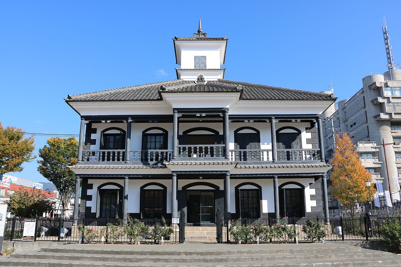
A school from Kamezawa was moved,via Takeda Shrine, to Kitaguchi.

Fujimura Memorial Hall. Nov. 2016.jpg
Photo by さかおり (CC BY-SA 4.0)

The former Mutsuzawa School building, completed in 1876 (Meiji 9), originally stood in Kamezawa, Kai City. It was moved to the grounds of Takeda Shrine in 1966 and to Kitaguchi in 2010. Said to have been encouraged by Prefectural Governor Fujimura Shiro, this pseudo-Western style is called Fujimura-style within the prefecture.

  • Important Cultural Property (designated 1967)
  • Completed 1876 (Meiji 9)
  • Moved in 1966 and 2010

03 / Dike

The dike in Mitake-chois about 35 m wide and 500 m long.

Distant view of Tsubakuro Iwa dyke cliff. D.jpg
Photo by さかおり (CC BY-SA 4.0)

The Tsubakuro-iwa dike, a national Natural Monument, is part of the volcanic rock that makes up the Kurofuji volcano. The prefecture calls its vertical joint faces magnificent, and the name is said to come from the Asian house martins that live there. The city lists it as a component of a Japan Heritage property.

  • National Natural Monument (designated 1934)
  • About 35 m wide, 500 m long
  • Component of a Japan Heritage property

Living here

85 minutes from Shinjuku by limited express, no changes.

  • about 190,000 people
  • 90 min to a city centre

The capital of Yamanashi Prefecture, with JR Kofu Station as its gateway. Chuo Main Line limited expresses Azusa and Kaiji run from Shinjuku without a change, and the fastest that runs every day takes 85 minutes. In the other direction, Kofu to Shinjuku takes 87 minutes.

People living here
189,591people
2010

−1.8% since 2015

198,992 → 189,591

Area
212.47km²

76.47km² of it habitable

2024

Households
87,019households

2.2 people per household

2020

Rent (average for rentals)
47,804yen

National average 60,630 yen

2023

Healthcare
14 hospitals / 219 clinics

12.3 per 10,000 people

2023

Area212.47km²Habitable land76.47km² / 36%
Area and habitable land at the same scalee-Stat B1101 / B1103

Population from 2010 onward (municipal boundary changed).2006-03-01 に中道町と上九一色村の北部(古関・梯)を編入。2010年調査から市域が変わっている。

Children waiting for childcare
—42 nurseries and similar
Home purchase subsidy
—
Average annual temperature
—

These 3 items are waiting on a nationwide data source. We do not fill them with estimates.

ACCESS

Where you can go from here.

Kofu City in Japan35.662°N 138.568°E
OsakaKofu City
Kofu Station
甲府駅2017
  • to ShinjukuJR limited express85min

Travel times follow JR東日本の駅時刻表(timetables.jreast.co.jp、2026年10月のダイヤ。URL階層 2610)。新宿駅の中央本線 下り(平日 0866050・土曜・休日 0866051)の特急(あずさ・かいじ)全便の列車ページを2026-10-08に読み、新宿発と甲府着を突き合わせた(都市→町の向き) (checked 2026-10-08). They vary by time of day.

Shape

Borders 10 municipalities across 1 prefectures.

Territory of Kofu City
Boundaries: National Land Numerical Information (N03)Lakes: National Land Numerical Information (Lake Data), MLIT. Processed by Machigatari. Prepared with the approval of the Director-General of the Geospatial Information Authority of Japan, using its Digital Map 25000 (Spatial Data Framework) and Digital Map 25000 (Place Names and Public Facilities). (承認番号 平27情使、第585号)

North to south

41.5km

Yamanashi Prefecture
笛吹市, 甲斐市, 山梨市, 北杜市, 中央市, 昭和町, 市川三郷町, 富士河口湖町, 身延町
Nagano Prefecture
川上村

Kofu City isthis kind of town.

  1. 01Manjumori Kofun in Yumura is a prefecturally designated historic site, a round tomb mound whose stone chamber has a record of use as a gunpowder magazine in the Edo period and later served as a hotel storeroom
  2. 02The Tenzushi-mai of Kose is an Important Intangible Folk Cultural Property and the former Mutsuzawa School building is an Important Cultural Property; Ubaguchi also has prefecturally designated puppet-play heads
  3. 03The Tsubakuro-iwa dike is a national Natural Monument. The Takeda clan residence site and Kofu Castle site are national historic sites, and Shinjuku is 85 minutes away by limited express

If something caught your eye, ask the town itself.