Shoji's Big Cedar A.jpg
Article

19430 / ふじかわぐちこまち

Yamanashi Prefecture 南都留郡

Fujikawaguchiko Town

Shrine cedar recorded at 40 m or more.

Shoji no Osugi, Suwa Shrine

Photo by さかおり (CC BY-SA 4.0)

01 / Festival

At the Kawaguchi Asama Shrine hall,girls offer a sacred kagura dance.

Kawaguchi Asama Shrine Oratory.JPG
Photo by Sakaori (CC BY-SA 3.0)

Kawaguchi no Chigo no Mai is a kagura dance by girls, offered in the worship hall of Kawaguchi Asama Shrine at the Magomi Festival (25 April) and the Daidai Mikagura Festival (28 July). The Agency for Cultural Affairs writes that it is thought to descend from the miko dance of the daidai kagura once performed by the Kawaguchi oshi, the pilgrim-guide priests of the early modern period; five pieces are handed down. It became a national Important Intangible Folk Cultural Property in 2017.

  • National Important Intangible Folk Cultural Property, designated 2017
  • Festivals on 25 April and 28 July
  • Five handed-down pieces

02 / Dugout

A dugout from Lake Saiko, made of timberfelled in the late Kamakura period.

The dugout, a prefecturally designated historical material owned by the town, was excavated from Lake Saiko: 10.85 m long and 0.8 m wide at its widest. The prefecture also designates three dugouts as tangible folk cultural properties: one 7.17 m boat found at the bottom of Lake Saiko and two found at the bottom of Lake Kawaguchi. These three are located in Funatsu.

  • 10.85 m long, 0.8 m wide
  • Prefectural designation, 7 November 1994
  • Three other boats designated 9 September 1963

03 / Cave

A lava cave that does not freeze in winteris where bats hibernate.

Inside the Lake Saiko Bat Cave A-Point.JPG
Photo by Sakaori (CC BY-SA 3.0)

Saiko Bat Cave, in Aokigahara, is called the largest of the lava caves on the northern foot of Mt. Fuji in the prefecture's cultural property guide, with a total length of 350 m. It has a great hall with a vaulted ceiling, and because it stays warm even in winter and does not freeze, many bats hibernate there. It became a national Natural Monument in 1929.

  • Total length 350 m
  • National Natural Monument, 1929
  • Four bat species in the designation text

Living here

From Shinjuku in 114 minutes by through express.

  • about 30,000 people
  • 2 hours to a city centre
  • Rural district town

The limited express Fuji Excursion runs from Shinjuku through to Kawaguchiko Station on the Fujikyuko Line without a change. It makes four round trips daily (plus one extra train in some seasons), and the fastest down service leaves Shinjuku at 10:30 and reaches Kawaguchiko at 12:24, 114 minutes (timetable from 14 March 2026).

People living here
26,082people
2010

+3% since 2015

25,471 → 26,082

Area
158.4km²

35.85km² of it habitable

2024

Households
10,653households

2.4 people per household

2020

Rent (average for rentals)
45,387yen

National average 60,630 yen

2023

Healthcare
1 hospital / 22 clinics

8.8 per 10,000 people

2023

Area158.4km²Habitable land35.85km² / 23%
Area and habitable land at the same scalee-Stat B1101 / B1103

Population from 2010 onward (municipal boundary changed).2003-11-15 に合併。2005年調査から町域が変わっている。2006-03-01 に上九一色村の南部(精進・本栖・富士ヶ嶺)を編入。2010年調査から町域が変わっている。

Children waiting for childcare
—8 nurseries and similar
Home purchase subsidy
—
Average annual temperature
—

These 3 items are waiting on a nationwide data source. We do not fill them with estimates.

ACCESS

Where you can go from here.

Fujikawaguchiko Town in Japan35.497°N 138.755°E
OsakaFujikawaguchiko Town
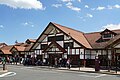
Kawaguchiko Station
河口湖駅2017
  • to ShinjukuLtd. exp. Fuji Excursion114min

Travel times follow 富士山麓電気鉄道(富士急行線)公式「JR・富士急行直通特急 富士回遊」のページに載る時刻表(2026年3月14日以降の時刻)。新宿〜河口湖は乗り換えなしの直通。同ページに「新宿発着(一部千葉発)の特急『富士回遊』を毎日4往復(時期により臨時列車1往復を運行)、富士急行線河口湖駅まで直通運転」 (checked 2026-10-08). They vary by time of day.

Shape

Borders 9 municipalities across 1 prefectures.

Territory of Fujikawaguchiko Town
Boundaries: National Land Numerical Information (N03)Lakes: National Land Numerical Information (Lake Data), MLIT. Processed by Machigatari. Prepared with the approval of the Director-General of the Geospatial Information Authority of Japan, using its Digital Map 25000 (Spatial Data Framework) and Digital Map 25000 (Place Names and Public Facilities). (承認番号 平27情使、第585号)

North to south

19.9km

Yamanashi Prefecture
鳴沢村, 富士吉田市, 笛吹市, 身延町, 甲府市, 都留市, 西桂町, 大月市
Shizuoka Prefecture
富士宮市

Fujikawaguchiko Town isthis kind of town.

  1. 01Shoji no Osugi is a national Natural Monument standing south of the main hall of Suwa Shrine on the shore of Lake Shoji. The prefecture gives its girth at eye level as 10 m and its height as 40 m or more, and notes that an accurate measurement cannot be taken because the base has been levelled with soil. Another cedar in the same precinct (6.9 m at eye level) is designated by the town (formerly Kamikuishiki Village)
  2. 02Kawaguchi Asama Shrine is one of the shrines that are constituent assets of the World Heritage site Fujisan. In the prefecture's list the town has eight constituent assets, and the chigo dance is offered in this shrine's worship hall
  3. 03The town also has Fugaku Wind Cave and Motosu Wind Cave, national Natural Monuments; the Misaka Tunnel (spanning the boundary with Fuefuki), a nationally Registered Tangible Cultural Property; and two prefectural traditional crafts, Koshu Oishi tsumugi pongee and Fuji Katsuyama suzu-bamboo craftwork

See the town as it is now.

Source: Wikidata (P2002, P2003, P2013, P2397)

If something caught your eye, ask the town itself.