Komahashi Power Station Ochiai Suirokyo.jpg
Article

19204 / つるし

Yamanashi Prefecture

Tsuru City

Water crosses a river on a brick bridge.

Komahashi Ochiai Aqueduct

Photo by Suikotei (CC BY-SA 4.0)

01 / Event

Every April,residents clear the waterways together.

Every year in early April, the Joshiki: waterways are cleared of silt all at once, from riverbeds to irrigation channels. The Ministry of the Environment calls it unique to Tsuru, with some 9,000 residents joining in each year. In 2026 it was held on 5 April, when sediment was removed from the city’s waterways.

  • Early April every year
  • About 9,000 people a year (Ministry of the Environment)
  • Held on 5 April in 2026

02 / Waterfall

Spring watertrickles down a cliff.

Taro-Jiro Falls.jpg
Photo by Hrykt (CC BY-SA 4.0)

Taro-Jiro Falls, where spring water trickles down a cliff in the Natsukari district. The city says the origin of the name is not certain. The Ministry of the Environment chose the Tokaichiba-Natsukari spring group, which includes the falls, for its Heisei-era list of 100 renowned waters.

  • Drop of about 20 m (city landscape plan)
  • Spring water about 12 °C all year

03 / Building

A square tower risesfrom the middle of the roof.

Ogata Museum.JPG
Photo by Abasaa (Public domain)

The former Ogata School is a two-storey wooden building with a pyramid-shaped roof and a square tower at its centre. The prefecture records its completion on 5 May 1878 and calls it a sign of how Fujimura-style architecture spread to the provinces. The city says restoration work was carried out in 1973.

  • Prefecture-designated tangible cultural property
  • Two-storey wooden building
  • Completed 1878 (prefecture)

Living here

85 minutes from Shinjuku by limited express, no changes.

  • about 30,000 people
  • 90 min to a city centre

The limited express Fuji Excursion runs through from Shinjuku onto the Fujikyu line, four round trips a day. It makes one stop in the city.

People living here
31,016people
19952020

−3.1% since 2015

35,398 → 31,016

Area
161.63km²

25.28km² of it habitable

2024

Households
14,044households

2.2 people per household

2020

Rent (average for rentals)
43,003yen

National average 60,630 yen

2023

Healthcare
3 hospitals / 16 clinics

6.1 per 10,000 people

2023

Area161.63km²Habitable land25.28km² / 16%
Area and habitable land at the same scalee-Stat B1101 / B1103
Children waiting for childcare
—11 nurseries and similar
Home purchase subsidy
—
Average annual temperature
—

These 3 items are waiting on a nationwide data source. We do not fill them with estimates.

ACCESS

Where you can go from here.

Tsuru City in Japan35.551°N 138.905°E
OsakaTsuru City
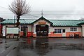
Yamuramachi Station
谷村町駅2017
  • to ShinjukuLtd. exp. Fuji Excursion85min

Travel times follow 富士山麓電気鉄道(富士急行線)公式の特急「富士回遊」時刻表(2026年3月14日以降の時刻。毎日4往復)と、JR東日本の時刻表(2026年10月分のページ。富士回遊15号は新宿10:30発・都留文科大学前11:55着) (checked 2026-10-08). They vary by time of day.

Shape

Borders 8 municipalities.

Territory of Tsuru City
Boundaries: National Land Numerical Information (N03)Lakes: National Land Numerical Information (Lake Data), MLIT. Processed by Machigatari. Prepared with the approval of the Director-General of the Geospatial Information Authority of Japan, using its Digital Map 25000 (Spatial Data Framework) and Digital Map 25000 (Place Names and Public Facilities). (承認番号 平27情使、第585号)

North to south

17.1km

大月市, 道志村, 西桂町, 忍野村, 上野原市, 富士河口湖町, 富士吉田市, 山中湖村

Tsuru City isthis kind of town.

  1. 01A brick bridge carries the Komahashi power station’s waterway over a river; it is a nationally registered tangible cultural property and a Selected Civil Engineering Heritage site for fiscal 2025
  2. 02Every April residents clear the waterways together in the Joshiki, and Taro-Jiro Falls is where spring water trickles down a cliff
  3. 03The prefecture-designated former Ogata School has a square tower in the middle of its roof

See the town as it is now.

Source: Wikidata (P2002, P2003, P2013, P2397)

If something caught your eye, ask the town itself.