石割神社の大岩.jpg
Article

19425 / やまなかこむら

Yamanashi Prefecture 南都留郡

Yamanakako Village

Through the cleft three times, luck comes, they say.

Ishiwari Shrine's great rock

Photo by Koda6029 (CC BY-SA 4.0)

01 / Festival

Women in white tabi socksscramble to cling to the mikoshi.

This is the autumn festival of Yamanaka Suwa Shrine (Yamanaka Myojin), a village-designated Intangible Cultural Property. The mikoshi, a portable shrine, goes from the main hall to its resting place on the evening of 4 September and returns to the main hall at the main festival on the 5th. Women rush to cling to it, and because pregnant and new mothers carry it, the village writes that it is said to be "one of the unusual festivals even nationwide".

  • Festival, 4-6 September
  • Village Intangible Cultural Property
  • Expectant mothers carry the mikoshi

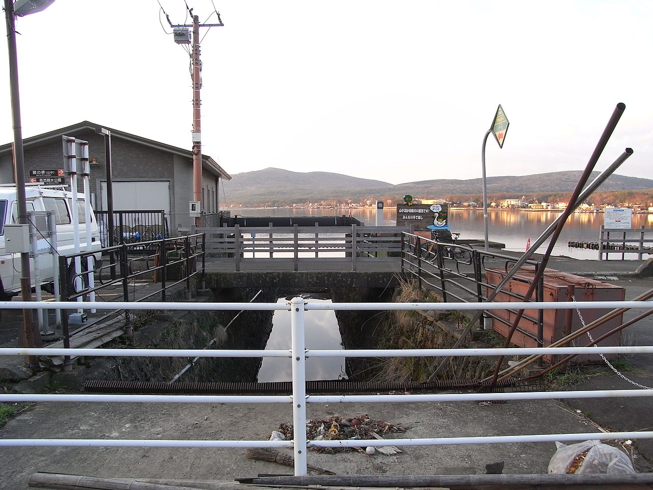
02 / Katsura River

The river leaving Lake Yamanakais called the Katsura in Yamanashi Prefecture.

相模川(桂川)の山中湖流出口(1).JPG
Photo by 散歩 (Public domain)

The Ministry of Land, Infrastructure, Transport and Tourism writes that the Sagami River rises on Mount Fuji and is called the Katsura River within Yamanashi Prefecture. From Lake Yamanaka it takes in tributaries such as the Sasago and Kazuno rivers, flows east into Kanagawa Prefecture and changes its name to the Sagami. A Yamanashi Prefecture project evaluation describes the Katsura as "having Lake Yamanaka as its source".

  • Katsura River in Yamanashi Prefecture
  • Sasago and Kazuno rivers join
  • Sagami River in Kanagawa Prefecture

03 / Monument

A monument that seems to markcarp released by a Saitama Fuji-ko group.

A village-designated historic site. The village writes that in 1801 members of a branch of the Fuji-ko confraternities of Yorii, Saitama Prefecture, came here for the ascetic pilgrimage called Hakkai-meguri and, following the custom of hojo-e, the releasing of captive creatures, set carp free; the monument seems to have been raised in memory. It also records it as "the oldest record of a release into the Fuji Five Lakes".

  • 1801
  • Fuji-ko of Yorii, Saitama Prefecture
  • Village-designated historic site

Living here

No station; 131 minutes from Shinjuku by express bus.

  • about 5,000 people
  • Rural district town

There is no JR or private-railway station in the village. Express buses of Fujikyu Bus and Keio Bus take as little as 131 minutes from Busta Shinjuku to the village office stop. The village office stands 980.5 m above sea level, and the village is made up of five districts.

People living here
5,179people
19952020

−0.6% since 2015

5,296 → 5,179

Area
53.05km²

13.8km² of it habitable

2024

Households
1,969households

2.6 people per household

2020

Rent (average for rentals)
—
Healthcare
0 hospitals / 3 clinics

5.8 per 10,000 people

2023

Area53.05km²Habitable land13.8km² / 26%
Area and habitable land at the same scalee-Stat B1101 / B1103
Children waiting for childcare
—2 nurseries and similar
Home purchase subsidy
—
Average annual temperature
—

These 3 items are waiting on a nationwide data source. We do not fill them with estimates.

ACCESS

Where you can go from here.

Yamanakako Village in Japan35.410°N 138.861°E
OsakaYamanakako Village
山中湖村役場前
山中湖村役場前2012
  • to ShinjukuHighway bus131min

Travel times follow 富士急バスの公式サイト『新宿駅~富士急ハイランド・河口湖駅・富士山駅・山中湖方面』の時刻表ページ(https://bus.fujikyu.co.jp/highway/fujisan/shinjuku-kawaguchiko/ 。Last-Modified 2026-10-08 05:49 GMT、取得 2026-10-08)。運行会社は富士急バス・京王バス。時刻表のデータ(ページ内の JSON)から、下り(バスタ新宿(南口)→山中湖村役場前)の山中湖に停まる便を数えた。1101便 07:15→09:26、1103便 07:55→10:06、1105便 08:25→10:36、1113便 10:25→12:36、1125便 12:05→14:16、1131便 14:05→16:16、1135便 16:15→18:26、1137便 18:15→20:26、1169便 20:15→22:26 などは全て131分。1151便 08:15→10:34 など6便(1151・1153・1157・1159・1165・1167)は139分。**下りは27便のうち21便が131分・6便が139分**。上りは山中湖村役場前→バスタ新宿(南口)が25便のうち18便が138分・7便(1154・1156・1164・1166・1168・1172・1174)が148分(138分の例 1102便 08:37→10:55、1126便 19:22→21:40) (checked 2026-10-08). They vary by time of day.

Shape

Borders 6 municipalities across 2 prefectures.

Territory of Yamanakako Village
Boundaries: National Land Numerical Information (N03)Lakes: National Land Numerical Information (Lake Data), MLIT. Processed by Machigatari. Prepared with the approval of the Director-General of the Geospatial Information Authority of Japan, using its Digital Map 25000 (Spatial Data Framework) and Digital Map 25000 (Place Names and Public Facilities). (承認番号 平27情使、第585号)

North to south

8.7km

Yamanashi Prefecture
富士吉田市, 忍野村, 都留市, 道志村
Kanagawa Prefecture
山北町
Shizuoka Prefecture
小山町

Yamanakako Village isthis kind of town.

  1. 01Behind Ishiwari Shrine stands a huge rock with a cleft, and a legend, told in an explanation by the national tourism and transport ministries, says that passing through its gap three times brings good luck
  2. 02The Yamanaka Myojin Anzan Festival of Yamanaka Suwa Shrine is a village Intangible Cultural Property, and at the resting shrine a costumed figure of Toyotamahime-no-mikoto is opened to view as the deity's body during the festival
  3. 03The river leaving Lake Yamanaka is called the Katsura in Yamanashi Prefecture, and the village holds the Fuji-ko carp monument of 1801

If something caught your eye, ask the town itself.