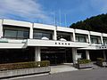
Mount Hiyama, Tennoyama, Katsurao Village
Article

07548 / かつらおむら

Fukushima Prefecture 双葉郡

Katsurao Village

Three shrines enshrined on the summit.

Mount Hiyama, Tennoyama

Photo by Σ64 (CC BY 3.0)

01 / Merchant estate ruins

For about 200 years from the Edo to the Meiji era,the Matsumoto family of wealthy merchants prospered here.

The village says this was the estate of the Matsumoto family, wealthy merchants who prospered for about 200 years from the Edo period into the Meiji era. They traded in timber, salt, raw silk and even iron, and became known as far away as Kyoto and Osaka. Stone walls, garden remains and the sites of storehouses survive on the broad grounds, now kept as a park.

  • About 200 years, Edo to Meiji
  • Trade in timber, salt, raw silk and iron
  • Stone walls, garden and storehouse sites remain

02 / Origin of a mountain's name

Its name is said to come from fifty retainersmade to sit on a great rock at the summit.

The village says Mount Gojunin, on the border of Katsurao Village and Miyakoji in Tamura City, is 883 m high. The name is said to come from Sakanoue no Tamuramaro, who had fifty retainers sit on a great boulder at the summit while he planned strategy. The boulder still stands on the summit, a broad grassy field of about one hectare with views from the Azuma range to the Pacific.

  • 883 m high
  • Summit: about one hectare of grass
  • Abukuma Highlands Central Prefectural Natural Park

03 / Lion dance

At the autumn festival, each district's lion danceis offered at the three shrines.

Lion dance in Katsurao Village
Photo by Koda6029 (CC BY-SA 4.0)

The village says that on the second Saturday of October an autumn festival is held at the three shrines on the summit, and each district's lion dance is offered. On the first Sunday of June, a mountain-opening event is held on the summit together with the spring festival of the three shrines.

  • Autumn festival on the second Saturday of October
  • Three shrines on the summit
  • Spring festival and mountain opening on the first Sunday of June

Katsurao Village from the sky

Now and 1974–78. Tap a photo to zoom in.

Wide (about 6 km across)

Close (about 1.5 km across)

Shot 1974–78

Source: Geospatial Information Authority of Japan (GSI) GSI Tiles(国土画像情報(第一期:1974〜1978年撮影))

Open in GSI Maps (1974–78)

Living here

Fifty-three minutes by bus from Funehiki Station.

  • about 1,000 people
  • Rural district town

There is no railway station in the village. A Fukushima Kotsu bus connects the village with the front of Funehiki Station in Tamura City. In the timetable of October 1, 2026, the 18:17 departure from Funehiki Station, listed with the same time on both weekdays and weekends and holidays, reaches the terminus at Ochiai at 19:10. The village says it lies in the Abukuma Mountains, ringed by many peaks led by Tennoyama.

People living here
420people
19952020

+2233.3% since 2015

1,831 → 420

Area
84.37km²

15.39km² of it habitable

2024

Households
205households

2.0 people per household

2020

Rent (average for rentals)
—
Healthcare
0 hospitals / 1 clinic

23.8 per 10,000 people

2023

Area84.37km²Habitable land15.39km² / 18%
Area and habitable land at the same scalee-Stat B1101 / B1103
Children waiting for childcare
—0 nurseries and similar
Home purchase subsidy
—
Average annual temperature
—

These 3 items are waiting on a nationwide data source. We do not fill them with estimates.

ACCESS

Where you can go from here.

Katsurao Village in Japan37.504°N 140.764°E
TokyoOsakaKatsurao Village
Katsurao Village Office
葛尾村役場2016
  • to FunehikiLocal bus53min

Travel times follow 福島交通『船引・小野管内 No.20』時刻表(2026年10月1日版。PDF作成2026-09-10。平日用・土日祝用)の『船引=石沢・移・葛尾』(移経由葛尾線)。事業者公式 https://www.fukushima-koutu.co.jp/route/paper-timetable.html の PDF(data/paper-timetable/20.pdf)。 (checked 2026-10-28). They vary by time of day.

Shape

Borders 3 municipalities.

Territory of Katsurao Village
Boundaries: National Land Numerical Information (Administrative Area Data), MLIT. Processed by Machigatari.Lakes: National Land Numerical Information (Lake Data), MLIT. Processed by Machigatari. Prepared with the approval of the Director-General of the Geospatial Information Authority of Japan, using its Digital Map 25000 (Spatial Data Framework) and Digital Map 25000 (Place Names and Public Facilities). (承認番号 平27情使、第585号)

Katsurao Village isthis kind of town.

  1. 01Mount Hiyama, also called Tennoyama, is 1,057 m high and spans two cities, two towns and one village; the village says three shrines are enshrined on its summit
  2. 02The Katsurao Daijin estate ruins mark the home of the Matsumoto family of wealthy merchants, who prospered for about 200 years from the Edo to the Meiji era; stone walls, garden and storehouse remains survive
  3. 03Mount Gojunin is said to take its name from fifty retainers made to sit on a great summit rock by Sakanoue no Tamuramaro, and each district's lion dance is offered at Hiyama's autumn festival on the second Saturday of October

If something caught your eye, ask the town itself.