The shrine behind a place name, Nishigo Village
Article

07461 / にしごうむら

Fukushima Prefecture 西白河郡

Nishigo Village

A place name recorded as a shrine's.

The shrine behind a place name

Photo by Zeter114514 (CC BY-SA 4.0)

01 / Gorge

Centered on an arch bridge over the Abukuma River,the area is called Yukiwari Gorge.

Gorge in Nishigo Village
Photo by 写真小僧 (CC BY-SA 3.0)

Yukiwari Bridge is an arch bridge over the Abukuma River, 138.5 m long. The bridge has been rebuilt several times, and the fifth one was completed in Reiwa 3 (2021). The area is called Yukiwari Gorge, and the tourism association says its spring and autumn scenery is especially fine.

  • 138.5 m long
  • Fifth bridge completed in Reiwa 3 (2021)
  • The Abukuma River rises on a mountain in the village
02 / Horse god

The head of an Arabian stallion was buried here,and a hall enshrines it as a horse god.

In Meiji 5 (1872), the village headman aimed to rebuild through horse breeding, and the government supplied an Arabian stallion. It died after leaving three foals; villagers buried its head, raised a monument, and enshrined it in a hall as a horse god: Arabiya Kannon.

  • The Arabian stallion died after leaving three foals
  • Horseshoes and votive horse plaques kept inside
  • Village Designated Important Cultural Property (No. 14)

03 / Dwarf yew

A dwarf yew, said to have been plantedin the Tensho era, stands at a village shrine.

The dwarf yew is a variety of yew, with leaves arranged irregularly in a spiral. The one at the village shrine is 4.0 m tall with a trunk circumference of 1.3 m. It is said to have been planted in the Tensho era (1573-1591), and the village records its vigor as good.

  • 4.0 m tall, 1.3 m trunk circumference
  • Said to have been planted in the Tensho era
  • Village Designated Important Cultural Property (No. 2)

Nishigo Village from the sky

Now and 1974–78. Tap a photo to zoom in.

Wide (about 6 km across)

Close (about 1.5 km across)

Now (shot June–July 2023)Shot 1974–78

Source: Geospatial Information Authority of Japan (GSI) GSI Tiles(全国最新写真(シームレス)/国土画像情報(第一期:1974〜1978年撮影))

Open in GSI Maps (now)Open in GSI Maps (1974–78)

Living here

Tokyo in 1 h 8 min by Shinkansen.

  • about 20,000 people
  • 90 min to a city centre
  • Shinkansen stops here
  • Rural district town

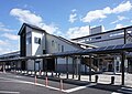
Shin-Shirakawa Station is in Nishigo Village. The fastest through train on the Tohoku Shinkansen from Tokyo Station to Shin-Shirakawa Station takes 68 minutes with no change (JR East timetable, October 2026 edition). The village says Tokyo is about 1 hour 20 minutes away.

People living here
20,808people
19952020

+2.4% since 2015

17,920 → 20,808

Area
192.06km²

62.11km² of it habitable

2024

Households
8,092households

2.6 people per household

2020

Rent (average for rentals)
48,862yen

National average 60,630 yen

2023

Healthcare
0 hospitals / 10 clinics

4.8 per 10,000 people

2023

Area192.06km²Habitable land62.11km² / 32%
Area and habitable land at the same scalee-Stat B1101 / B1103
Children waiting for childcare
—3 nurseries and similar
Home purchase subsidy
—
Average annual temperature
—

These 3 items are waiting on a nationwide data source. We do not fill them with estimates.

ACCESS

Where you can go from here.

Nishigo Village in Japan37.142°N 140.155°E
OsakaNishigo Village
Shin-Shirakawa Station
新白河駅2021
  • to TokyoTohoku Shinkansen68min

Travel times follow JR東日本の列車時刻表(2026年11月号・URL に 2611)。東京駅の東北・北海道新幹線 下りの駅時刻表(tt02。平日・土休日)から、東京発・新白河着の列車ごとのページを引いて差を数えた(2026-10-28 閲覧。本体が機械で数えた表 fukushima-prep/jr/count.out と一致) (checked 2026-10-28). They vary by time of day.

Shape

Borders 5 municipalities across 1 prefectures.

Territory of Nishigo Village
Boundaries: National Land Numerical Information (Administrative Area Data), MLIT. Processed by Machigatari.Lakes: National Land Numerical Information (Lake Data), MLIT. Processed by Machigatari. Prepared with the approval of the Director-General of the Geospatial Information Authority of Japan, using its Digital Map 25000 (Spatial Data Framework) and Digital Map 25000 (Place Names and Public Facilities). (承認番号 平27情使、第585号)

North to south

17.1km

Tochigi Prefecture
Nasu Town, Nasushiobara City

Nishigo Village isthis kind of town.

  1. 01The shrine is one of the seven Shirakawa District shrines listed in the Engishiki, and the Shirakawa Fudoki records that the place name was altered over time from the shrine's name; it is a village designated cultural property
  2. 02Yukiwari Bridge is an arch bridge over the Abukuma River, the area is called Yukiwari Gorge, and the Abukuma River rises on a mountain in the village
  3. 03Arabiya Kannon is a hall enshrining an Arabian stallion as a horse god, and the dwarf yew at a village shrine is a tree said to have been planted in the Tensho era; both are village designated cultural properties

See the town as it is now.

Source: Wikidata (P2002, P2003, P2013, P2397)

If something caught your eye, ask the town itself.