Dragon Mound, a keyhole tumulus, Ten-ei Village
Article

07344 / てんえいむら

Fukushima Prefecture 岩瀬郡

Ten-ei Village

Cut by paddies, still a keyhole mound.

Dragon Mound, a keyhole tumulus

Photo by Duff Figgy (CC BY-SA 3.0)

01 / Woodcrafters' settlement

A settlement site recorded as home to a groupof woodturners who came from Omi Province.

Woodcrafters' settlement in Ten-ei Village
Photo by Mizuki Kusakawa (CC BY-SA 4.0)

The village says records remain of a group of woodturners who came from Omi Province to Aizu and settled here. They were craftsmen who turned horse chestnut, beech and other woods into bowls and trays on a lathe. At its peak the settlement had 28 houses, and its history of over 200 years came to an end.

  • Village-designated cultural property (historic site)
  • Designated September 1, 1982
  • 28 houses at its peak

02 / Watershed

Rain falling on the village heads west to the Sea of Japanand east to the Pacific, split at a mountain pass.

Watershed in Ten-ei Village
Photo by Puchi-masashi (CC BY-SA 4.0)

The village says that, divided at a mountain-pass watershed, the east has a Pacific-side climate with little snow and the west a Sea of Japan-side climate with up to 2 m of snow in winter. The village tourism association says the pass lies near the center of the village and that rain goes west to the Sea of Japan and east to the Pacific.

  • A mountain pass, a watershed near the village center
  • Pacific-side climate east, Sea of Japan-side west
  • Farmland along two rivers in the east

03 / Old tree

A prefectural natural monument, an old ginkgo with leaf-borne nuts,stands in the grounds of a village shrine.

The village says the grounds of a village shrine hold an old ginkgo with leaf-borne nuts, one of few in Japan, 250 years old and 32 m tall. The village tourism association says it is handed down that Fujiwara no Kamatari stopped here and gave land to the shrine, and the tree was planted afterward.

  • Prefectural natural monument (March 29, 2024)
  • 250 years old, 32 m tall (village)
  • Village shrine main hall: village-designated

Ten-ei Village from the sky

Now and 1974–78. Tap a photo to zoom in.

Wide (about 6 km across)

Close (about 1.5 km across)

Now (shot 1974–1978)Shot 1974–78

Source: Geospatial Information Authority of Japan (GSI) GSI Tiles(全国最新写真(シームレス)/国土画像情報(第一期:1974〜1978年撮影))

Open in GSI Maps (now)Open in GSI Maps (1974–78)

Living here

Forty-six minutes by local bus from Sukagawa Station.

  • about 5,000 people
  • Rural district town

There is no railway station in the village. The village says it is about 30 minutes by car from Shin-Shirakawa Station on the Tohoku Shinkansen. In the Fukushima Kotsu timetable revised on October 1, 2026, the fastest daily bus takes 46 minutes from Sukagawa Station to the Ten-ei Village Office stop. The village lies in the mountains of the Nasu range, and its climate divides east and west at a mountain pass.

People living here
5,194people
19952020

−7.4% since 2015

7,153 → 5,194

Area
225.52km²

37.21km² of it habitable

2024

Households
1,671households

3.1 people per household

2020

Rent (average for rentals)
—
Healthcare
0 hospitals / 7 clinics

13.5 per 10,000 people

2023

Area225.52km²Habitable land37.21km² / 16%
Area and habitable land at the same scalee-Stat B1101 / B1103
Children waiting for childcare
—1 nurseries and similar
Home purchase subsidy
—
Average annual temperature
—

These 3 items are waiting on a nationwide data source. We do not fill them with estimates.

ACCESS

Where you can go from here.

Ten-ei Village in Japan37.255°N 140.247°E
TokyoOsakaTen-ei Village
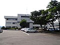
Ten-ei Village Office
天栄村役場2011
  • to SukagawaLocal bus46min

Travel times follow 福島交通『2026年10月1日改正 紙式時刻表 須賀川・石川管内No.21』(http://www.fukushima-koutu.co.jp/route/data/paper-timetable/21.pdf。表紙『2610福交_S21-2』)の『須賀川⇨(鏡石)⇨丸山・南沢・竜生・二岐』。平日用・土日祝用の両方に載る便:須賀川駅前 9:20 → 天栄村役場 10:06(46分。途中 須賀川市中央体育館前 9:30・鏡石駅前 9:40)、15:30(土日祝は『年』印つき=年末年始等の運休の注記)→16:16(46分)。平日だけの便も 7:00→7:46・7:35→8:21・12:15→13:01・14:00→14:46・16:30→17:16・17:50→18:36 はすべて46分(12:35→13:22 は南沢経由で47分)。運賃は須賀川駅前→天栄村役場950円。逆向き(天栄村役場→須賀川駅前)は平日 6:44→7:30、7:14→8:00、7:39→8:25、8:14→9:00、8:49→9:36、9:09→9:55、13:49→14:35、14:42→15:28、16:22→17:08=すべて46〜47分。村公式『路線バス』(更新2024-04-03。https://www.vill.tenei.fukushima.jp/soshiki/35/bus-schedule2.html)が『竜生・二岐線』『古戸経由南沢線』など須賀川駅前発の系統を挙げ、時刻・料金は福島交通へと書く (checked 2026-10-28). They vary by time of day.

Shape

Borders 8 municipalities.

Territory of Ten-ei Village
Boundaries: National Land Numerical Information (Administrative Area Data), MLIT. Processed by Machigatari.Lakes: National Land Numerical Information (Lake Data), MLIT. Processed by Machigatari. Prepared with the approval of the Director-General of the Geospatial Information Authority of Japan, using its Digital Map 25000 (Spatial Data Framework) and Digital Map 25000 (Place Names and Public Facilities). (承認番号 平27情使、第585号)

Ten-ei Village isthis kind of town.

  1. 01Dragon Mound is a keyhole-shaped tumulus in one district; its base was cut away for rice fields, and a stone shrine to the deity Awashima stands on the front mound. A bronze private seal found at a site in the same district is a prefectural important cultural property (archaeological material)
  2. 02A settlement ruin holds records of woodturners from Omi settling there, and the village tourism association says rain from a mountain pass near the village center runs west to the Sea of Japan and east to the Pacific
  3. 03In the grounds of a village shrine stands a prefectural natural monument, an old ginkgo with leaf-borne nuts that the village calls one of few in Japan

If something caught your eye, ask the town itself.