Miyanomae Kofun, chamber at Kawabe, Tamakawa Village
Article

07502 / たまかわむら

Fukushima Prefecture 石川郡

Tamakawa Village

A cut-stone chamber faces south-southeast.

Miyanomae Kofun, chamber at Kawabe

Photo by Saigen Jiro (CC0)

01 / Stone pagoda

On the back of the Dainichi statue plugging the pedestal hole,an inscription of the second year of Genkyu is carved.

Stone pagoda in Tamakawa Village
Photo by Duff Figgy (CC BY-SA 3.0)

The Tamakawa tourism and products association says the front of this stone shrine, about 180 cm high, is built like a door, with the names of the 49 halls of the Maitreya pure land carved around it. The hole in the pedestal is thought to have held the relics, and an inscription is on the back of the Dainichi stone statue that plugs it. It refers to the era of the monk who founded Tofukuji Temple.

  • National Historic Site since June 7, 1935
  • About 180 cm high
  • Inscription of the second year of Genkyu
02 / Five-ring tower

A stone tower built as the grave of a local lordis housed in a covered hall on the temple approach.

The village says the five-ring tower, designated an Important Cultural Property in 1938, is a stone tower built at the end of the Fujiwara period as the grave of the local lord. It is housed in a covered hall on the temple approach, and the association gives its height as 180 cm.

  • Important Cultural Property since July 4, 1938
  • 180 cm high
  • Built at the end of the Fujiwara period, per the village

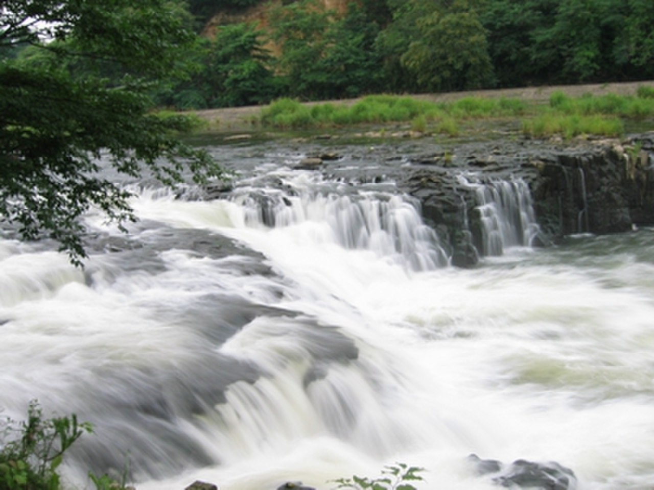
03 / Waterfall

Two theories explain the name:the shape of the flow at high water, or the fault seen from the side.

Waterfall in Tamakawa Village
Photo by Stu (CC BY-SA 3.0)

The village says the name of Otsujigataki, also chosen as one of Japan's 100 best waterfalls, has two explanations: the shape of the flow when the water rises, and the shape of the fault seen from the side. The association says that when the water rises, it pours across the full 100 m width of the falls.

  • One of Japan's 100 best waterfalls
  • 100 m wide when the water rises
  • Basho's verse monument beside the falls-viewing Fudo hall

Tamakawa Village from the sky

Now and 1974–78. Tap a photo to zoom in.

Wide (about 6 km across)

Close (about 1.5 km across)

Now (shot July–September 2022)Shot 1974–78

Source: Geospatial Information Authority of Japan (GSI) GSI Tiles(全国最新写真(シームレス)/国土画像情報(第一期:1974〜1978年撮影))

Open in GSI Maps (now)Open in GSI Maps (1974–78)

Living here

Izumigo Station is on the Suigun Line.

  • about 6,000 people
  • Rural district town

The village has two stations on the JR Suigun Line, Izumigo and Kawabeoki. The village's access page gives the train route as a change between the Tohoku Shinkansen and the Suigun Line, and names Izumigo last. The present village was formed in 1955 by the merger of Izumi and Sugama villages.

People living here
6,392people
19952020

−5.7% since 2015

7,593 → 6,392

Area
46.67km²

25.46km² of it habitable

2024

Households
1,980households

3.2 people per household

2020

Rent (average for rentals)
—
Healthcare
0 hospitals / 5 clinics

7.8 per 10,000 people

2023

Area46.67km²Habitable land25.46km² / 55%
Area and habitable land at the same scalee-Stat B1101 / B1103
Children waiting for childcare
—1 nurseries and similar
Home purchase subsidy
—
Average annual temperature
—

These 3 items are waiting on a nationwide data source. We do not fill them with estimates.

Shape

Borders 5 municipalities.

Tamakawa Village in Japan37.211°N 140.409°E
TokyoOsakaTamakawa Village
Territory of Tamakawa Village
Boundaries: National Land Numerical Information (Administrative Area Data), MLIT. Processed by Machigatari.Lakes: National Land Numerical Information (Lake Data), MLIT. Processed by Machigatari. Prepared with the approval of the Director-General of the Geospatial Information Authority of Japan, using its Digital Map 25000 (Spatial Data Framework) and Digital Map 25000 (Place Names and Public Facilities). (承認番号 平27情使、第585号)

North to south

8.6km

Travel times per leg are not published by the municipality, so they are not shown.

Tamakawa Village isthis kind of town.

  1. 01Miyanomae Kofun, a prefectural historic site in Kawabe, has a stone chamber of fitted cut stone that opens to the south-southeast and is thought to date from the late 7th century
  2. 02Tofukuji Temple's stone relic shrine, a national historic site, carries an inscription on the back of its Dainichi statue, and the village says it expresses the Maitreya pure land thought of the Kamakura period
  3. 03The village says the five-ring tower in the Ganpoji district was built as the grave of a lord at the end of the Fujiwara period, and the name of Otsujigataki has two explanations

If something caught your eye, ask the town itself.

From this town's themes