村国座 (岐阜県各務ヶ原市)-堀道murakuniza021.jpg
Article

21213 / かかみがはらし

Gifu Prefecture

Kakamigahara City

Actors use a tunnel under the hanamichi.

Murakuniza, Kagami no Butai

Photo by 杉山宣嗣 (CC BY-SA 4.0)

01 / Tengudani site

A tomb from the end of the Kofun periodand Nara and Heian kilns are preserved and developed at the same site.

Tengudani iseki-2.JPG
Photo by onaonan (CC BY-SA 3.0)

Sue, the district where the site lies, was a ceramics-producing area from the Kofun period to the Kamakura period. At the Tengudani site, a Nara-period sue ware kiln and a Heian-period ash-glazed ware kiln are preserved on the spot, and a horizontal-entry stone-chamber tomb from the end of the Kofun period has also been developed. It was designated a City Historic Site in 1991.

  • City Historic Site, May 24, 1991
  • Nara-period sue ware kiln
  • Heian-period ash-glazed ware kiln

02 / Owari boundary stone

Where Owari and shogunate land interlocked,Owari set up a stone: "From here east, Owari territory."

The Stone that indicates the territory of the Owari Clan 20221226.jpg
Photo by 先従隗始 (CC0)

Along the Nakasendo, the Owari Tokugawa's village of Unuma and a village held directly by the shogunate formed a tangled boundary, so the Owari domain set up boundary stones beside the Nakasendo. Two stones are carved "From here east, Owari territory" and "From here west, Owari territory." Today they stand near the Unuma Nakasendo traffic signal on the Route 21 Unuma Bypass.

  • Carved "From here east, Owari territory"
  • Two stones, for the east and west sides
  • Once stood about 800 m west of today's spot

03 / Hyakujuro cherry trees

Ichikawa Hyakujuro, a kabuki actor from the area,gave the cherry trees to mark a channel's completion.

百十朗桜.JPG
Photo by レルバ (CC BY-SA 3.0)

The cherry trees lining the Shin-Sakaigawa began with a gift from Ichikawa Hyakujuro, a kabuki actor from the area, to commemorate the completion of the Sakaigawa diversion channel, and are called Hyakujuro-zakura. The city dates the gift to the early Showa era and says the trees were replanted to mark the city's founding. They were chosen as one of Japan's 100 cherry blossom sites in 1990.

  • Gift of Ichikawa Hyakujuro
  • Marks the channel's completion
  • 1990: chosen as a top-100 cherry site

Living here

Born from four towns, joined by Kawashima in 2004.

  • about 140,000 people
  • 30 min to a city centre

The city was formed in 1963 by the merger of the towns of Naka, Inaba, Unuma and Sohara, and merged with the town of Kawashima, in Hashima District, in 2004. Its area is 87.81 km², with the Kakamigahara Plateau, at 30 to 60 m above sea level, spreading across it, and the Kiso River flowing east to west along the prefectural border to the south. The gateway is Kakamigahara-Shiyakusho-mae Station on the Meitetsu Kakamigahara Line.

People living here
144,521people
20052020

−0.1% since 2015

144,174 → 144,521

Area
87.81km²

70.2km² of it habitable

2024

Households
57,129households

2.5 people per household

2020

Rent (average for rentals)
49,058yen

National average 60,630 yen

2023

Healthcare
4 hospitals / 114 clinics

8.2 per 10,000 people

2023

Area87.81km²Habitable land70.2km² / 80%
Area and habitable land at the same scalee-Stat B1101 / B1103

Population from 2005 onward (municipal boundary changed).2004-11-01 に合併。2005年調査から市域が変わっている。

Children waiting for childcare
—16 nurseries and similar
Home purchase subsidy
—
Average annual temperature
—

These 3 items are waiting on a nationwide data source. We do not fill them with estimates.

ACCESS

Where you can go from here.

Kakamigahara City in Japan35.399°N 136.848°E
TokyoKakamigahara City
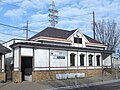
Kakamigahara-shiyakusho-mae Station
各務原市役所前駅2021
  • to NagoyaMeitetsu rapid limited express30min

Travel times follow 名古屋鉄道『路線別時刻表』(2026.3.14からの時刻表)の PDF『犬山線・各務原線』下り(神宮前→岩倉→犬山→名鉄岐阜)平日 20260314_IY_W1.pdf・土・休日 20260314_IY_H1.pdf と、上り(名鉄岐阜→犬山→岩倉→神宮前)平日 IY_W2.pdf・土・休日 IY_H2.pdf。pdftotext -bbox で各列車の『名鉄名古屋 発』『新鵜沼 着』(上りは『新鵜沼 発』『名鉄名古屋 着』)の時刻を座標で読み、列車ごとの差を数えた。『毎日運転』は、平日表と土・休日表の両方に同じ種別・同じ発着時刻の便があるものとした (checked 2026-10-15). They vary by time of day.

Shape

Borders 9 municipalities across 1 prefectures.

Territory of Kakamigahara City
Boundaries: National Land Numerical Information (N03)

North to south

10.1km

Gifu Prefecture
岐阜市, 関市, 笠松町, 坂祝町, 岐南町
Aichi Prefecture
犬山市, 江南市, 一宮市, 扶桑町

Kakamigahara City isthis kind of town.

  1. 01Murakuniza is a rural stage in the grounds of Murakuni Shrine, a nationally designated Important Tangible Folk Cultural Property known as Kagami no Butai; actors go from the area beneath the stage through an underfloor passage below the hanamichi into the small room at its end
  2. 02The Tengudani site is a City Historic Site that preserves sue ware kilns and an ash-glazed ware kiln on the spot and has developed a horizontal-entry stone-chamber tomb; the Owari boundary stones at Unuma-juku were set up by the Owari domain where its land and shogunate land interlocked
  3. 03The Hyakujuro cherry trees along the Shin-Sakaigawa began with a gift from Ichikawa Hyakujuro to mark the completion of the Sakaigawa diversion channel; in 2025 a Nara-period bronze weight called a ken was excavated at the Managoshi site, which the city considers to be a reference standard called a tameshi

If something caught your eye, ask the town itself.