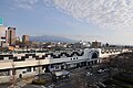
Iwagami no Tobiishi, Tone River, Maebashi City
Article

10201 / まえばしし

Gunma Prefecture

Maebashi City

A rock thought Akagi's came on Asama mud

Iwagami no Tobiishi, Tone River

Photo by さかおり (CC BY-SA 4.0)

01 / Sanno-haiji

One inscribed tile showed it wasthe temple named in the Yamanoue Stele.

Sanno-haiji in Maebashi City
Photo by Saigen Jiro (Public domain)

This is the site of an ancient temple thought to have been founded in the late 7th century, and a national historic site. A single tile inscribed "Hokoji" found in a 1981 excavation showed it to be the same temple as the "Hokoji" in the inscription of the Yamanoue Stele in Takasaki.

  • National historic site
  • One inscribed tile (1981 excavation)
  • Thought founded in the late 7th century

02 / Soja Tumulus Cluster

Chamfered cut stones,a chamber with traces of plaster.

Soja Tumulus Cluster in Maebashi City
Photo by Saigen Jiro (CC0)

The chamber of Hotozan Tumulus has walls and a ceiling of chamfered, cut andesite with traces of plaster, and a house-shaped stone coffin in the burial room. Jaketsuzan Tumulus is similar and is estimated to have been built at the end of the 7th century. The cluster became a national historic site in 2024.

  • National historic site, 2024 (Soja Tumulus Cluster)
  • Jaketsuzan: estimated end of 7th century
  • Hotozan stone coffin 2.3 m long

03 / Tenguiwa Canal

A canal named for the legendof a tengu clearing a boulder.

Tenguiwa Canal in Maebashi City
Photo by Indiana jo (CC BY-SA 4.0)

Akimoto Nagatomo, the first lord of Soja, had this canal dug over about three years from 1604. It runs from Kitatachibana in Shibukawa to northern Toiyamachi in Maebashi. The Rikuden Iai monument, said to have been raised by farmers in 1776 in gratitude, is a prefectural historic site.

  • Dug over about three years from 1604
  • Rikuden Iai monument, 1776, prefectural historic site
  • World Heritage Irrigation Structure, 2020

Maebashi City from the sky

Now and 1974–78. Tap a photo to zoom in.

Wide (about 6 km across)

Close (about 1.5 km across)

Now (shot August 2020)Shot 1974–78

Source: Geospatial Information Authority of Japan (GSI) GSI Tiles(全国最新写真(シームレス)/国土画像情報(第一期:1974〜1978年撮影))

Open in GSI Maps (now)Open in GSI Maps (1974–78)

Living here

85 minutes to Ueno by limited express, 131 to Tokyo.

  • about 330,000 people
  • 90 min to a city centre

The city covers 311.59 km², about 20 km east to west and 27 km north to south. The limited express Kusatsu/Shima takes 85 minutes at the fastest from Ueno, arriving at Shin-Maebashi Station. From Tokyo, one through JR Ueno-Tokyo Line train in the evening reaches Maebashi Station in 131 minutes.

People living here
332,149people
2010

−1.2% since 2015

340,291 → 332,149

Area
311.59km²

238.67km² of it habitable

2024

Households
141,882households

2.3 people per household

2020

Rent (average for rentals)
46,596yen

National average 60,630 yen

2023

Healthcare
20 hospitals / 340 clinics

10.8 per 10,000 people

2023

Area311.59km²Habitable land238.67km² / 77%
Area and habitable land at the same scalee-Stat B1101 / B1103

Population from 2010 onward (municipal boundary changed).2004-12-05 に合併。2005年調査から市域が変わっている。2009-05-05 に編入合併(富士見村)。2010年調査から市域が変わっている。

Children waiting for childcare
—68 nurseries and similar
Home purchase subsidy
—
Average annual temperature
—

These 3 items are waiting on a nationwide data source. We do not fill them with estimates.

ACCESS

Where you can go from here.

Maebashi City in Japan36.389°N 139.063°E
OsakaMaebashi City
Maebashi Station
前橋駅2021
  • to UenoLtd. exp. Kusatsu/Shima85min
  • to TokyoJR Ueno-Tokyo Line and Takasaki Line131min

Travel times follow JR東日本の駅の時刻表(2026年10月改正ダイヤ。timetables.jreast.co.jp の前橋駅・新前橋駅の時刻表と各列車の停車駅一覧、2026-10-21 閲覧) (checked 2026-10-21). They vary by time of day.

Shape

Borders 8 municipalities.

Territory of Maebashi City
Boundaries: National Land Numerical Information (Administrative Area Data), MLIT. Processed by Machigatari.Lakes: National Land Numerical Information (Lake Data), MLIT. Processed by Machigatari. Prepared with the approval of the Director-General of the Geospatial Information Authority of Japan, using its Digital Map 25000 (Spatial Data Framework) and Digital Map 25000 (Place Names and Public Facilities). (承認番号 平27情使、第585号)

Maebashi City isthis kind of town.

  1. 01Iwagami no Tobiishi, a boulder 70 m around and 10 m high, was long thought to come from an eruption of Mt. Akagi, but surveys showed it was carried by the Maebashi mudflow from an eruption of Mt. Asama about 24,000 years ago
  2. 02In the Soja area, a tile inscribed "Hokoji" showed Sanno-haiji to be the temple of the Yamanoue Stele, and the chambers of Hotozan and Jaketsuzan Tumuli have traces of plaster
  3. 03The Tenguiwa Canal, dug by Akimoto Nagatomo over about three years from 1604, was registered as a World Heritage Irrigation Structure in 2020

If something caught your eye, ask the town itself.

From this town's themes