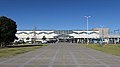
Former Time Signal Bell Tower, Isesaki City
Article

10204 / いせさきし

Gunma Prefecture

Isesaki City

Time signals passed to a siren in 1937.

Former Time Signal Bell Tower

Photo by Abasaa (Public domain)

01 / Ancient office

An octagonal storehouse, dug up,matches a 1030 record's "Hachimen Koso".

A 2005 survey found an octagonal storehouse. The city describes it as the first such find in Japan. It matches the entry for the Sai District granary, "Hachimen Koso", in the 1030 Kozuke Province Kotai Jitsurokucho. The storehouses were in use from the late 7th to the early 10th century. It is a National Historic Site.

  • 2005: octagonal storehouse found
  • Matches the "Hachimen Koso" entry
  • National Historic Site, 2014

02 / Burial mound

A 6.8-tonne stone coffin, thought to bemade by craftsmen sent from Kinai.

Burial mound in Isesaki City
Photo by Saigen Jiro (CC0)

On the rear mound of Ofujiyama Kofun, a keyhole-shaped tomb 125 metres long, lies a sandstone nagamochi-gata stone coffin, 285 cm long and weighing 6.8 tonnes. In the prefecture it is confirmed only here and at Tenjinyama Kofun in Ota. Craftsmen from the Kinai region are thought to have been sent east to make it.

  • 285 cm long, 6.8 tonnes
  • Confirmed at only two sites in the prefecture
  • Prefectural Important Cultural Property, 2001

03 / Irrigation canal

No sign of water on the canal floor,so it is thought to be unfinished.

Irrigation canal in Isesaki City
Photo by こやまひろ (CC BY 4.0)

Onna-bori is a mid-12th-century irrigation canal running 12.75 km from Kamiizumi-cho in Maebashi to Tabui-cho in Isesaki. No trace of flowing water has been found on its floor, and it is thought to be unfinished. A legend says a woman dug it overnight with a hairpin. It became a National Historic Site in 1983.

  • 12.75 km in total length
  • Dug in the mid-12th century
  • National Historic Site, 1983 (Akabori area)

Isesaki City from the sky

Now and 1974–78. Tap a photo to zoom in.

Wide (about 6 km across)

Close (about 1.5 km across)

Now (shot May–July 2010)Shot 1974–78

Source: Geospatial Information Authority of Japan (GSI) GSI Tiles(全国最新写真(シームレス)/国土画像情報(第一期:1974〜1978年撮影))

Open in GSI Maps (now)Open in GSI Maps (1974–78)

Living here

138 minutes from Shinjuku by express bus, 178 from Tokyo Station.

  • about 210,000 people

Isesaki Station in the city is served by the JR Ryomo Line and the Tobu Isesaki Line. The express bus that stops in front of it takes 138 minutes from Busta Shinjuku and 178 minutes from Tokyo Station's Yaesu South Exit on the fastest daily service (JR Bus Kanto timetable, revised 1 June 2026; reserved seats). The city covers 139.44 km² and is almost entirely flat.

People living here
211,850people
20052020

+1.5% since 2015

202,447 → 211,850

Area
139.44km²

139.11km² of it habitable

2024

Households
86,200households

2.5 people per household

2020

Rent (average for rentals)
46,201yen

National average 60,630 yen

2023

Healthcare
10 hospitals / 147 clinics

7.4 per 10,000 people

2023

Almost entirely flat.Almost all of it is habitable land (99.8%)
Area and habitable land at the same scalee-Stat B1101 / B1103

Population from 2005 onward (municipal boundary changed).2005-01-01 に合併。2005年調査から市域が変わっている。

Children waiting for childcare
—44 nurseries and similar
Home purchase subsidy
—
Average annual temperature
—

These 3 items are waiting on a nationwide data source. We do not fill them with estimates.

ACCESS

Where you can go from here.

Isesaki City in Japan36.311°N 139.197°E
OsakaIsesaki City
Isesaki Station
伊勢崎駅2020
  • to TokyoHighway bus178min
  • to ShinjukuHighway bus138min

Travel times follow JRバス関東「高速バス デジタル時刻表」の『東京・新宿~伊勢崎・前橋駒形(群馬中央バス運行)』(2026年6月1日改正)。下り〈本庄・伊勢崎方面・全日〉の東京駅八重洲南口発・バスタ新宿(新宿駅新南口)発→伊勢崎駅着 (checked 2026-10-21). They vary by time of day.

Shape

Borders 7 municipalities across 1 prefectures.

Territory of Isesaki City
Boundaries: National Land Numerical Information (Administrative Area Data), MLIT. Processed by Machigatari.Lakes: National Land Numerical Information (Lake Data), MLIT. Processed by Machigatari. Prepared with the approval of the Director-General of the Geospatial Information Authority of Japan, using its Digital Map 25000 (Spatial Data Framework) and Digital Map 25000 (Place Names and Public Facilities). (承認番号 平27情使、第585号)

North to south

18.4km

Saitama Prefecture
Honjo City, Fukaya City

Isesaki City isthis kind of town.

  1. 01The Former Time Signal Bell Tower in Kuruwa-cho, a 14.71 m tower begun in 1915 with a donation from Kobayashi Keisuke, a Yokohama apothecary, lost its time signal to a siren in 1937
  2. 02The octagonal storehouse at the Kozuke Province Sai District granary site matches a document's entry, and Ofujiyama Kofun's stone coffin is one of two confirmed in the prefecture
  3. 03Onna-bori shows no trace of water and is thought to be unfinished, and in Sakaishima stands the home of Tajima Yahei, who perfected seiryo-iku (a World Heritage component)

See the town as it is now.

Source: Wikidata (P2002, P2003, P2013, P2397)

If something caught your eye, ask the town itself.