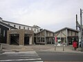
Kawamata Station, over the Tone, Meiwa Town
Article

10522 / めいわまち

Gunma Prefecture 邑楽郡

Meiwa Town

A station moved across the Tone River.

Kawamata Station, over the Tone

Photo by D-s-yama (CC BY-SA 4.0)

01 / Ferry crossing

A ferry on the Tone River wasone of Edo's defensive outposts.

Ferry crossing in Meiwa Town
Photo by 竹太郎 at Japanese Wikipedia (Public domain)

In 1616 the Kawamata ferry landing was designated one of the 16 official river crossings of the Kanto region, set up to defend Edo. Because Mount Fuji could be seen clearly from it, ordinary people called it Fujimi no Watashi, the "Fuji-viewing Ferry". The post town of Kawamata lost its role in 1907, with the opening of the railway among other changes.

  • One of 16 Kanto crossings, 1616
  • "Fujimi no Watashi"
  • Role ended with the railway, 1907

02 / Stone sutra

Sutra characters, one to a stone,buried in a corner of the shrine.

To save people from epidemics, the priest Gyoban copied a sutra onto stones he had picked up, one character to a stone, finishing on the 27th day of the fifth month of 1713. He buried them in the northwest corner of the local Tenmangu shrine and raised a tower there. It is a town-designated historic site.

  • One character to a stone
  • Finished 27th day, fifth month, 1713
  • Town-designated historic site

03 / Torii

The torii's inscription recordsa dedication to 188 pilgrimage sites.

The torii gate of Sugawara Shrine in Suga carries an inscription dating its erection to an auspicious day in the ninth month of 1736. It reads that the gate was raised as a dedication to the 188 pilgrimage sites of Shikoku, Saigoku, Bando and Chichibu, and it names the priest Keisan. It is a town-designated historic site.

  • 1736 inscription
  • 188 pilgrimage sites
  • Town-designated historic site

Meiwa Town from the sky

Now and 1974–78. Tap a photo to zoom in.

Wide (about 6 km across)

Close (about 1.5 km across)

Now (shot April 2021)Shot 1974–78

Source: Geospatial Information Authority of Japan (GSI) GSI Tiles(全国最新写真(シームレス)/国土画像情報(第一期:1974〜1978年撮影))

Open in GSI Maps (now)Open in GSI Maps (1974–78)

Living here

Cross the Tone River's iron bridge, and you are in Meiwa.

  • about 10,000 people
  • Rural district town

The town's station is Kawamata Station on the Tobu Isesaki Line. The town is long and narrow along the Tone River, about 11 km east to west and 3 km north to south, at an elevation of roughly 17 to 21 m. Pear orchards dot the town, and every July four districts hold the sasara dance, in which three lions beat drums.

People living here
10,882people
19952020

−1.5% since 2015

11,255 → 10,882

Area
19.64km²

19.62km² of it habitable

2024

Households
4,089households

2.7 people per household

2020

Rent (average for rentals)
—
Healthcare
1 hospital / 5 clinics

5.5 per 10,000 people

2023

Almost entirely flat.Almost all of it is habitable land (99.9%)
Area and habitable land at the same scalee-Stat B1101 / B1103
Children waiting for childcare
—1 nurseries and similar
Home purchase subsidy
—
Average annual temperature
—

These 3 items are waiting on a nationwide data source. We do not fill them with estimates.

ACCESS

Where you can go from here.

Meiwa Town in Japan36.211°N 139.534°E
OsakaMeiwa Town
Kawamata Station
川俣駅2020
  • to AsakusaTobu Skytree Line and Isesaki Line81min
  • to Kita-SenjuTobu Skytree Line and Isesaki Line66min

Travel times follow 町公式「明和町へのアクセス」(2026-04-07 更新)の値と、Yahoo!路線情報の川俣駅の時刻表(東武伊勢崎線・館林方面。列車ごとの停車表に始発駅・発着時刻・運転日の注釈が出る。2026-10-21 に読んだ)で数え直した値 (checked 2026-10-21). They vary by time of day.

Shape

Borders 5 municipalities across 1 prefectures.

Territory of Meiwa Town
Boundaries: National Land Numerical Information (Administrative Area Data), MLIT. Processed by Machigatari.Lakes: National Land Numerical Information (Lake Data), MLIT. Processed by Machigatari. Prepared with the approval of the Director-General of the Geospatial Information Authority of Japan, using its Digital Map 25000 (Spatial Data Framework) and Digital Map 25000 (Place Names and Public Facilities). (承認番号 平27情使、第585号)

North to south

3.4km

Saitama Prefecture
Hanyu City, Gyoda City

Meiwa Town isthis kind of town.

  1. 01Kawamata Station opened provisionally on the Tone River's right bank in 1903, and in 1907 moved to Nakaya in Meiwa on the left bank, as the Tone River bridge opened
  2. 02The Kawamata ferry was one of the 16 official Kanto river crossings set up to defend Edo, and was called the "Fuji-viewing Ferry"
  3. 03Town-designated historic sites include a tower where a sutra written one character to a stone was buried, and a Sugawara Shrine torii inscribed for 188 pilgrimage sites

If something caught your eye, ask the town itself.