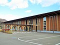
Former Kanno House, gold buying, Sumita Town
Article

03441 / すみたちょう

Iwate Prefecture 気仙郡

Sumita Town

Records say it bought an 88 g gold lump.

Former Kanno House, gold buying

Photo by Ty19080914 (CC BY-SA 4.0)

01 / Ironworks site

Two blast furnaces, plus a post office and school:a whole ironworks village.

Kuriki Tetsuzan was not a mine that dug iron ore but an ironworks that made iron. The town says it had two blast furnaces, a foundry, housing for staff and workers, a post office, a company store and even a school. The site was designated a National Historic Site in 2021.

  • Two blast furnaces
  • National Historic Site, Oct. 11, 2021
  • Prefectural Historic Site, 1999

02 / School building

An early Showa school built with Kesen carpenters' skillwas moved and reused as a museum.

School building in Sumita Town
Photo by Ty19080914 (CC BY-SA 4.0)

The Agency for Cultural Affairs describes a two-storey wooden building with clapboard walls, German-style upper walls and a porch at the center with a symmetrical layout. The town says the former Kami-Arisu Elementary School, built with the high skill of Kesen carpenters, was moved and restored at its present site.

  • Early Showa school building
  • Registered, March 27, 2018
  • Kesen carpenters' craft

03 / Bridge

A concrete arch bridge built in 1931has a farm irrigation channel on one side.

Bridge in Sumita Town
Photo by Ty19080914 (CC BY-SA 4.0)

The spectacles-style bridge in Kami-Arisu is a concrete arch bridge built in 1931, during the agricultural depression. Its parapets are low and one side is an irrigation channel for farmland. The town writes that its beautiful arch conveys a stance of keeping a sense of beauty.

  • 1931
  • Concrete arch bridge
  • Irrigation channel on one side

Sumita Town from the sky

Now and 1974–78. Tap a photo to zoom in.

Wide (about 6 km across)

Close (about 1.5 km across)

Now (shot September–December 2013)Shot 1974–78

Source: Geospatial Information Authority of Japan (GSI) GSI Tiles(全国最新写真(シームレス)/国土画像情報(第一期:1974〜1978年撮影))

Open in GSI Maps (now)Open in GSI Maps (1974–78)

Living here

1 hour 43 minutes by bus from Morioka Station, in the hills.

  • about 5,000 people
  • Rural district town

The town's access guide tells visitors to take the Iwate Kenkotsu Ofunato-Morioka bus line from Morioka Station and get off at Setamai Station. In the timetable revised in October 2025, the 17:45 bus from in front of Morioka Station, via the expressway, reaches Setamai-ekimae at 19:28, 103 minutes; the 13:40 bus via Tono takes 154. Setamai-ekimae is a bus stop name; the town's map shows Kami-Arisu Station about 30 minutes by car from Shin-Hanamaki Station.

People living here
5,045people
19952020

−11.8% since 2015

7,783 → 5,045

Area
334.84km²

35.12km² of it habitable

2024

Households
1,981households

2.5 people per household

2020

Rent (average for rentals)
—
Healthcare
0 hospitals / 5 clinics

9.9 per 10,000 people

2023

Area334.84km²Habitable land35.12km² / 10%
Area and habitable land at the same scalee-Stat B1101 / B1103
Children waiting for childcare
—2 nurseries and similar
Home purchase subsidy
—
Average annual temperature
—

These 3 items are waiting on a nationwide data source. We do not fill them with estimates.

ACCESS

Where you can go from here.

Sumita Town in Japan39.142°N 141.575°E
TokyoOsakaSumita Town
Sumita Town Office
住田町役場2017
  • to MoriokaLocal bus103min

Travel times follow 岩手県交通『大船渡盛岡線 バス時刻表』(岩手県交通公式 https://www.iwatekenkotsu.co.jp/engan.html の『大船渡・盛岡線 平日・土日祝日』PDF。2025年10月1日運賃改定の版)。盛岡駅前(8番のりば)発 13:40→世田米駅前着 16:14(154分・遠野経由)と 17:45→19:28(103分・荷沢経由)の2本。逆向きは世田米駅前発 13:54→盛岡駅前着 16:28(154分)・7:54→9:37(103分)。大船渡駅前発 7:25→世田米駅前 7:54 と 13:25→13:54 の2本はどちらも29分(荷沢峠経由)。町公式『アクセス情報』の図(https://www.town.sumita.iwate.jp/access.html の画像 access02_2022.gif)に『盛岡駅 岩手県交通 大船渡・盛岡線(大迫・遠野経由)→世田米駅下車 2時間34分 ※高速道経由の場合は1日2便/1時間43分』とあり、2つの値は時刻表の154分・103分と一致する (checked 2026-10-23). They vary by time of day.

Shape

Borders 6 municipalities.

Territory of Sumita Town
Boundaries: National Land Numerical Information (Administrative Area Data), MLIT. Processed by Machigatari.

Sumita Town isthis kind of town.

  1. 01The Former Kanno House is a townhouse facing the street in Setamai; its main house, annex and four storehouses were registered as Tangible Cultural Properties in 2017, and the town writes that it bought river gold and has a record of buying an 88 g gold lump in 1890 and exhibiting at the 1900 Paris Exposition
  2. 02The Kuriki Tetsuzan site is the remains of a privately run ironworks with two blast furnaces and a foundry, a Prefectural Historic Site in 1999 and a National Historic Site in 2021; the town explains it had a post office and a school, forming one ironworks village
  3. 03The former Kami-Arisu Elementary School building was built in the early Showa era with Kesen carpenters' skill and reused as a museum after being moved; the spectacles-style bridge in Kami-Arisu is a concrete arch bridge of 1931 with an irrigation channel on one side

If something caught your eye, ask the town itself.