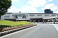
Maizuru Yoshihara 2019-05 ac (6).jpg
Article

26202 / まいづるし

Kyoto Prefecture

Maizuru City

An inlet runs down the middle of town.

Yoshihara, a fishers' town plan

Photo by Asturio Cantabrio (CC BY-SA 4.0)

01 / Warehouses

Brick warehouses with a round windowset in the upper gable wall.

Maizuru Red Brick Warehouses 2021-03 ac (2).jpg
Photo by Asturio Cantabrio (CC BY-SA 4.0)

The Maizuru Former Naval District Warehouse Facilities were designated an Important Cultural Property in 2008. The brick walls of the weapons warehouses, including the Reserve Fleet Ordnance Warehouse, and of the supply warehouses are laid in English bond, two and a half bricks thick below and two above. A round window is set high in each gable wall.

  • Important Cultural Property, 2008
  • Walls laid in English bond
  • Two and a half bricks thick below, two above

02 / Station

A gabled porch projectsfrom the front of the waiting room.

MatuSt2.jpg
Photo by Sea of Japan (CC BY-SA 3.0)

The former station building on the Obama Line stands on the south side of the present platform, facing south. It has a gabled roof and an entrance on the long side: the waiting room is on the east, the office on the west, a gabled porch projects from the front of the waiting room, and a lean-to runs along the whole back. Built in 1922, it was registered as a Tangible Cultural Property (building) in 2018.

  • Built in 1922; single-storey timber
  • Building area 128 m²
  • Registered Tangible Cultural Property (building), 2018

03 / Dugout canoe

A canoe hollowed from a giant cedaris thought to be for the open sea.

At the Uranyu site on the east shore of the mouth of Maizuru Bay, a dugout canoe from the early Jomon period was found in 1997. It was made by splitting a cedar more than 1 m in diameter and hollowing it out with stone axes. The surviving part is 5 m long and 1 m wide at most; the hull is estimated at around 8 m.

  • Found in 1997
  • Surviving length 5 m, greatest width 1 m
  • Hull estimated at around 8 m

Living here

93 minutes from Kyoto on the Limited Express Maizuru.

  • about 80,000 people

The gateway is JR Higashi-Maizuru Station. The fastest Limited Express Maizuru from Kyoto Station takes 93 minutes, with no change of trains.

People living here
80,336people
19952020

−4.4% since 2015

94,784 → 80,336

Area
342.13km²

73.08km² of it habitable

2024

Households
35,188households

2.3 people per household

2020

Rent (average for rentals)
42,874yen

National average 60,630 yen

2023

Healthcare
7 hospitals / 60 clinics

8.3 per 10,000 people

2023

Area342.13km²Habitable land73.08km² / 21%
Area and habitable land at the same scalee-Stat B1101 / B1103
Children waiting for childcare
—15 nurseries and similar
Home purchase subsidy
—
Average annual temperature
—

These 3 items are waiting on a nationwide data source. We do not fill them with estimates.

ACCESS

Where you can go from here.

Maizuru City in Japan35.475°N 135.386°E
TokyoMaizuru City
Higashi-Maizuru Station
東舞鶴駅2019
  • to KyotoJR limited express93min

Travel times follow JR西日本『JRおでかけネット』の列車時刻表(timetable.jr-odekake.net。データは『JR時刻表』2026年10月号に基づく。日付指定 2026-10-08)。京都駅の嵯峨野線の駅時刻表(station-timetable/2784055001)で『特急まいづる』の列車を取り、各列車のページ(train-timetable/…)で停車駅と運転日を読んだ。京都→東舞鶴の乗り換えなしの特急まいづる8本:1号 8:38→10:11(93分)・3号 10:25→12:01(96分)・5号 12:25→14:02(97分)・7号 14:25→16:01(96分)・9号 16:25→18:02(97分)・11号 18:28→20:18(110分)・13号 19:28→21:15(107分)・15号 20:36→22:21(105分)。7・9・11・13・15号の運転日は『毎日運転』のみ。1・3・5号の運転日欄には『10月19〜21日は運休・バス代行輸送』の注記(この3日だけの運休で、それ以外は運転)。いずれも京都〜綾部は特急はしだて・きのさきと併結で、綾部・福知山・西舞鶴の順に停まり、東舞鶴で終点(乗り換えなし)。逆向き(東舞鶴→京都)は東舞鶴駅の駅時刻表(station-timetable/3238056001)の特急まいづる2〜14号:6:39→8:21(102分)・8:25→10:06(101分)・10:27→12:07(100分)・12:29→14:06(97分)・14:28→16:06(98分)・16:26→18:07(101分)・18:36→20:21(105分) (checked 2026-10-08). They vary by time of day.

Shape

Borders 4 municipalities across 1 prefectures.

Territory of Maizuru City
Boundaries: National Land Numerical Information (N03)Lakes: National Land Numerical Information (Lake Data), MLIT. Processed by Machigatari. Prepared with the approval of the Director-General of the Geospatial Information Authority of Japan, using its Digital Map 25000 (Spatial Data Framework) and Digital Map 25000 (Place Names and Public Facilities). (承認番号 平27情使、第585号)

North to south

37.1km

Kyoto Prefecture
綾部市, 宮津市, 福知山市
Fukui Prefecture
高浜町

Maizuru City isthis kind of town.

  1. 01Yoshihara began as the fishers' town moved to its present site when the Tanabe castle town was reworked in the mid-Edo period, and an inlet extends through its centre. In April 2026 the city designated it a preservation district for groups of traditional buildings, and a fire festival in which a fish-shaped lantern frame is lit and spun in the river has been held on the night of 16 August
  2. 02The Maizuru Former Naval District Warehouse Facilities are an Important Cultural Property, with brick walls in English bond. The former main building of Matsunoodera Station is a timber station from 1922, a Registered Tangible Cultural Property
  3. 03A dugout canoe from the early Jomon period was excavated at the Uranyu site. The Shiroya fire festival is held at Amabiki Shrine on 14 August, the Yukinaga family house is an Important Cultural Property, and the Kanmuri Island shearwater colony is a National Natural Monument

See the town as it is now.

Source: Wikidata (P2002, P2003, P2013, P2397)

If something caught your eye, ask the town itself.