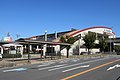
Shibaraki Tooth Shrine.jpg
Article

27217 / まつばらし

Osaka Prefecture

Matsubara City

Festival from 8:08 p.m. on August 8.

Hagami Shrine, Shibagaki Shrine

Photo by Barsaka2 (CC0)

01 / Kofun stone

The basin by the assembly hall is saidto be stone from a kofun's burial chamber.

Shibagaki-jinja, chozubachi.jpg
Photo by Saigen Jiro (CC0)

The basin is inscribed with the words for Tenmangu, Kyowa 1 (1801), and the parishioners of Higashi-Otsuka village. The city records it as reused from part of the burial chamber of Kawachi Otsukayama Kofun. The Tenmangu shrine once stood on the mound's round rear part and was merged into Shibagaki Shrine in Meiji 41 (1908). The kofun became a mausoleum reference site in 1925, and the village on the mound was ordered to move out by 1928.

  • Inscribed Kyowa 1 (1801)
  • 1908: Tenmangu merged into the shrine
  • 1925: made a mausoleum reference site

02 / Archaeological site

From a settlement under Furuike Pond,a bronze scale weight and a ditch 4.8 m wide.

河合遺跡 大溝 丹比大溝 河合大溝.jpg
Photo by 松原市教育委員会 (CC BY-SA 4.0)

Under the bed of Furuike Pond in Kawai 3-chome, a settlement from the Nara to Kamakura periods was found. A post hole in the eastern embankment yielded a bronze weight for a scale (60.5 g), dated to the Asuka to Nara periods. The ditch south of the post holes, the Tajihi Great Ditch, is about 4.8 m wide and about 2 m deep, and is thought to have been dug in the Asuka period to bring water from the Nishiyoke River to rice fields.

  • Bronze weight, 60.5 g
  • Ditch about 4.8 m wide, about 2 m deep
  • Settlement of the Nara to Kamakura periods

03 / Natural monument

In the guest-hall garden of a Tannan temple,stands a juniper over 500 years old.

Raigou-ji, Matsubara 来迎寺のいぶき.jpg
Photo by 松原市 (CC BY-SA 4.0)

The ibuki (Chinese juniper) in the guest-hall garden of Raigo-ji Temple is 15 m tall and 4.1 m around the trunk, with a 12 m spread. It was designated an Osaka Prefecture Natural Monument in 1981. The city notes that the species' trunk twists greatly as it grows large, that few reach this size, and calls it a representative tree of the city.

  • Over 500 years old
  • 15 m tall, 4.1 m around the trunk
  • 1981: prefectural designation

Living here

8 to 9 minutes from Osaka Abenobashi by semi-express.

  • about 120,000 people
  • 30 min to a city centre

To Kawachi-Matsubara Station on the Kintetsu Minami-Osaka Line it is 9 minutes by semi-express from Osaka Abenobashi at midday, and 8 minutes on some morning, evening and night trains. City Hall is about 150 m north along the shopping street from the station's northwest exit, then about 400 m after a left turn. The city has four stations, all on the Kintetsu Minami-Osaka Line.

People living here
117,641people
19952020

−2.6% since 2015

134,457 → 117,641

Area
16.66km²

16.66km² of it habitable

2024

Households
51,902households

2.3 people per household

2020

Rent (average for rentals)
52,703yen

National average 60,630 yen

2023

Healthcare
6 hospitals / 96 clinics

8.7 per 10,000 people

2023

Almost entirely flat.Almost all of it is habitable land (100.0%)
Area and habitable land at the same scalee-Stat B1101 / B1103
Children waiting for childcare
—19 nurseries and similar
Home purchase subsidy
—
Average annual temperature
—

These 3 items are waiting on a nationwide data source. We do not fill them with estimates.

ACCESS

Where you can go from here.

Matsubara City in Japan34.578°N 135.552°E
TokyoMatsubara City
Kawachi-Matsubara Station
河内松原駅2019
  • to OsakaKintetsu Minami-Osaka Line semi-express8min

Travel times follow 近畿日本鉄道『駅の時刻表』(eki.kintetsu.co.jp。ページに「2026/3/14現在」)。大阪阿部野橋駅(slCode=349-0)の発車時刻表の『古市・河内長野・橿原神宮前・吉野方面』の平日のダイヤ・土休日のダイヤを朝5時台から終電まで全部拾い(平日270本・土休日255本。普通を除く特急・急行・区間急行・準急・青の交響曲を1本ずつ停車駅表 T7 で開いた)、河内松原『着』を大阪阿部野橋『発』から引いた。逆向きは河内松原駅(slCode=349-9)の『大阪阿部野橋方面』の平日・土休日の全列車(平日211本・土休日201本。普通を除く準急を1本ずつ T7 で開いた)。 (checked 2026-10-14). They vary by time of day.

Shape

Borders 5 municipalities.

Territory of Matsubara City
Boundaries: National Land Numerical Information (N03)

North to south

5.1km

堺市, 大阪市, 羽曳野市, 藤井寺市, 八尾市

Matsubara City isthis kind of town.

  1. 01Hagami Shrine, a small shrine in the grounds of Shibagaki Shrine, holds its festival every year from 8:08 p.m. on August 8, according to the tourist association. Shibagaki Shrine is said to stand where Emperor Hanzei's Tajihi Shibagaki Palace was, and is a component of the Japan Heritage story of the Takenouchi Kaido and Yokooji (Daido) roads. The city records a signpost lettered "Chichikami-bashi" on the Nagao Kaido road in Ueda 1-chome
  2. 02Kawachi Otsukayama Kofun is a keyhole-shaped mound 335 m long, a mausoleum reference site that straddles Matsubara and Habikino. At the Kawai site, a settlement from the Nara period on and the Tajihi Great Ditch were found under Furuike Pond, and the juniper of Raigo-ji Temple became an Osaka Prefecture Natural Monument in 1981
  3. 03Naniwa Daido is a road of the Asuka period found at the Yamatogawa-Imaike site, with a width of 19 m measured between the centres of its side ditches. Nunose Shrine holds the Nunose Hakkei plaques that nearby village heads and monks dedicated in Hoei 2 (1705). Osaka Abenobashi is 8 to 9 minutes away on the Kintetsu semi-express

See the town as it is now.

Source: Wikidata (P2002, P2003, P2013, P2397)

If something caught your eye, ask the town itself.