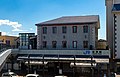
West Gate (Sugaura) 20230212 03.jpg
Article

25203 / ながはまし

Shiga Prefecture

Nagahama City

Gates still divide inside from outside.

Shisokumon gates, Sugaura

Photo by 先従隗始 (CC0)

01 / Telescope

With a telescope he built himself,he watched sunspots for over a year.

Kunitomo Gun Museum 20210131 23.jpg
Photo by 先従隗始 (CC0)

Born into a family of Kunitomo gunsmiths, Ikkansai began building a reflecting telescope in 1832 (Tenpo 3). From the 6th day of the first month of Tenpo 6 (1835) to 8 February the next year, he observed sunspots twice a day whenever the sun was visible. The 953 items of the Kunitomo Ikkansai-related materials became an Important Cultural Property in 2023.

  • Telescope work began, 1832
  • Sunspots observed twice a day
  • Important Cultural Property, 2023

02 / Waterway

To save the village from floods,they dug through the mountain rock.

西野水道入口.jpg
Photo by Ryoma6352、OAS (CC BY-SA 3.0)

The Nishino Suido in Takatsuki-cho is a drainage channel cut through bedrock to carry water to Lake Biwa and protect the village from floods. Under the guidance of the village temple's head priest, the villagers took the lead, with support from Hikone Domain, and began digging in 1840 (Tenpo 11) with three stonemasons brought from Noto. It became a prefectural historic site in 1984.

  • Digging began, 1840
  • Three stonemasons from Noto
  • Prefectural Historic Site, 1984

03 / Garden

The emperor's lodging went up in three-plus months,and the garden came 25 years later.

Keiunkan05s3200.jpg
Photo by 663highland (CC BY 2.5)

Keiunkan was begun on 3 November 1886 (Meiji 19) and, after a rush job of just over three months, is said to have been finished on the morning of the visit of Emperor Meiji and the Empress on 21 February the next year. The garden was laid out in 1912 (Meiji 45) to mark the visit's 25th anniversary, and in 2006 it was designated a Place of Scenic Beauty.

  • Begun, 1886
  • Garden laid out, 1912
  • Place of Scenic Beauty, 2006

Living here

From Nagahama Station, 65 minutes to Kyoto and 95 to Osaka.

  • about 110,000 people
  • 90 min to a city centre

On the JR Special Rapid, it is 65 minutes from Nagahama Station to Kyoto and 95 minutes to Osaka. Some Shirasagi limited express trains also stop at Nagahama, reaching Nagoya in 71 minutes at the fastest. Nagahama Station is the city's busiest, used by about 10,000 people a day in total, with route buses from its east exit.

People living here
113,636people
2010

−3.9% since 2015

124,131 → 113,636

Area
681.02km²

164.28km² of it habitable

2024

Households
42,570households

2.7 people per household

2020

Rent (average for rentals)
47,497yen

National average 60,630 yen

2023

Healthcare
4 hospitals / 93 clinics

8.5 per 10,000 people

2023

Area681.02km²Habitable land164.28km² / 24%
Area and habitable land at the same scalee-Stat B1101 / B1103

Population from 2010 onward (municipal boundary changed).2006-02-13 に新設合併(浅井町・びわ町)。2010年調査から市域が変わっている。2010-01-01 に編入合併(虎姫町・湖北町・高月町・木之本町・余呉町・西浅井町)。2010年調査から市域が変わっている。

Children waiting for childcare
—23 nurseries and similar
Home purchase subsidy
—
Average annual temperature
—

These 3 items are waiting on a nationwide data source. We do not fill them with estimates.

ACCESS

Where you can go from here.

Nagahama City in Japan35.381°N 136.278°E
TokyoNagahama City
Nagahama Station
長浜駅2019
  • to KyotoJR Special Rapid65min
  • to OsakaJR Special Rapid95min
  • to NagoyaLtd. exp. Shirasagi71min

Travel times follow JR西日本『JRおでかけネット』区間時刻表(timetable.jr-odekake.net)。①line-timetable/2235『JR神戸線・JR京都線・琵琶湖線・山陽・東海道本線(姫路~大阪~米原)上り』(京都・大阪の『発』と、行先〈終着〉の列)、②line-timetable/2834『北陸本線(琵琶湖線)(大阪~京都/米原~近江今津~敦賀)下り』(米原・長浜・近江塩津などの時刻と、特急しらさぎの名古屋始発)。ページの日付は 2026-10-07(水)と 2026-10-10(土)の2日分を取り、運転日注意欄の印(『平』『土休』)の無い列車だけを『毎日乗れる定期便』として数えた。乗り換えなしかは、同じ列車が起点の『発』と長浜の時刻を持つか(2235 の行先が『長浜』か、行先が敦賀・近江塩津の列車は 2834 で同じ行先・同じ時刻の列車の長浜の時刻を引いた)で数えた (checked 2026-10-07). They vary by time of day.

Shape

Borders 5 municipalities across 2 prefectures.

Territory of Nagahama City
Boundaries: National Land Numerical Information (N03)Lakes: National Land Numerical Information (Lake Data), MLIT. Processed by Machigatari. Prepared with the approval of the Director-General of the Geospatial Information Authority of Japan, using its Digital Map 25000 (Spatial Data Framework) and Digital Map 25000 (Place Names and Public Facilities). (承認番号 平27情使、第585号)

North to south

40.1km

Shiga Prefecture
米原市, 高島市
Fukui Prefecture
敦賀市, 南越前町
Gifu Prefecture
揖斐川町

Nagahama City isthis kind of town.

  1. 01Sugaura, on Lake Biwa's northern shore, marks the edge of the village with its west and east shisokumon gates, and the Sugaura documents, which tell of the medieval "so" village, are a National Treasure
  2. 02Ikkansai of Kunitomo observed sunspots with a telescope he built himself, and the Nishino Suido in Takatsuki is a drainage channel the villagers dug through mountain bedrock to protect the village from floods
  3. 03The port town has the garden of Keiunkan, the Emperor's lodging (a Place of Scenic Beauty), and the city also has the Nagahama Hikiyama Festival's float rites (a nationally designated Important Intangible Folk Cultural Property) and Chikubu Island (a Place of Scenic Beauty and Historic Site)

See the town as it is now.

Source: Wikidata (P2002, P2003, P2013, P2397)

If something caught your eye, ask the town itself.