Isaki-ji (bar).jpg
Article

25204 / おうみはちまんし

Shiga Prefecture

Omihachiman City

A monk walks to a pole's end over water.

Saotobi, Isaki-ji Temple

Photo by Alpsdake (CC BY-SA 4.0)

01 / Island

No cars, no traffic lights:the island's wheels are big tricycles.

Okishima tricycle ac (3).jpg
Photo by Asturio Cantabrio (CC BY-SA 4.0)

Okishima, about 1.5 km off the shore of Lake Biwa, is about 6.8 km around. It has no cars and no traffic lights. Islanders mainly get around on tricycles with a large cargo bed at the back. Covering the saddle with a can called a "gangan" is the Okishima style. A regular boat from Horikiri Port takes about 10 to 15 minutes.

  • No cars or traffic lights
  • About 6.8 km around
  • About 10 to 15 minutes by regular boat

02 / School

Most of the schoolhouse's costwas covered by donations.

Front View of Hakuunkan.jpg
Photo by 陳 ポーハン (CC BY 2.0)

Hakuunkan was built in 1877 (Meiji 10) as the Hachiman Higashi School. It was a schoolhouse meant to improve children's education, and most of its cost was covered by donations: 6,000 yen of the day, when a bale of rice cost 1 yen 34 sen, was raised. It is a Registered Tangible Cultural Property of Japan.

  • Built in 1877 as a school
  • 6,000 yen, when a bale of rice cost 1 yen 34 sen
  • Registered Tangible Cultural Property

03 / Rakuichi

Below a mountain castle of stone walls,a rakuichi market was held in 1549.

Kannonjij10.jpg
Photo by ブレイズマン (Public domain)

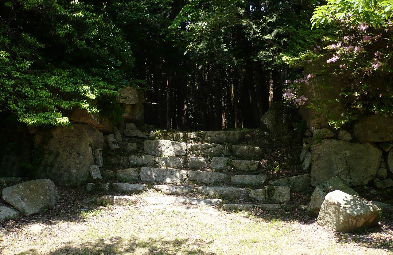
The Kannonji Castle site on Mount Kinugasa is a National Historic Site. The castle is thought to have been given its heavy use of stone walls in the 1530s to 1550s. At Ishidera on the mountain's southern foot, the prefecture's cultural properties page says the "first rakuichi in history" was held at Ishidera Shinichi in the 18th year of Tenbun (1549).

  • National Historic Site: Kannonji Castle site
  • 1530s-1550s: heavy use of stone walls
  • 1549: rakuichi at Ishidera Shinichi

Living here

34 minutes to Kyoto, 64 to Osaka, by Special Rapid.

  • about 80,000 people
  • 90 min to a city centre

From JR Omi-Hachiman Station, the JR Special Rapid reaches Kyoto in 34 minutes and Osaka in 64 (JR West timetable; the fastest daily service). The Ohmi Railway also calls at the station.

People living here
81,122people
2010

−0.2% since 2015

81,738 → 81,122

Area
177.45km²

80.01km² of it habitable

2024

Households
31,403households

2.6 people per household

2020

Rent (average for rentals)
51,350yen

National average 60,630 yen

2023

Healthcare
3 hospitals / 59 clinics

7.6 per 10,000 people

2023

Area177.45km²Habitable land80.01km² / 45%
Area and habitable land at the same scalee-Stat B1101 / B1103

Population from 2010 onward (municipal boundary changed).2010-03-21 に新設合併(安土町)。2010年調査から市域が変わっている。

Children waiting for childcare
—15 nurseries and similar
Home purchase subsidy
—
Average annual temperature
—

These 3 items are waiting on a nationwide data source. We do not fill them with estimates.

ACCESS

Where you can go from here.

Omihachiman City in Japan35.128°N 136.098°E
TokyoOmihachiman City
Ōmi-Hachiman Station
近江八幡駅2010
  • to KyotoJR Special Rapid34min
  • to OsakaJR Special Rapid64min

Travel times follow JR西日本『JRおでかけネット』区間時刻表(ページの日付 2026年10月7日)。上り(姫路〜大阪〜米原)line-timetable/2235 で『京都 発』→『近江八幡 着』と『大阪 発』→『近江八幡 着』、下り(米原〜大阪〜姫路)line-timetable/2234 で『近江八幡 発』→『京都 着』『大阪 着』を、同じ列車の列で数えた(乗り換えなし)。 (checked 2026-10-07). They vary by time of day.

Shape

Borders 3 municipalities.

Territory of Omihachiman City
Boundaries: National Land Numerical Information (N03)Lakes: National Land Numerical Information (Lake Data), MLIT. Processed by Machigatari. Prepared with the approval of the Director-General of the Geospatial Information Authority of Japan, using its Digital Map 25000 (Spatial Data Framework) and Digital Map 25000 (Place Names and Public Facilities). (承認番号 平27情使、第585号)

North to south

15.4km

東近江市, 野洲市, 竜王町

Omihachiman City isthis kind of town.

  1. 01At Isaki-ji Temple, on 1 August every year, a monk who has completed the 100-day mountain circuit practice walks out on a pole jutting several metres above the water and jumps from its tip into Lake Biwa; the rite is called saotobi
  2. 02On Okishima, which has no cars or traffic lights, tricycles with a large cargo bed at the back are the islanders' main way of getting around
  3. 03There is Hakuunkan, a schoolhouse built with donations, and at Ishidera below the Kannonji Castle site the prefecture records a rakuichi in 1549; the Azuchi Castle site, a Special Historic Site, is also in the city

See the town as it is now.

Source: Wikidata (P2002, P2003, P2013, P2397)

If something caught your eye, ask the town itself.