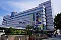
Suzuki Plaza 01.jpg
Article

22130 / はままつし

Shizuoka Prefecture

Hamamatsu City

Where Japan's big 3 motorcycle makers began.

Honda, Yamaha and Suzuki

Photo by Yones (CC BY-SA 3.0)

01 / Manufacturing

Honda, Yamaha and Suzukiwere all born here.

Hamamatsu Museum of Musical Instruments Historical Pianos.jpg
Photo by ScribblingGeek (CC BY-SA 4.0)

Honda, Yamaha, Suzuki: three of the world's leading motorcycle makers were all born in Hamamatsu, and at the peak about 40 makers were based in the city. Musical instrument makers gather here too, led by Yamaha, Kawai and Roland, and pianos, electronic organs, wind instruments and guitars are made in the city.

  • Birthplace of the big three motorcycle makers
  • About 40 makers at the peak
  • Yamaha, Kawai, Roland

02 / Lake Hamana

The sandbar broke,and the sea came into the lake.

Tsubute Island in Lake Hamana.jpg
Photo by Alpsdake (CC BY-SA 3.0)

Lake Hamana is a brackish lake joined to the Enshū-nada Sea by the Imagire-guchi (今切口) channel, 200 m wide. The sandbar that once separated lake and sea is said to have broken in disasters such as the Meiō earthquake of 1498, and the place came to be called Imagire, "just broken". The lake is shallow, 5 m deep on average, and yields the mud crab known locally as dōman (ドウマン), found in only a few places in Japan.

  • Imagire-guchi, 200 m wide
  • Meiō earthquake, 1498
  • 5 m deep on average

03 / Forest

Two-thirds of the city is forest,called Tenryū Birin.

Natsuyaki area, Shizuoka.jpg
Photo by Yones (CC BY-SA 3.0)

With the 2005 merger, the wide forests of the upper Tenryū River became part of the city. Forest covers about 103,000 ha, 66% of the city. More than 70% of it is planted cedar and cypress, known as Tenryū Birin (天竜美林) and counted among Japan's three great planted forests. In the Meiji era, Kinpara Meizen (金原明善) planted trees to put an end to the Tenryū River's floods.

  • About 103,000 ha of forest
  • 66% of the city
  • One of Japan's three great planted forests

Living here

90 minutes to Tokyo, 30 to Nagoya by Shinkansen.

  • about 790,000 people
  • 30 min to a city centre
  • Shinkansen stops here

On the Tōkaidō Shinkansen Hikari, Hamamatsu Station is about an hour and a half from Tokyo and about 30 minutes from Nagoya. City Hall is about 5 minutes by bus from the north exit of Hamamatsu Station. The city is the second largest municipality in Japan by area, and since January 2024 it has been divided into three wards: Chūō, Hamana and Tenryū.

People living here
790,718people
2010

−0.9% since 2015

800,866 → 790,718

Area
1,558.11km²

490.43km² of it habitable

2024

Households
320,749households

2.5 people per household

2020

Rent (average for rentals)
53,213yen

National average 60,630 yen

2023

Healthcare
32 hospitals / 650 clinics

8.6 per 10,000 people

2023

Area1558.11km²Habitable land490.43km² / 31%
Area and habitable land at the same scalee-Stat B1101 / B1103
Children waiting for childcare
—110 nurseries and similar
Home purchase subsidy
—
Average annual temperature
—

These 3 items are waiting on a nationwide data source. We do not fill them with estimates.

ACCESS

Where you can go from here.

Hamamatsu City in Japan34.711°N 137.726°E
TokyoOsakaHamamatsu City
Hamamatsu Station
浜松駅2018
  • to TokyoShinkansen Hikari90min
  • to NagoyaShinkansen Hikari30min
  • to OsakaShinkansen Hikari90min

Travel times follow 市公式「浜松市の強み・魅力」(企業立地、2026-07-31 更新)の「新幹線、高速道路での所要時間」の表に載っている値 (checked 2026-09-24). They vary by time of day.

Shape

Borders 11 municipalities across 2 prefectures.

Territory of Hamamatsu City
Boundaries: National Land Numerical Information (N03)

North to south

73.0km

Shizuoka Prefecture
川根本町, 磐田市, 森町, 湖西市, 島田市
Aichi Prefecture
新城市, 豊根村, 東栄町, 豊橋市
Nagano Prefecture
飯田市, 天龍村

Hamamatsu City isthis kind of town.

  1. 01A manufacturing city where Honda, Yamaha and Suzuki, the big three motorcycle makers, were born, and where instrument makers gather
  2. 02It holds Lake Hamana, a brackish lake joined to the Enshū-nada Sea by the 200 m Imagire-guchi channel
  3. 0366% of the city is forest, and the planted cedar and cypress of the upper Tenryū River are called Tenryū Birin

See the town as it is now.

Source: Wikidata (P2002, P2003, P2013, P2397)

If something caught your eye, ask the town itself.