美濃田の淵 - panoramio.jpg
Article

36489 / ひがしみよしちょう

Tokushima Prefecture 三好郡

Higashimiyoshi Town

A half-built pier stands on a rock.

Minoda no Fuchi, Phantom Bridge

Photo by ball banban (CC BY 3.0)

01 / Kamo no Okusu

The national, prefectural and town governmentsbought about 40 a of paddies to protect the great camphor.
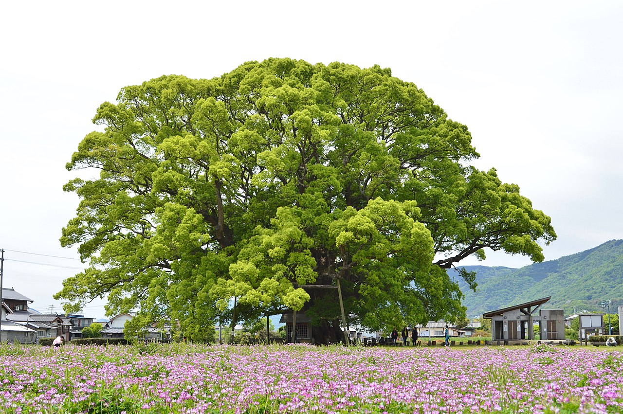
Kamo-no-Okusu-1.jpg
Photo by Saigen Jiro (CC0)

In 1965 (Showa 40) the national, prefectural and town governments launched a protection project costing 3.5 million yen and bought about 40 a of rice paddies around the Kamo no Okusu (加茂の大クス). The town says soil was mounded at the base, an iron fence set up and fertiliser given. A Special Natural Monument, it is described in the Agency for Cultural Affairs record as standing among the paddies.

  • Protection project of 3.5 million yen by the national, prefectural and town governments, 1965 (town)
  • About 40 a of surrounding paddies bought (same)
  • Designated a Special Natural Monument in 1956 (Agency for Cultural Affairs)

02 / Chozenji, Ekiroyama

Eight temples were designated as lodgings by the domain.Chozenji (長善寺) became one of them in Keicho 3.

Tyouzenji 20200404 01.jpg
Photo by Dokudami (CC BY-SA 4.0)

In June of Keicho 3 (1598), the domain lord Hachisuka Iemasa designated temples along the main routes of Awa Province as lodgings, called ekiroji (駅路寺). Chozenji holds the regulations issued then, the "Ekiroji Monjo" (a town-designated tangible cultural property). Its two paintings, of Manjushri and Vajrasattva, are Important Cultural Properties, kept at the Kyoto National Museum.

  • Designated an ekiroji in Keicho 3 (1598) (town)
  • Eight ekiroji in all (town)
  • Two silk paintings are Important Cultural Properties (Agency for Cultural Affairs)

03 / Hachiman Shrine's stone rows

387 standing stones of crystalline schistring Nakasho's Hachiman Shrine in two rows.

The standing stones cover about 114 m east-west and 65 m north-south, 387 in all. Called iwakura or kekkaiseki (boundary stones), they are said by the town to be without parallel in Japan. On October 14, the eve of the autumn festival, the Yoimiya rite has been held; designated a prefectural cultural property (folk material) in 1955, it includes the kagura "Tsurugi no Mai" (sword dance).

  • 387 standing stones in all (town, citing the Mikamo town history)
  • About 114 m east-west and 65 m north-south (same)
  • Yoimiya rite designated a Tokushima prefectural cultural property in 1955 (town)

Living here

Two former towns joined across the Yoshino River.

  • about 10,000 people
  • Rural district town

The town formed in 2006 from the merger of Miyoshi and Mikamo. The Awa mountains lie to the north, the Shikoku mountains to the south, and the Yoshino River runs between; Sansan Bridge links the two former towns. Area 122.48 km². It works with the prefecture on the Nishi-Awa strawberry town plan and publishes a vacant-house bank.

People living here
13,622people
2010

−6.9% since 2015

15,044 → 13,622

Area
122.48km²

25.56km² of it habitable

2024

Households
5,182households

2.6 people per household

2020

Rent (average for rentals)
—
Healthcare
3 hospitals / 8 clinics

8.1 per 10,000 people

2023

Area122.48km²Habitable land25.56km² / 21%
Area and habitable land at the same scalee-Stat B1101 / B1103
Children waiting for childcare
—3 nurseries and similar
Home purchase subsidy
—
Average annual temperature
—

These 3 items are waiting on a nationwide data source. We do not fill them with estimates.

Shape

Borders 4 municipalities across 1 prefectures.

Higashimiyoshi Town in Japan34.037°N 133.937°E
TokyoHigashimiyoshi Town
Territory of Higashimiyoshi Town
Boundaries: National Land Numerical Information (N03)

North to south

16.4km

Tokushima Prefecture
三好市, つるぎ町
Kagawa Prefecture
まんのう町, 三豊市

Travel times per leg are not published by the municipality, so they are not shown.

Higashimiyoshi Town isthis kind of town.

  1. 01Minoda no Fuchi (美濃田の淵) in Ashiro is a pool 2 km long and 100 m wide on the middle Yoshino River, a prefectural place of scenic beauty and natural monument. A sightseeing bridge begun in 1953 was abandoned halfway, and its piers stand on the rocks.
  2. 02Former Mikamo has the Kamo no Okusu, a national Special Natural Monument, and the Tanda Kofun, a national historic site; former Miyoshi has the Ashiro nagi grove, a prefectural natural monument. The Sanbaso-mawashi puppets and the Hoichi rural stage are also town cultural properties.
  3. 03The town's rail stations are the three on the JR Tokushima Line: Awa-Kamo, Mikamo and Eguchi. The town publishes bus and shared-taxi services, and its migration site says highway buses arrive at Miyoshi BS at Yoshinogawa SA.

See the town as it is now.

Source: Wikidata (P2002, P2003, P2013, P2397)

If something caught your eye, ask the town itself.