Takamatsu castle09s3872.jpg
Article

37201 / たかまつし

Kagawa Prefecture

Takamatsu City

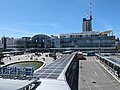
The castle moat is filled with seawater.

Takamatsu Castle moat

Photo by 663highland (CC BY 2.5)

01 / Yashima

A mountain 5 km long and 2 km wide,recognised as a classic mesa.

海上からの屋島.JPG
Photo by 屋嶋の仙人 (CC BY-SA 4.0)

About 14 million years ago, volcanic lava hardened into solid rock, while the softer rock around it eroded away over time, leaving a flat-topped plateau standing like a roof. Designated a National Historic Site and Natural Monument in 1934, Yashima (屋島) is a textbook example of a "mesa." Genpei War battle sites spread around its foot.

  • About 5 km north-south, 2 km east-west
  • 292 m elevation
  • National Historic Site & Natural Monument, 1934

02 / Bonsai

Eight in ten of Japan's pine bonsaigrow in fields across Kagawa.

Bonsai01.jpg
Photo by Toto-tarou (CC BY-SA 3.0)

Kagawa Prefecture produces about 80% of Japan's pine bonsai, centred on the Kinashi (鬼無) and Kokubunji (国分寺) districts of Takamatsu. Fields of black pine, five-needle pine and nishikimatsu (錦松) pines stretch out, said to have begun in the Edo period when wild pines were potted and sold. They are now exported to Europe and Asia, though the number of growers has fallen by about 30% in 15 years as growers age.

  • About 80% of Japan's pine bonsai (Kagawa Pref.)
  • 11.8 ha under cultivation (2015)
  • 199 growers (2015, down about 30% in 15 years)

03 / Prefectural Government Office

A postwar office building still in use,made a National Cultural Property first.

Kagawa-Pref-Office-east.jpg
Photo by Nakaful (CC BY-SA 3.0)

Designed by Kenzo Tange and completed in 1958, the East Building of the Kagawa Prefectural Government Office was designated a National Important Cultural Property in 2022 — the first time a postwar government building still in active use had been so designated. The ground floor has no offices, only a lobby and piloti open to the public, and Genichiro Inokuma's mural Wakei Seijaku (和敬清寂) and furniture by Isamu Kenmochi are also part of the designation.

  • Completed 1958, designed by Kenzo Tange
  • 2022: first postwar government building named an Important Cultural Property
  • 57 additional items designated (furniture, mural, etc.)

Living here

No bullet train, but a sleeper to Tokyo.

  • about 420,000 people

The JR Shikoku Yosan and Kotoku lines meet at Takamatsu Station, along with the Kotoden lines. There's no Shinkansen, but the Sunrise Seto sleeper train runs straight through to Tokyo without changing trains — the only such service in Shikoku. Highway buses connect to the Osaka, Kyoto and Kobe areas.

People living here
417,496people
2010

−0.8% since 2015

419,429 → 417,496

Area
375.54km²

233.3km² of it habitable

2024

Households
187,511households

2.2 people per household

2020

Rent (average for rentals)
49,771yen

National average 60,630 yen

2023

Healthcare
33 hospitals / 404 clinics

10.5 per 10,000 people

2023

Area375.54km²Habitable land233.3km² / 62%
Area and habitable land at the same scalee-Stat B1101 / B1103

Population from 2010 onward (municipal boundary changed).2005-09-26 に編入合併(塩江町)。2005年調査から市域が変わっている。2006-01-10 に編入合併(庵治町・香川町・香南町・国分寺町)。2010年調査から市域が変わっている。2006-01-10 に編入合併(牟礼町)。2010年調査から市域が変わっている。

Children waiting for childcare
—76 nurseries and similar
Home purchase subsidy
—
Average annual temperature
—

These 3 items are waiting on a nationwide data source. We do not fill them with estimates.

ACCESS

Where you can go from here.

Takamatsu City in Japan34.343°N 134.047°E
TokyoTakamatsu City
Takamatsu Station
高松駅2024
  • to TokyoSleeper ltd. exp. Sunrise Seto570min
  • to OsakaHighway bus200min
  • to KyotoHighway bus220min
  • to SannomiyaHighway bus180min

Travel times follow 高松市の観光公式サイト「エクスペリエンス高松」の「ACCESS」(2018年2月現在の表示だが、鉄道・高速バスの運行会社の現行時刻表と突き合わせて確かめた)に、東京から『JR東京駅 サンライズ瀬戸/約9時間30分 JR高松駅』、大阪から『JR大阪駅 たかなんフットバス/約3時間20分 JR高松駅』、京都から『JR京都駅 高松エクスプレス京都号/約3時間40分 JR高松駅』。三ノ宮は神姫バス公式「神戸三宮・舞子-高松線」の『164km/約3時間』 (checked 2026-09-25). They vary by time of day.

Shape

Borders 7 municipalities across 2 prefectures.

Territory of Takamatsu City
Boundaries: National Land Numerical Information (N03)

North to south

35.8km

Kagawa Prefecture
綾川町, 三木町, 坂出市, まんのう町, さぬき市
Tokushima Prefecture
美馬市
Okayama Prefecture
玉野市

Takamatsu City isthis kind of town.

  1. 01The moat of Takamatsu Castle, filled with seawater from the Seto Inland Sea, is still home to fish from the sea.
  2. 02Yashima, a 5 km mesa formed by volcanic activity, is a National Historic Site and Natural Monument, and Kagawa's fields, centred on Kinashi and Kokubunji, grow 80% of Japan's pine bonsai.
  3. 03The East Building of the Kagawa Prefectural Government Office, designed by Kenzo Tange, became Japan's first postwar government building to be a National Important Cultural Property in 2022.

See the town as it is now.

Source: Wikidata (P2002, P2003, P2013, P2397)

If something caught your eye, ask the town itself.