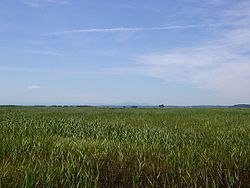
Osorezan, Lake Usori, Mutsu City
Article

02208 / むつし

Aomori Prefecture

Mutsu City

There is no mountain called Osorezan.

Osorezan, Lake Usori

Photo by Daderot (CC0)

01 / Stone weir

A gravity-arch stone weir,9 m high and 27.5 m long.

Stone weir in Mutsu City
Photo by 河川一等兵 (CC BY-SA 4.0)

The former Ominato water-source waterworks were built from 1902 to 1910 (Meiji 35 to 43), and the Agency for Cultural Affairs calls them the first modern waterworks built in the Tohoku region. The settling-basin weir is a gravity-arch stone weir 27.5 m long and 9 m high; the Shimokita Geopark site says it was made with rock from Mt. Kamafuse. It became an Important Cultural Property in 2009.

  • 27.5 m long, 9 m high
  • Built 1902 to 1910
  • Important Cultural Property, 2009

02 / Taijima

On the island off the cape,pillow lava can be seen.

Taijima in Mutsu City
Photo by Mannequin (CC BY-SA 3.0)

Taijima lies 1 km off a cape in Wakinosawa, and the city site describes its shape as like a sea bream. According to the Shimokita Geopark site, the island is made of lava from a seafloor volcano, and its pillow lava, rounded like pillows laid side by side, formed as the outside hardened quickly and the inside broke through and flowed; it can be observed there.

  • 1 km offshore
  • Seafloor volcanic lava
  • Pillow lava

03 / Clay masks

Clay masks came froma terrace by the Tsugaru Strait.

The Nimaibashi 2 site in Ohata stands on a terrace facing the Tsugaru Strait. 1,308 finds, mainly from the late Jomon period, became Important Cultural Properties in 2012. The 19 clay masks are, the Agency for Cultural Affairs writes, the most from a single site so far. The city says it has no facility for permanent display.

  • 19 clay masks
  • 1,308 finds
  • Important Cultural Property, 2012

Mutsu City from the sky

Now and 1974–78. Tap a photo to zoom in.

Wide (about 6 km across)

Close (about 1.5 km across)

Now (shot May–October 2021)Shot 1974–78

Source: Geospatial Information Authority of Japan (GSI) GSI Tiles(全国最新写真(シームレス)/国土画像情報(第一期:1974〜1978年撮影))

Open in GSI Maps (now)Open in GSI Maps (1974–78)

Living here

From Shimokita Station, 40 minutes by car to the Osorezan area.

  • about 50,000 people

Shimokita Station on the JR Ominato Line is one of the city's railway stations. The Shimokita Geopark site gives 40 minutes by car from the station to the Osorezan area and 60 minutes to Ushinokubi Rural Park.

People living here
54,103people
20052020

−7.5% since 2015

64,052 → 54,103

Area
864.2km²

138.93km² of it habitable

2024

Households
24,077households

2.2 people per household

2020

Rent (average for rentals)
40,640yen

National average 60,630 yen

2023

Healthcare
2 hospitals / 38 clinics

7.4 per 10,000 people

2023

Area864.2km²Habitable land138.93km² / 16%
Area and habitable land at the same scalee-Stat B1101 / B1103

Population from 2005 onward (municipal boundary changed).2005-03-14 に合併。2005年調査から市域が変わっている。

Children waiting for childcare
—14 nurseries and similar
Home purchase subsidy
—
Average annual temperature
—

These 3 items are waiting on a nationwide data source. We do not fill them with estimates.

Shape

Borders 5 municipalities.

Mutsu City in Japan41.293°N 141.184°E
TokyoOsakaMutsu City
Territory of Mutsu City
Boundaries: National Land Numerical Information (Administrative Area Data), MLIT. Processed by Machigatari.Lakes: National Land Numerical Information (Lake Data), MLIT. Processed by Machigatari. Prepared with the approval of the Director-General of the Geospatial Information Authority of Japan, using its Digital Map 25000 (Spatial Data Framework) and Digital Map 25000 (Place Names and Public Facilities). (承認番号 平27情使、第585号)

North to south

37.4km

Travel times per leg are not published by the municipality, so they are not shown.

Mutsu City isthis kind of town.

  1. 01Osorezan is not a single mountain but the name for the mountains in central Shimokita, Mt. Kamafuse among them, and the area around its lake is a caldera of a volcano that is still active
  2. 02The settling-basin weir of the former Ominato waterworks is a gravity-arch stone weir 9 m high, and Taijima in Wakinosawa is an island of seafloor volcanic lava
  3. 03The 19 clay masks from the Nimaibashi 2 site in Ohata are Important Cultural Properties, and the Osorezan area is 40 minutes by car from Shimokita Station

See the town as it is now.

Source: Wikidata (P2002, P2003, P2013, P2397)

If something caught your eye, ask the town itself.

From this town's themes