基山 山頂.JPG
Article

41341 / きやまちょう

Saga Prefecture 三養基郡

Kiyama Town

Shrine, torii and a summit rock line up.

Tamatama Stone, Kiyama summit

Photo by Wxrx (CC BY-SA 3.0)

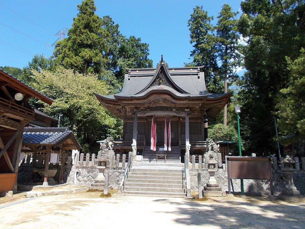
01 / Araho Shrine's Miyuki Festival

At Araho Shrine's autumn festival, a gong of about10 to 15 kg is swung overhead and struck.
Araho-jinja 03.jpg
Photo by STA3816 (CC BY-SA 4.0)

Araho Shrine's Miyuki Festival (御神幸祭) is held on Autumnal Equinox Day, and townspeople nickname it "Don, Kyan-Kyan" for its sound. The gong used in the gong performance (鉦風流) weighs about 10 to 15 kg. A fragment dated 1505 lists "dengaku, bugaku and shishi," and the town's plan says the festival has been held since at least the early 16th century.

  • Gong of about 10 to 15 kg
  • Held on Autumnal Equinox Day
  • 1505 fragment: "dengaku, bugaku and shishi"

02 / Water Gate Ruins, Kii Castle

A water gate about 10 m long runs throughthe base of a stone wall built across a valley.

基肄城 水門.JPG
Photo by Wxrx (CC BY-SA 3.0)

In a valley of the Kii Castle Ruins (基肄城跡), the stone wall about 26 m long, 8.5 m high and 3.3 m wide at the top remains. The water gate ruins pass through its base to let the water of the Sumiyoshi River (住吉川, also written 簡川), fed by valley water inside the castle, flow, about 10 m long, 1.4 m high and 1 m wide. Two related earthworks in the town (関屋土塁 and とうれぎ土塁) are also called "small Mizuki" (小水城) and are not on the list of designated cultural properties.

  • Stone wall about 26 m long, 8.5 m high
  • Water gate about 10 m long, 1.4 m high, 1 m wide
  • Two earthworks called "small Mizuki"

03 / The Withered Pine Border Dispute

A pine at the Hizen-Chikuzen border withered, and a dispute began.A Hizen-side village headman raised the three-province border.

According to the town's plan, early in the Bunka era a pine planted at the Hizen-Chikuzen border withered and led to a dispute. The headman family (梁井家) of a Hizen-side village (城戸村) set the dispute aside and raised the issue of the three-province border; talks with a mediating headman are said to have settled the two-province border too. The central marker of the two-province border stones (二国境石) now stands in a small park beside Route 3.

  • A pine at the two-province border withered early in the Bunka era
  • A Hizen-side headman family raised the three-province border
  • Central marker now in a small park beside Route 3

Living here

About two-thirds of its 22.15 km² is hills.

  • about 20,000 people
  • Rural district town

The town lies at the eastern end of Saga Prefecture, next to Chikushino and Ogori in Fukuoka Prefecture. Its area is 22.15 km², about two-thirds of it hills. In the north, mountains led by Mt. Kizan (基山) stretch out; the south is hill country opening onto the Chikushi Plain, where the Akimitsu and Yamashita rivers flow into the Chikugo River. In 1889 four villages, Ogura, Nagano, Sonobe and Miyaura, merged to form Kiyama Village, which became a town in 1939.

People living here
17,250people
19952020

−1.4% since 2015

18,444 → 17,250

Area
22.15km²

12.63km² of it habitable

2024

Households
6,756households

2.6 people per household

2020

Rent (average for rentals)
47,372yen

National average 60,630 yen

2023

Healthcare
1 hospital / 13 clinics

8.1 per 10,000 people

2023

Area22.15km²Habitable land12.63km² / 57%
Area and habitable land at the same scalee-Stat B1101 / B1103
Children waiting for childcare
—1 nurseries and similar
Home purchase subsidy
—
Average annual temperature
—

These 3 items are waiting on a nationwide data source. We do not fill them with estimates.

Shape

Borders 3 municipalities across 1 prefectures.

Kiyama Town in Japan33.427°N 130.523°E
TokyoOsakaKiyama Town
Territory of Kiyama Town
Boundaries: National Land Numerical Information (N03)

North to south

6.1km

Saga Prefecture
鳥栖市
Fukuoka Prefecture
筑紫野市, 小郡市

Travel times per leg are not published by the municipality, so they are not shown.

Kiyama Town isthis kind of town.

  1. 01On the summit of Mt. Kizan (基山) is a granite rock called Tamatama-ishi (タマタマ石). The town's plan records that the chief deity of Araho Shrine at the foot of the mountain is said to have been a god who used this rock as an iwakura, and writes that the rock still lies on the line extending from the shrine's south torii and sanctuary. Elderly locals are said to call it "Tamahime-sama."
  2. 02The Kii Castle Ruins (基肄城跡) are the remains of a mountain fortress whose construction in the 4th year of Tenji (665) is recorded in the Nihon Shoki; they were designated a Special Historic Site in 1954. Earthen and stone walls of about 3.9 km run from the summit of Mt. Kizan across a valley to the eastern peak.
  3. 03The town's plan also records Komottaki (コモッタキ), a fire kept burning at a shrine in the Ogura district (小倉老松神社) on the last Saturday of November, and the Ebisu festival on January 10 (十日恵比須祭) at Wakamiya Hachiman Shrine, in the old post-town district (木山口町) along the Nagasaki Highway, where visitors borrow small change from Ebisu. The bronze plowshares excavated at the Sendoyama Site are a prefecturally designated cultural property.

See the town as it is now.

Source: Wikidata (P2002, P2003, P2013, P2397)

If something caught your eye, ask the town itself.