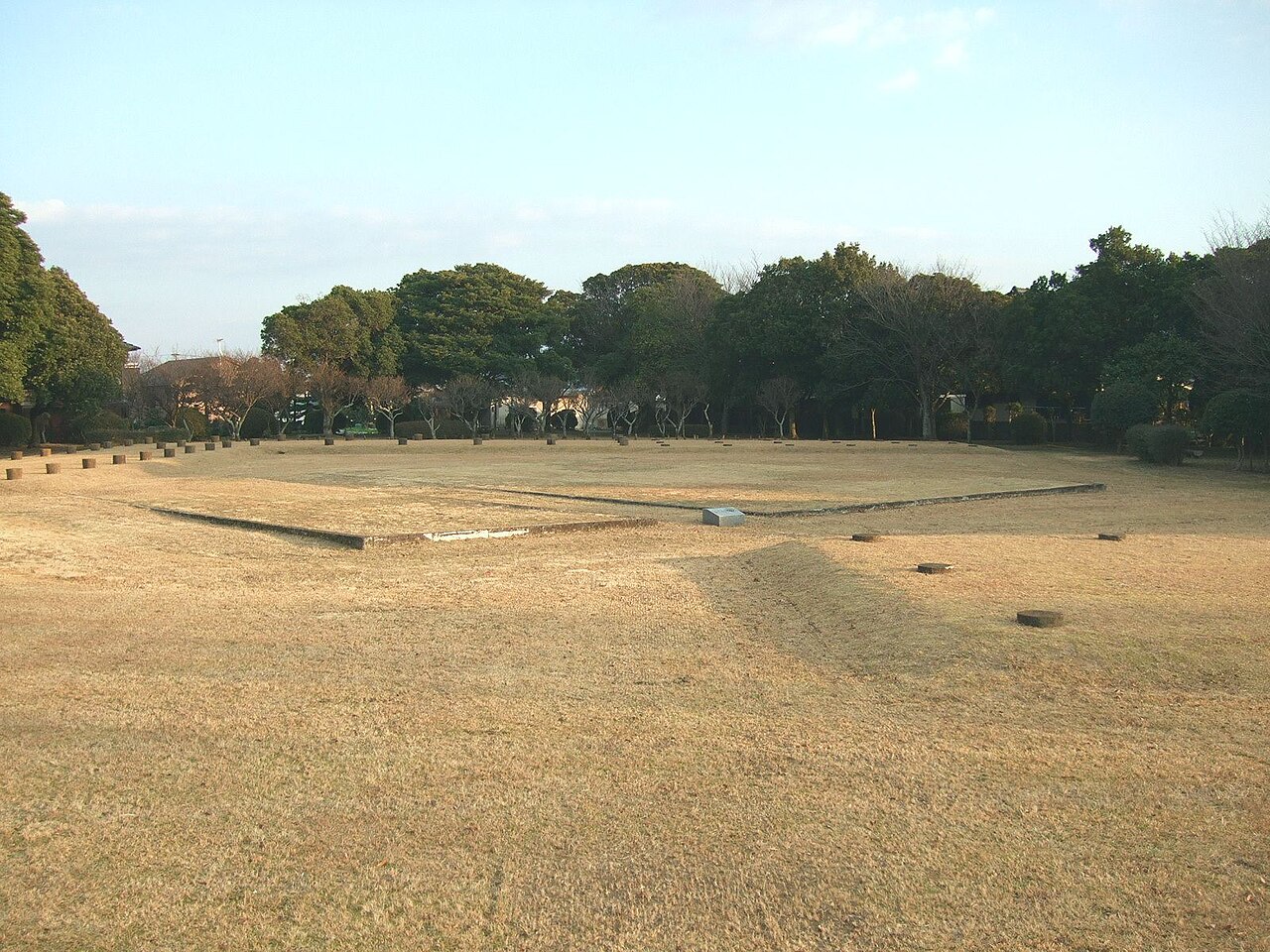
Yokogumayama Site Park 20160515-3.JPG
Article

40216 / おごおりし

Fukuoka Prefecture

Ogori City

Found at housing site, saved by citizens

Yokogumayama Kofun

Photo by そらみみ (Soramimi) (CC BY-SA 4.0)

01 / Matsuzaki Post Town (松崎宿) and the Matsuzaki Domain

The Matsuzaki Domain, independent for about 15 years.With its founding, Matsuzaki was developed as a post town.

Matsuzaki-shuku hatago 20190613 01.jpg
Photo by STA3816 (CC BY-SA 4.0)

In 1668 Arima Toyonori (有馬豊範) received a share of the Kurume Domain, and for about 15 years a wide area of today's city was independent as the Matsuzaki Domain. With its founding, the Satsuma Road (薩摩街道) came to be used as the route for daimyo processions, and Matsuzaki was developed as a post town. The former Matsuzaki Hatago Aburaya (旧松崎旅籠油屋), a large inn built in the last years of the Edo period, remains.

  • Arima Toyonori received a share of land in 1668
  • Independent as the Matsuzaki Domain for about 15 years
  • Former Matsuzaki Hatago Aburaya: city-designated tangible cultural property
02 / Ogori Kanga Ruins (小郡官衙遺跡群)

The office of Mihara District, Chikugo Province, moved from Kamiiwatato Ogori Kanga, then to Shimotakahashi.

Ogori Kanga Ruins01.jpg
Photo by Muyo (CC BY-SA 3.0)

The Ogori Kanga Ruins are the site of the office of Mihara District (御原郡), Chikugo Province, built from the late 7th to the first half of the 8th century, and a national Historic Site. An administrative hall, officials' quarters and storehouses were laid out in a planned way inside a 240 m-square enclosure ringed by ditches. The office is known to have moved from the Kamiiwata Ruins (上岩田遺跡), 2.1 km to the east, and then on to the Shimotakahashi Kanga Ruins in the town of Tachiarai (大刀洗町).

  • Site of a Chikugo Province district office
  • An enclosure 240 m on a side, ringed by ditches
  • Kamiiwata Ruins lie 2.1 km to the east

03 / Uchiyama Ikichi (内山伊吉) and His Wax-Tree Variety (伊吉櫨)

A wax tree improved by Uchiyama Ikichispread as the variety bearing his name.

Hirata Family Residence 03.jpg
Photo by 水だらけのプール (CC0)

Uchiyama Ikichi, born in 1730 (Kyoho 15), improved the wax tree (haze) through repeated refinement and produced a new variety (伊吉櫨), which spread widely. Ogori enjoyed a great boom in wax made from its fruit, and that prosperity can be seen in the Hirata Family Residence (平田家住宅), the mansion of a merchant who made his fortune in wax.

  • Uchiyama Ikichi was born in 1730 (Kyoho 15)
  • The variety spread widely
  • Hirata Family Residence: mansion of a wax-trade merchant

Living here

Housing west of the Hochiman River, farmland east.

  • about 60,000 people

The Hochiman River (宝満川) runs north to south through the middle of the city, with residential areas on the west bank and farmland on the east. There are seven stations on the Nishitetsu Tenjin Omuta Line and five on the Amagi Railway, and it is about 30 minutes by express from Fukuoka Tenjin Station to Ogori Station. The city was founded in 1972 (Showa 47).

People living here
59,360people
19952020

+2.4% since 2015

50,612 → 59,360

Area
45.51km²

44.31km² of it habitable

2024

Households
22,746households

2.6 people per household

2020

Rent (average for rentals)
46,657yen

National average 60,630 yen

2023

Healthcare
8 hospitals / 50 clinics

9.8 per 10,000 people

2023

Almost entirely flat.Almost all of it is habitable land (97.4%)
Area and habitable land at the same scalee-Stat B1101 / B1103
Children waiting for childcare
—12 nurseries and similar
Home purchase subsidy
—
Average annual temperature
—

These 3 items are waiting on a nationwide data source. We do not fill them with estimates.

Shape

Surrounded by 6 municipalities, and almost entirely flat.

Ogori City in Japan33.396°N 130.556°E
TokyoOsakaOgori City
Territory of Ogori City
Boundaries: National Land Numerical Information (N03)

North to south

12.0km

Fukuoka Prefecture
久留米市, 大刀洗町, 筑紫野市, 筑前町
Saga Prefecture
鳥栖市, 基山町

Travel times per leg are not published by the municipality, so they are not shown.

Ogori City isthis kind of town.

  1. 01Yokogumayama Kofun (横隈山古墳) is a keyhole-shaped tomb 31.6 m long, found in 1973 (Showa 48) while the Mikuni-no-Higashi housing estate was being built. The city records that it was saved through the earliest citizen movement in Kyushu to preserve an archaeological site, and it is now kept as Yokogumayama Kofun Park.
  2. 02Across the Hochiman River face each other Tanabata Shrine (七夕神社, formally Himekoso Shrine, 媛社神社), which enshrines the weaving goddess, and Inayoshi Oimatsu Shrine (稲吉老松神社), which enshrines Inukai-gami (犬飼神, the Cowherd Star); the city builds its town-making around this as the "Tanabata no Sato Ogori." The Shogun Wisteria (将軍藤) at Onakatomi Shrine in Fukudo, a prefectural Natural Monument, is said to have been offered by Prince Kanenaga (懐良親王), who was badly wounded in the Battle of Obaruhara (大保原合戦).
  3. 03The poet Noda Utaro (野田宇太郎) was born in Matsuzaki, and the city records that the word "bungaku sanpo" (文学散歩, literary walk) was his coinage. The two multi-knobbed fine-line mirrors from the Ogori Wakayama site are a national Important Cultural Property, and the Otoguma boundary stone (乙隈境石) on the Satsuma Road is a city-designated marker of the border between Chikuzen and Chikugo.

See the town as it is now.

Source: Wikidata (P2002, P2003, P2013, P2397)

If something caught your eye, ask the town itself.