Mount Fuji with Nippon Seishi paper plant 2022-01-21.jpg
Article

22210 / ふじし

Shizuoka Prefecture

Fuji City

The city that makes about 40% of Japan’s toilet paper.

Photo by m-louis .® (CC BY-SA 2.0)

01 / Paper

About 40% of Japan’stoilet paper comes from here.
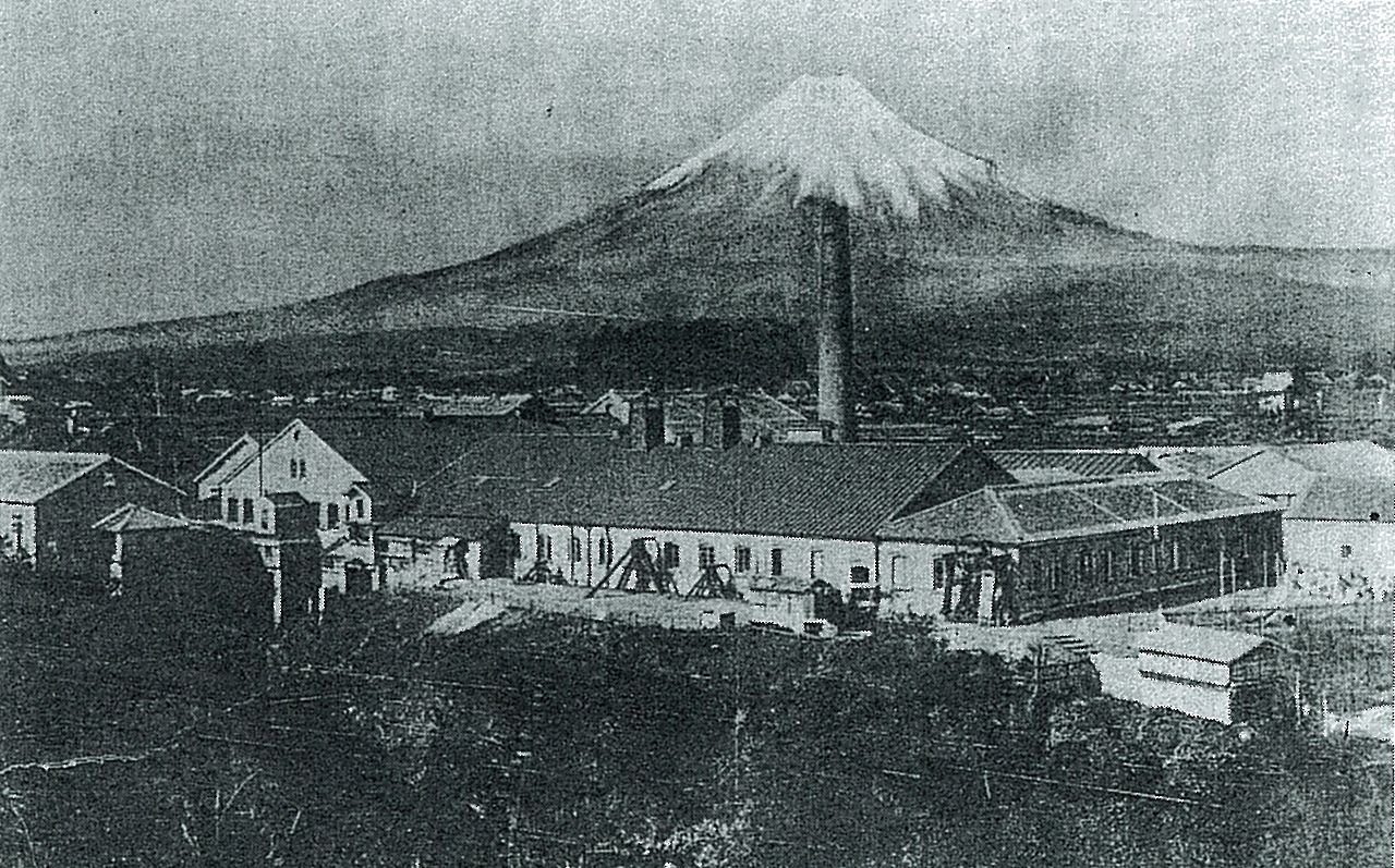
富士製紙入山瀬工場.jpg
Photo by Unknown author (Public domain)

Abundant water, nearby sources of timber and closeness to big markets made this a “paper town”, where mills gathered from the Meiji era on. It took up paper recycling early, and about 40% of the toilet paper made in Japan is produced in the city. Pulp and paper account for about 30% of the city’s manufactured shipments.

  • About 40% of Japan
  • Paper recycling
  • About 30% of shipments

02 / Shirasu

One-boat trawlingkeeps the whitebait unbruised.

ハーフ丼(田子の浦漁協食堂)20240428-P1041827.jpg
Photo by くろふね (CC BY 4.0)

Tagonoura shirasu (田子の浦しらす), the whitebait landed at Tagonoura Port, is caught by single-boat trawling, which lands less but keeps the fish unbruised. Raw shirasu was registered as a Geographical Indication (GI) in 2017, and boiled shirasu in 2021. West of the fishing cooperative runs the “Fujisan Shirasu Kaido”, a road lined with shirasu shops.

  • Single-boat trawling
  • GI registered 2017
  • Fujisan Shirasu Kaido

03 / Sea to summit

From sea levelto Mt. Fuji.

田子の浦港20240428-IMG 1008.jpg
Photo by くろふね (CC BY 4.0)

The city’s brand message is “Itadaki e no, hajimari” — “the beginning, toward the summit”. The city explains that “summit” means Mt. Fuji and “beginning” Suruga Bay, and that it is the only city in Japan whose area runs from 0 m above sea level to Mt. Fuji. There are about 180 parks, large and small, in the city.

  • From 0 m above sea level
  • “Itadaki e no, hajimari”
  • About 180 parks

Living here

About 70 minutes to Tokyo from Shin-Fuji.

  • about 250,000 people
  • 90 min to a city centre
  • Shinkansen stops here

From Shin-Fuji Station on the Tokaido Shinkansen it is about 70 minutes to Tokyo Station. The Tokaido Main Line and both the Tomei and Shin-Tomei expressways also pass through the city. It is the third most populous city in Shizuoka Prefecture.

People living here
245,392people
2010

−1.2% since 2015

254,027 → 245,392

Area
244.94km²

123.85km² of it habitable

2024

Households
97,333households

2.5 people per household

2020

Rent (average for rentals)
48,974yen

National average 60,630 yen

2023

Healthcare
12 hospitals / 182 clinics

7.9 per 10,000 people

2023

Area244.94km²Habitable land123.85km² / 51%
Area and habitable land at the same scalee-Stat B1101 / B1103

Population from 2010 onward (municipal boundary changed).2008-11-01 に編入合併(富士川町)。2010年調査から市域が変わっている。

Children waiting for childcare
—43 nurseries and similar
Home purchase subsidy
—
Average annual temperature
—

These 3 items are waiting on a nationwide data source. We do not fill them with estimates.

ACCESS

Where you can go from here.

Fuji City in Japan35.161°N 138.676°E
OsakaFuji City
Shin-Fuji Station
新富士駅2007
  • to TokyoShinkansen Kodama70min

Travel times follow 市公式の企業立地ガイド「交通アクセス」(2025-05-15 更新)と移住サイト「富士市の魅力」に載っている値 (checked 2026-09-24). They vary by time of day.

Shape

Borders 6 municipalities.

Territory of Fuji City
Boundaries: National Land Numerical Information (N03)

North to south

26.9km

富士宮市, 沼津市, 裾野市, 静岡市, 御殿場市, 長泉町

Fuji City isthis kind of town.

  1. 01A “paper town” that makes about 40% of Japan’s toilet paper
  2. 02GI-registered Tagonoura shirasu, landed unbruised by single-boat trawling
  3. 03A city that runs from sea level to Mt. Fuji

See the town as it is now.

Source: Wikidata (P2002, P2003, P2013, P2397)

If something caught your eye, ask the town itself.