

01 / Kashihara Rice Terraces and Rural Landscape
Set beside an 1813 survey map,the land use is unchanged after 200+ years.
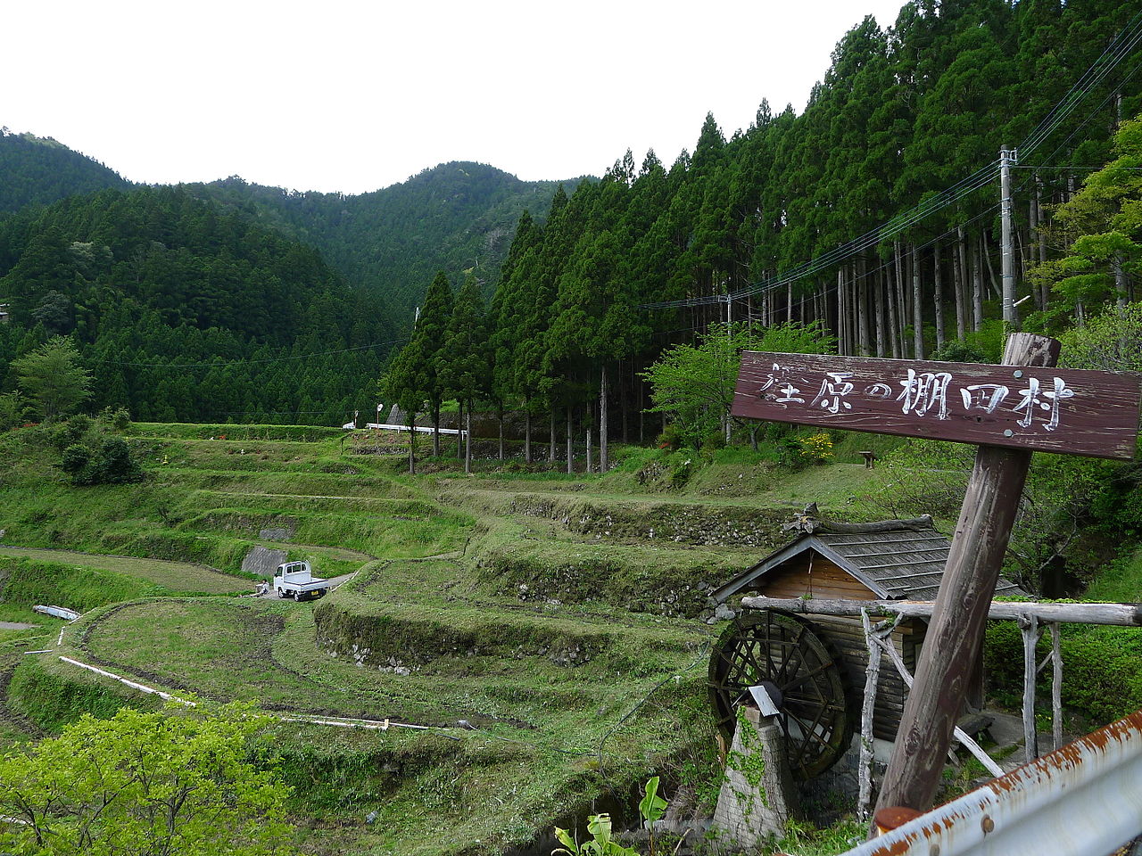
In Kashihara, terraced fields and hamlets spread across steep slopes in the upper reaches of the Katsuura River. The Agency for Cultural Affairs selected them as an Important Cultural Landscape in 2010. Compared with the fields, houses and roads in a survey map (bunken ezu) from Bunka 10 (1813), the land use shows no change in over 200 years.
- Selected as an Important Cultural Landscape in 2010
- Survey map (bunken ezu) of Bunka 10 (1813)
- 500–700m above sea level


