Shimomiwa Gyokudayato Tomb Group, Machida City
Article

13209 / まちだし

Tokyo

Machida City

Tomb ceiling carved as a house roof.

Shimomiwa Gyokudayato Tomb Group

Photo by 小池 隆 (CC BY 3.0)

01 / River source

The Tsurumi River risesin one of Machida's yato valleys.
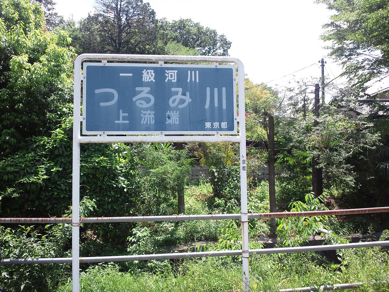
River source in Machida City
Photo by MASA KUROFUNE (CC BY-SA 3.0)

The Ministry of Land, Infrastructure, Transport and Tourism records that the Tsurumi River rises in the Tanaka valley (about 170 m high), one of a group of yato valleys in Kami-Oyamada, Machida. It is a Class A river with a 43 km main channel and a 235 km² basin; the city calls the Oyamada area its uppermost headwaters.

  • Source: the Tanaka valley (about 170 m; Ministry)
  • Main channel 43 km, basin 235 km²
  • Oyamada is the uppermost headwaters (city)

02 / Farmhouse

A farmhouse from Onojinow stands in Yakushiike Park.

Farmhouse in Machida City
Photo by Suikotei (CC BY 4.0)

It was originally a farmhouse in Onoji-machi, which the city describes as a typical farmhouse of the Tama hills. Hip-roofed and thatched, it is recorded by the Agency for Cultural Affairs' database as among the oldest houses in the Tokyo suburbs, and was moved into the park.

  • Important Cultural Property (21 January 1978)
  • Hip roof, thatch
  • Originally a farmhouse in Onoji-machi

03 / Archaeological site

A bent burdock led toa Jomon dwelling site.

Archaeological site in Machida City
Photo by MChew (CC BY-SA 4.0)

The city records that the site was found in 1925 after a burdock in a field grew bent. The next year it was designated a National Historic Site as the first dwelling site found on hill land. The paved-stone dwelling at the Roba site is preserved under a cover building.

  • National Historic Site (designated 24 February 1926)
  • Three areas: Roba, Inariyama and Hachimandaira
  • Found in 1925 (city)

Machida City from the sky

Now and 1974–78. Tap a photo to zoom in.

Wide (about 6 km across)

Close (about 1.5 km across)

Now (shot June–August 2019)Shot 1974–78

Source: Geospatial Information Authority of Japan (GSI) GSI Tiles(全国最新写真(シームレス)/国土画像情報(第一期:1974〜1978年撮影))

Open in GSI Maps (now)Open in GSI Maps (1974–78)

Living here

26 minutes from Shinjuku, without changing.

  • about 430,000 people
  • 30 min to a city centre

From Shinjuku Station to Machida Station it takes 26 minutes by Odakyu Romancecar (a limited express fee applies; October 2026 timetable) and 30 minutes by rapid express. City Hall is about an 8-minute walk from the west exit of Odakyu's Machida Station (city guide).

People living here
431,079people
19952020

−0.3% since 2015

360,525 → 431,079

Area
71.55km²

63.76km² of it habitable

2024

Households
192,015households

2.2 people per household

2020

Rent (average for rentals)
61,154yen

National average 60,630 yen

2023

Healthcare
21 hospitals / 341 clinics

8.4 per 10,000 people

2023

Area71.55km²Habitable land63.76km² / 89%
Area and habitable land at the same scalee-Stat B1101 / B1103
Children waiting for childcare
—71 nurseries and similar
Home purchase subsidy
—
Average annual temperature
—

These 3 items are waiting on a nationwide data source. We do not fill them with estimates.

ACCESS

Where you can go from here.

Machida City in Japan35.547°N 139.439°E
OsakaMachida City
Machida Station
町田駅2017
  • to ShinjukuOdakyu Romancecar26min

Travel times follow 小田急電鉄の駅時刻表(新宿駅の下り・小田原線。NAVITIME が配信する小田急公式サイトの時刻表と、列車ごとの停車駅・時刻の画面)を、平日(2026-10-22)と日曜(2026-10-25)の快速急行・急行・ロマンスカーすべてについて1本ずつ引いて、新宿の発→町田の着を数えた(ロマンスカーを含む) (checked 2026-10-22). They vary by time of day.

Shape

Borders 6 municipalities across 1 prefectures.

Territory of Machida City
Boundaries: National Land Numerical Information (Administrative Area Data), MLIT. Processed by Machigatari.

North to south

13.6km

Machida City isthis kind of town.

  1. 01The Shimomiwa Gyokudayato Tomb Group is a group of tombs estimated to date from the late 6th to the 7th century; Tombs 1 and 3 are known as house-shaped tombs with a roof structure in relief on the ceiling (Tokyo Metropolitan Historic Site)
  2. 02The Tsurumi River rises in the Tanaka valley (about 170 m), one of a group of yato valleys in Kami-Oyamada, Machida
  3. 0326 minutes from Shinjuku Station to Machida Station by Odakyu Romancecar

If something caught your eye, ask the town itself.

From this town's themes