Kaiyou-sha Etajima 2014.JPG
Article

34215 / えたじまし

Hiroshima Prefecture

Etajima City

A navy men's club with a balcony.

Former Etajima Navy Men's Club

Photo by Sanjo (CC BY-SA 3.0)

01 / Tagashira Family Great Lantern Rite (田頭家大提灯献灯行事)

The Tagashira family of Etajima began itby guiding Miyajima's ceremonial boat with torches.

It began in the Genroku 14 year (1701), and in 1948 it was granted the status of "Itsukushima Shrine service." The Kangensai Odaichin Saiwainoura Preservation Society in Saiwainoura carries on the great lantern's role on the spring-tide days of July and August, when Miyajima holds its Kangensai festival. It is a folk cultural property designated by Etajima City.

  • Founded in Genroku 14 (1701)
  • Granted "Itsukushima Shrine service" status in 1948
  • Designated folk cultural property of Etajima City
02 / Sutra-Stone Tower at Ohara's Yakushi Hall (大原薬師堂の経石塔)

For those who died in famine,the Yakushi sutra was copied on stones and buried.

A granite tower stands in the grounds of the Yakushi Hall in Ohara. Floods and droughts were said to come every four years, and to make offerings for those who died in successive famines, the priest of Hōji-ji (宝持寺) had the Yakushi Sutra copied one character per stone and buried, made it a sutra mound, and raised the tower. It bears the date An'ei 2 (1773).

  • Inscribed An'ei 2 (1773)
  • Yakushi Sutra copied one character per stone and buried
  • Tangible cultural property (structure) designated by Etajima City

03 / The Cycad of Kanokawa (鹿川のソテツ)

Its trunk splits into six large and small stems,and countless bulbils make a strange sight.

It stands in the garden of the Tokusei family in Kanokawa, Nomi, and is a natural monument designated by Hiroshima Prefecture. Three of the surrounding stems are almost twice as long as the others. The prefecture calls it "one of the prefecture's leading giant trees"; the city gives a girth of about 6 m and a height of about 5 m, and says it was brought from Yakushima in the Kōchō era (1261-1264) and planted.

  • Natural monument designated by Hiroshima Prefecture
  • Six large and small stems
  • Girth about 6 m, height about 5 m (city)

Living here

On ten islands, tangerine slopes and cucumber greenhouses.

  • about 20,000 people

Etajima is a city made of ten islands large and small, including Etajima and Nōmi Island, with 19,936 residents (end of May 2026). From late October the slopes turn the color of tangerines, and cucumbers are grown in greenhouses; the joint-shipping volume was 613 t in Reiwa 5 (2023). The city is joined to Kure by the Ondo Ohashi and Hayase Ohashi bridges, and boats run to Koyo Port from Hiroshima Port and Kure Port.

People living here
21,930people
20052020

−9.9% since 2015

29,939 → 21,930

Area
100.65km²

44.44km² of it habitable

2024

Households
10,141households

2.2 people per household

2020

Rent (average for rentals)
32,859yen

National average 60,630 yen

2023

Healthcare
4 hospitals / 18 clinics

10.0 per 10,000 people

2023

Area100.65km²Habitable land44.44km² / 44%
Area and habitable land at the same scalee-Stat B1101 / B1103
Children waiting for childcare
—9 nurseries and similar
Home purchase subsidy
—
Average annual temperature
—

These 3 items are waiting on a nationwide data source. We do not fill them with estimates.

ACCESS

Where you can go from here.

Etajima City in Japan34.175°N 132.462°E
TokyoOsakaEtajima City
Port of Koyō
小用港2014
  • to HiroshimaSetouchi Sea Line22min
  • to KureSetouchi Sea Line10min

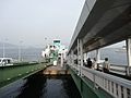
Travel times follow 島の町の決め(駅の無い町のバスの起点と同じ扱い。航路は町内の港へ乗り換えなしで着く船の起点を都市名にする。香川の土庄町・島根の海士町と同じ)。町公式『海上交通【航路・運航事業者一覧】』(articles/show/4866)の航路のうち小用桟橋に着く2航路を、運航事業者(瀬戸内シーライン㈱。瀬戸内海汽船のサイトに時刻表がある)の時刻表で見た。**時刻表ページの見出しは『2022年12月1日現在』のままだが、江田島市の『公共交通マップ』(令和8年10月1日現在・市公式 files/uploads/koutsuumap(2).pdf)の船時刻表が同じ内容**(広島港〈宇品〉→小用 7:15→7:37、呉港→小用 6:56→7:07 など、全便一致)なので現行とみて採った。①広島港(宇品)→小用:高速船(旅客のみ)1日20便。直行は21〜22分で、22分が9便・21分が8便のため22分を採った(一部は切串西沖・プリンスホテル港に寄り24〜28分)。②呉港→小用港:高速船13便(10〜11分)とフェリー13便(20分)が同数なので、短い高速船10分を採った(『▲』の便は日・祝日運休)。 (checked 2026-09-29). They vary by time of day.

Shape

Borders 0 municipalities.

Territory of Etajima City
Boundaries: National Land Numerical Information (N03)

North to south

18.9km

Etajima City isthis kind of town.

  1. 01The former Etajima Naval Petty Officers' and Sailors' Clubhouse (Kaiyūsha, 海友舎) in Etajima-chō is one of the clubhouses the navy built at its naval ports as welfare facilities for petty officers and sailors. Its two-story wing and a one-story wing moved from Kure are both nationally Registered Tangible Cultural Properties; the owner is a private party, an NPO preserves and uses it, and visits are guided tours by advance reservation.
  2. 02The Tagashira Family Great Lantern Rite in Saiwainoura was founded in Genroku 14 (1701), and at the Yakushi Hall in Ohara stands a sutra-stone tower dated An'ei 2 (1773). The cycad of Kanokawa is a prefectural natural monument.
  3. 03The city is joined to Kure by the Ondo Ohashi and Hayase Ohashi bridges, and on Mt. Mitaka in Okimi-chō there are Meiji-era battery ruins. From Hiroshima Port (Ujina) to Koyo Port it takes 21-22 minutes by high-speed boat.

See the town as it is now.

Source: Wikidata (P2002, P2003, P2013, P2397)

If something caught your eye, ask the town itself.