Former Fukuhara Fishing Ground, Yoichi Town
Article

01408 / よいちちょう

Hokkaido 余市郡

Yoichi Town

At herring's peak, floors became tables.

Former Fukuhara Fishing Ground

Photo by さかおり (CC BY-SA 4.0)

01 / Former Shimo-Yoichi Unjoya

A building with a long stone-weighted roofis the "only surviving unjoya."

Former Shimo-Yoichi Unjoya in Yoichi Town
Photo by さかおり (CC BY-SA 4.0)

The Former Shimo-Yoichi Unjoya was the base of merchants who held the Matsumae domain's trading rights with the Ainu, built in 1853. The town describes its long gabled roof weighted with stones. The national Historic Site commentary calls it the only surviving unjoya, with later alterations but the frame well preserved.

  • Built 1853 (Kaei 6)
  • Gabled stone-weighted roof (town)
  • Important Cultural Property, 1971
  • National Historic Site, 1973

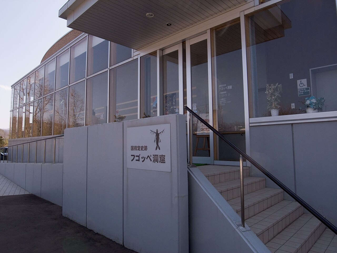
02 / Fugoppe Cave

On the cave's walls,there are over 800 carvings.

Fugoppe Cave in Yoichi Town
Photo by Ozizo (Public domain)

The town says the walls of Fugoppe Cave bear over 800 carvings, including figures that look costumed, boats, fish and sea mammals. Analysis of pottery and bone and horn tools from the sediment shows an Epi-Jomon site, from about 2,000 to 1,500 years ago.

  • Over 800 carvings (town)
  • Epi-Jomon, about 2,000 to 1,500 years ago (town)
  • National Historic Site, 1953

03 / Nishizakiyama Stone Circle

Seven stone arrangements in a sundial patternare thought to be a tomb of about 3,500 years ago.

Nishizakiyama Stone Circle in Yoichi Town
Photo by Fred Cherrygarden (CC BY-SA 4.0)

The Nishizakiyama Stone Circle lies on a hill that runs to the cape marking the boundary with Otaru City. The area open to visitors is an oval 20 m by 10 m, with seven stone arrangements of about 1 m across. Round river stones and angular pillar-like stones are set in a sundial pattern, and the town writes that it is thought to be a tomb of about 3,500 years ago.

  • 7 stone arrangements
  • Oval, 20 m by 10 m
  • Hokkaido Prefectural Historic Site, 1951

Yoichi Town from the sky

Now and 1974–78. Tap a photo to zoom in.

Wide (about 6 km across)

Close (about 1.5 km across)

Now (shot May–June 2025)Shot 1974–78

Source: Geospatial Information Authority of Japan (GSI) GSI Tiles(全国最新写真(シームレス)/国土画像情報(第一期:1974〜1978年撮影))

Open in GSI Maps (now)Open in GSI Maps (1974–78)

Living here

Herring fishing built the town's foundations.

  • about 20,000 people
  • Rural district town

At the eastern base of the Shakotan Peninsula, the town faces the Sea of Japan to the north and is ringed by gentle hills on the other three sides, the town explains. Cape Siripa, jutting out west of Yoichi Bay, is a cliff with well-developed columnar joints, which the town calls its symbol. The area is 140.62 km², about 67 percent forest.

People living here
18,000people
19952020

−8.2% since 2015

24,485 → 18,000

Area
140.62km²

47.52km² of it habitable

2024

Households
8,283households

2.2 people per household

2020

Rent (average for rentals)
37,567yen

National average 60,630 yen

2023

Healthcare
2 hospitals / 15 clinics

9.4 per 10,000 people

2023

Area140.62km²Habitable land47.52km² / 34%
Area and habitable land at the same scalee-Stat B1101 / B1103
Children waiting for childcare
—3 nurseries and similar
Home purchase subsidy
—
Average annual temperature
—

These 3 items are waiting on a nationwide data source. We do not fill them with estimates.

Shape

Borders 4 municipalities.

Yoichi Town in Japan43.195°N 140.784°E
TokyoOsakaYoichi Town
Territory of Yoichi Town
Boundaries: National Land Numerical Information (Administrative Area Data), MLIT. Processed by Machigatari.Lakes: National Land Numerical Information (Lake Data), MLIT. Processed by Machigatari. Prepared with the approval of the Director-General of the Geospatial Information Authority of Japan, using its Digital Map 25000 (Spatial Data Framework) and Digital Map 25000 (Place Names and Public Facilities). (承認番号 平27情使、第585号)

North to south

15.8km

Travel times per leg are not published by the municipality, so they are not shown.

Yoichi Town isthis kind of town.

  1. 01The Former Yoichi Fukuhara Fishing Ground is a group of buildings of a herring fishery run by the Fukuhara family, where at the peak of the catch the floorboards of the bunkhouse came up to serve as a table
  2. 02The Former Shimo-Yoichi Unjoya, built in 1853, was the base of merchants who held trading rights for the Matsumae domain, and the national Historic Site commentary calls it the only surviving unjoya
  3. 03Fugoppe Cave has over 800 carvings, and the Nishizakiyama Stone Circle has seven sundial-pattern stone arrangements thought to be a tomb of about 3,500 years ago

If something caught your eye, ask the town itself.