Tosa Scenes of Kabuki by Ekin (Konan).jpg
Article

39211 / こうなんし

Kochi Prefecture

Konan City

Peer at painted screens through a hole.

Kabuki-scene screens, old Akaoka

Photo by Hirose Kinzō (Public domain)

01 / Dug-out harbor

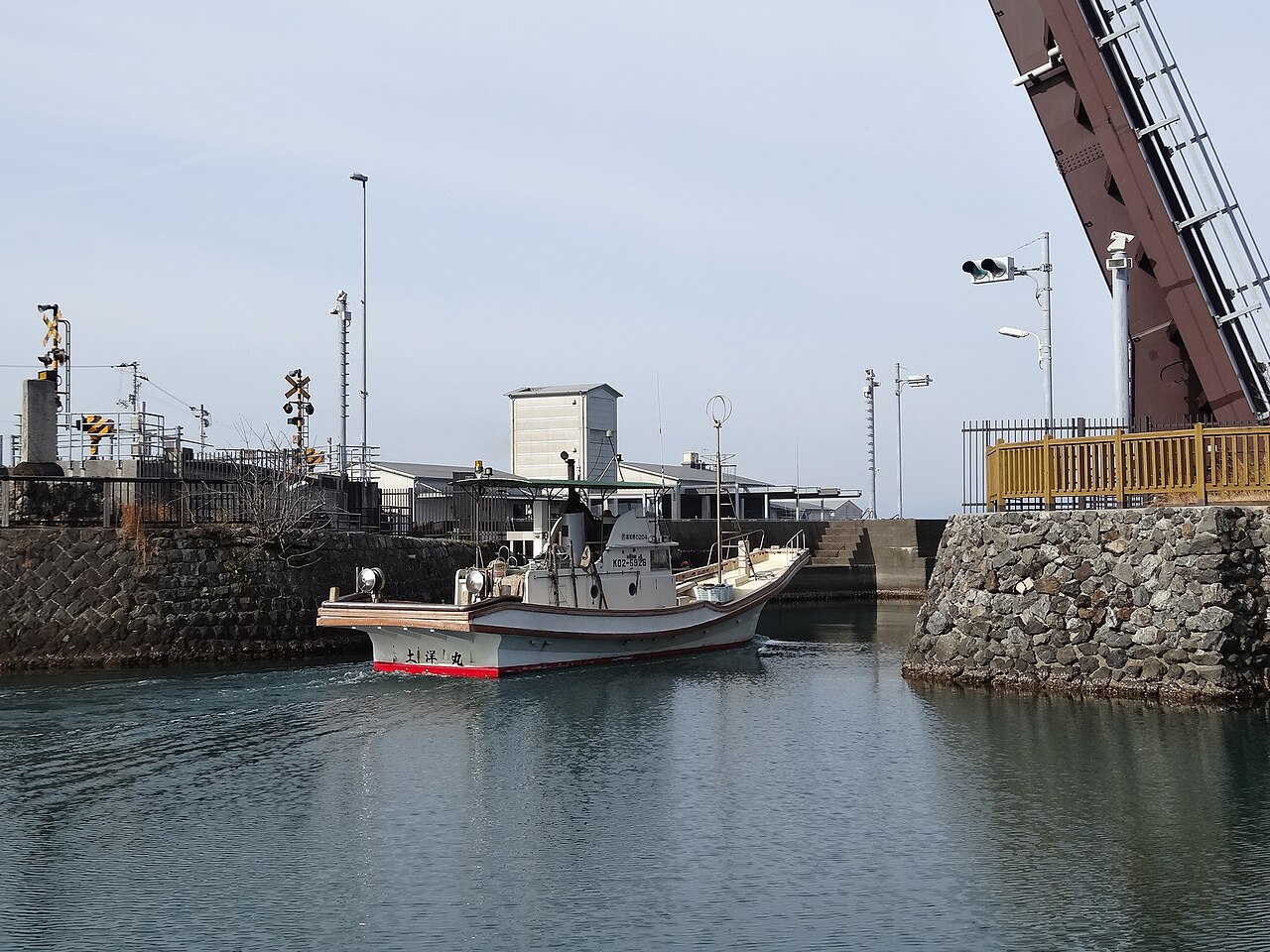
A harbor dug out under Nonaka Kenzanstill takes in fishing boats.
Tei drawbridge Kochi 02.JPG
Photo by Sanjo (CC BY-SA 3.0)

Tei Inner Harbor is a dug-out harbor built in the early Edo period under Nonaka Kenzan, a senior retainer of the Tosa domain, according to the city's 2026 profile. The city website says it was among the largest of its kind from the early Edo period, at about 112 m north to south and 49 m east to west in the History of Japanese Harbor Construction. Fishing boats are still moored here.

  • About 112 m north-south, 49 m east-west (History of Japanese Harbor Construction, city website)
  • Built in the early Edo period under Nonaka Kenzan (city profile 2026)
  • Movable bridge at the harbor mouth completed in September 2002 (tourism association)
  • The bridge is about 32 m long and takes about 6 minutes to open or close (same)

02 / Castaway

A sailor washed up on Torishimaand built a small boat to get home.

Nomura Chohei was a sailor from Kishimoto. In Tenmei 5 (1785), returning from carrying rice from Akaoka, he was caught in a winter gale and drifted to the uninhabited island of Torishima, the city says. After his companions had all died, he built a small boat with survivors of ships from Osaka and Satsuma that had also drifted there, and returned alive after 13 years, it says. His grave is a city historic site.

  • Drifted to Torishima in 1785 while returning from carrying rice from Akaoka to Tano and Nahari (city website)
  • Built a small boat and returned after 13 years (same)
  • The grave is a city historic site (same)
  • Statue placed near Kagami Station in 1998, restored in 2021 (tourism association)

03 / Giant cedar

A giant cedar with a hollow trunk,big enough for about ten children.

Tenjin no Osugi, zenkei.jpg
Photo by Saigen Jiro (CC0)

The cedar stands in the grounds of the Tenman shrine in Kamibun, Kagami, and the city gives its age as about 850 years, height 55 m and trunk girth 9.8 m. The inside is hollow, with room for about ten children. It is a national Natural Monument, and in 1996 work was done to close the hole at its base.

  • About 850 years old, 55 m tall, 9.8 m around at eye level (city website)
  • National Natural Monument, designated 19 February 1943 (same)
  • Work to close the hole at the base in 1996 (tourism association)

Living here

With a mild, dry climate,early vegetable growing developed.

  • about 30,000 people

The city lies about 20 to 30 km east of Kochi City and covers 126.46 km². It was formed in 2006 by the merger of five former towns and villages. The city says that, using its mild, low-rainfall climate, greenhouse-centered vegetable farming has developed since long ago. For the Boys' Festival, many houses fly furai, a flag custom peculiar to this region.

People living here
32,207people
2010

−2.3% since 2015

33,830 → 32,207

Area
126.46km²

53.42km² of it habitable

2024

Households
13,146households

2.4 people per household

2020

Rent (average for rentals)
42,814yen

National average 60,630 yen

2023

Healthcare
1 hospital / 25 clinics

8.1 per 10,000 people

2023

Area126.46km²Habitable land53.42km² / 42%
Area and habitable land at the same scalee-Stat B1101 / B1103
Children waiting for childcare
—8 nurseries and similar
Home purchase subsidy
—
Average annual temperature
—

These 3 items are waiting on a nationwide data source. We do not fill them with estimates.

Shape

Borders 4 municipalities.

Konan City in Japan33.564°N 133.701°E
TokyoOsakaKonan City
Territory of Konan City
Boundaries: National Land Numerical Information (N03)

North to south

16.3km

香美市, 芸西村, 安芸市, 南国市

Travel times per leg are not published by the municipality, so they are not shown.

Konan City isthis kind of town.

  1. 01The Tosa kabuki-scene screens of former Akaoka Town were painted by the artist Ekin, who settled in Akaoka in the late Edo period, and are a prefecture-protected Tangible Cultural Property. They are kept at Ekingura, where two are always on view through holes in the wall. At the Ekin Festival on the third weekend of July each year, they are displayed along Akaoka's shopping streets.
  2. 02The city was formed in 2006 by the merger of Akaoka, Kagami, Noichi, Yasu and Yoshikawa. The bronze sword of Usuda Hachimangu, a national Important Cultural Property, carries half-relief figures of seven animals of four kinds: deer, egret, frog and mantis, and the city calls it a sword with no equal in the country. There are also Hokyoji Temple site, with Kosokabe family five-ring gravestones, and the former Morita family residence, birthplace of the psychiatrist Morita Shoma.
  3. 03It lies about 20 to 30 km east of Kochi City and is served by the Tosa Kuroshio Railway Gomen-Nahari Line. The station nearest the city hall is Noichi, about a 3-minute walk. The city flower, the mandarin orange, was chosen for the city's Yamakita mandarins.

If something caught your eye, ask the town itself.