平地地蔵の蓑着せ6.jpg
Article

26212 / きょうたんごし

Kyoto Prefecture

Kyotango City

A day when stone Jizo gets a straw cape.

Heiji Jizo, straw-cape dressing

Photo by 漱石の猫 (CC BY-SA 4.0)

01 / Office building

On the plan, three buildings joined by corridors.The Sankokan entrance is close to that entrance block.

Kumihama Kamitani jinja Sankokan 2019-05 ac.jpg
Photo by Asturio Cantabrio (CC BY-SA 4.0)

Kumihama Prefecture was set up in 1868 (Meiji 1) and abolished in 1871. According to the ridge-tablet inscription, the new office was completed in May 1870, and part of it was moved to its present site in 1923. The area around the Sankokan's entrance roughly matches part of the outer walls of the entrance block.

  • New office completed May 1870 (ridge-tablet inscription)
  • Moved in 1923
  • Kyoto Prefecture designated, 1985

02 / Rock

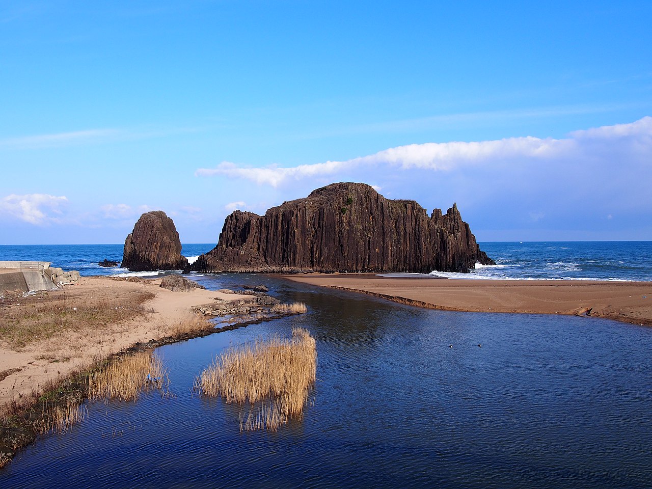
Sand carried by the Takeno Riverjoined an island rock to the land.

Tateiwarock0001.jpg
Photo by VinayaMoto (CC BY-SA 4.0)

Tateiwa, on the Nochigahama coast, is about 20 m high. According to the prefecture's Red Data Book, vertical columnar jointing is well developed. A sandbar of sand carried by the Takeno River joined it to the land, making it a tied island. It is also said that demons were sealed in this rock during a prince's demon-slaying.

  • About 20 m high
  • Vertical columnar jointing
  • Joined to land by a sandbar at the Takeno River mouth

03 / Burial mound

Cylindrical haniwa unique to the Tango regionring each tier of the three-tier mound.

網野銚子山古墳出土 丹後型円筒埴輪.JPG
Photo by Saigen Jiro (Public domain)

A keyhole-shaped tomb and National Historic Site, 201 m long and estimated to date from the late 4th century. Stone cladding was set on the slopes, and Tango-type cylindrical haniwa were placed around the terrace of each tier. Restoration of the site was completed in April 2025, with part of the cladding and haniwa row restored on the mound.

  • Mound length 201 m
  • Estimated late 4th century
  • Site restoration completed April 2025

Living here

150 minutes from Kyoto by limited express, no transfer.

  • about 50,000 people

From Kyoto, the Limited Express Hashidate No. 7 reaches Mineyama Station in 150 minutes without a transfer (daily; October 2026 timetable). It is the only through service from Kyoto. The main city hall is in Mineyama.

People living here
50,860people
20052020

−7.6% since 2015

62,723 → 50,860

Area
501.44km²

122.69km² of it habitable

2024

Households
20,138households

2.5 people per household

2020

Rent (average for rentals)
40,407yen

National average 60,630 yen

2023

Healthcare
4 hospitals / 36 clinics

7.9 per 10,000 people

2023

Area501.44km²Habitable land122.69km² / 24%
Area and habitable land at the same scalee-Stat B1101 / B1103
Children waiting for childcare
—16 nurseries and similar
Home purchase subsidy
—
Average annual temperature
—

These 3 items are waiting on a nationwide data source. We do not fill them with estimates.

ACCESS

Where you can go from here.

Kyotango City in Japan35.624°N 135.061°E
TokyoKyotango City
Mineyama Station
峰山駅2016
  • to KyotoLtd. exp. Hashidate150min

Travel times follow JR西日本『JRおでかけネット』の列車時刻表(特急はしだて7号・5087D。運転日『毎日運転』。京都12:25発→京丹後大宮14:49着→峰山14:55着。豊岡行・乗り換えなし)。区間時刻表(嵯峨野線・山陰本線 下り)で 2026-10-08・10・11・12・13 の5日とも京都12:25発・運転日注意なし。京都丹後鉄道(WILLER TRAINS)の峰山駅の発車時刻表(2026-03-14改正)にも『14:56 特急はしだて7号 夕日ヶ浦木津温泉(豊岡)行』が載る (checked 2026-10-08). They vary by time of day.

Shape

Borders 4 municipalities across 1 prefectures.

Territory of Kyotango City
Boundaries: National Land Numerical Information (N03)Lakes: National Land Numerical Information (Lake Data), MLIT. Processed by Machigatari. Prepared with the approval of the Director-General of the Geospatial Information Authority of Japan, using its Digital Map 25000 (Spatial Data Framework) and Digital Map 25000 (Place Names and Public Facilities). (承認番号 平27情使、第585号)

North to south

29.7km

Kyoto Prefecture
与謝野町, 宮津市, 伊根町
Hyogo Prefecture
豊岡市

Kyotango City isthis kind of town.

  1. 01Heiji Jizo, at Jizo-in in the Omiya district, is a stone standing statue of Jizo Bodhisattva erected in 1833 and designated by the city. According to the city's tourism corporation, a straw-woven hood and cape are put on it on 23 November
  2. 02The Sankokan (the former Kumihama Prefectural Office entrance block) is designated by Kyoto Prefecture, Tateiwa is a rock about 20 m high at the mouth of the Takeno River, and the Amino Choshiyama Kofun is a National Historic Site whose restoration was completed in April 2025
  3. 03The mirror dated Seiryu 3 (AD 235) from Ota-Minami Tomb No. 5 is an Important Cultural Property, Kotohikihama is a nationally designated Place of Scenic Beauty and Natural Monument, and the Nonaka Dengaku, a folk performing art, is nationally selected and prefecture-designated; Kyoto is 150 minutes away by limited express

See the town as it is now.

Source: Wikidata (P2002, P2003, P2013, P2397)

If something caught your eye, ask the town itself.