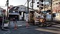
Gogura, Horikiri School grounds, Katsushika Ward
Article

13122 / かつしかく

Tokyo

Katsushika Ward

A thatched storehouse on school grounds.

Gogura, Horikiri School grounds

Photo by Higa4 (CC0)

01 / Handcar railway

Usually 4 pushers; on Koshin days,about 120 extra were hired.

Handcar railway in Katsushika Ward
Photo by ブルーノ・プラス (CC BY 4.0)

People pushed the cars along about 1.5 km between Kanamachi Station and Shibamata Taishakuten. It opened on December 17, 1899, as the fifth handcar railway in Japan. The line was double-tracked, with 4 pushers on ordinary days and about 120 extra hired every 60 days on Koshin days. The photo shows a replica.

  • Opened December 17, 1899
  • About 1.5 km, Kanamachi to Shibamata Taishakuten
  • About 120 extra pushers on Koshin days

02 / Lock gate bridge

On the 5 western arches are groovesfor raising and lowering boards that stop water.

Lock gate bridge in Katsushika Ward
Photo by 京浜にけ (Keihin Nike) (CC BY-SA 3.0)

Komonbashi in Nishi-Mizumoto was completed in 1909. Built with the latest technology of its day to prevent floods of the Furu-Tone and Oba rivers, it regulated water volume with a sluice. Its brick was made in Kanamachi. The west side has 5 arches and the east side 3. The top is a footpath. It is a Ward Registered Tangible Cultural Property.

  • Completed in 1909
  • 5 arches on the west side, 3 on the east
  • Katsushika Ward Registered Tangible Cultural Property

03 / Tateishi-sama

The stone that gave Tateishi its namewas carried from the Boso Peninsula.

Tateishi-sama in Katsushika Ward
Photo by Higa4 (CC0)

This stone stands in a children's park in Tateishi 8-chome and is the source of the place name. It is Bosho stone from around Mt. Nokogiri in Chiba, and may have been used in the stone chamber of a tumulus. Once about 60 cm tall in the Ansei era, it is described in the Tokyo Metropolitan description as about 4 cm after being chipped away. It is a Tokyo Metropolitan Historic Site.

  • Bosho stone from around Mt. Nokogiri, Chiba
  • About 60 cm in the Ansei era; about 4 cm per the Metropolitan description
  • Tokyo Metropolitan Historic Site

Katsushika Ward from the sky

Now and 1974–78. Tap a photo to zoom in.

Wide (about 6 km across)

Close (about 1.5 km across)

Now (shot June–November 2019)Shot 1974–78

Source: Geospatial Information Authority of Japan (GSI) GSI Tiles(全国最新写真(シームレス)/国土画像情報(第一期:1974〜1978年撮影))

Open in GSI Maps (now)Open in GSI Maps (1974–78)

Living here

Tokyo in 12 minutes at best on the JR Sobu Line (Rapid).

  • about 450,000 people
  • 30 min to a city centre

Rapid trains of the JR Sobu Line stop at Shin-Koiwa Station. The fastest daily train takes 12 minutes from Tokyo, and daytime rapids take about 13 minutes (October 2026 timetable). Ward Office is about a 7-minute walk from Keisei Tateishi Station.

People living here
453,093people
19952020

+2.3% since 2015

424,478 → 453,093

Area
34.8km²

34.8km² of it habitable

2024

Households
215,948households

2.1 people per household

2020

Rent (average for rentals)
69,004yen

National average 60,630 yen

2023

Healthcare
22 hospitals / 368 clinics

8.6 per 10,000 people

2023

Almost entirely flat.Almost all of it is habitable land (100.0%)
Area and habitable land at the same scalee-Stat B1101 / B1103
Children waiting for childcare
—94 nurseries and similar
Home purchase subsidy
—
Average annual temperature
—

These 3 items are waiting on a nationwide data source. We do not fill them with estimates.

ACCESS

Where you can go from here.

Katsushika Ward in Japan35.743°N 139.847°E
OsakaKatsushika Ward
Keisei Tateishi Station
京成立石駅2017
  • to TokyoJR Sobu Line (Rapid)12min

Travel times follow JR東日本 駅の時刻表(2610版・2026年10月ダイヤ)の東京駅(駅コード1039)の下り『市川・千葉方面』の平日(1039080)と土曜・休日(1039081)。千葉の取り込みで本体が作った $SP/check88/jr/trains-1039.json(東京駅の下りの列車ページを全部引いたもの)から、東京の発→新小岩の発(総武快速は新小岩に停まる)を列車ごとに数えた (checked 2026-10-23). They vary by time of day.

Shape

Borders 6 municipalities across 2 prefectures.

Territory of Katsushika Ward
Boundaries: National Land Numerical Information (Administrative Area Data), MLIT. Processed by Machigatari.

North to south

9.6km

Saitama Prefecture
Misato City, Yashio City
Chiba Prefecture
Matsudo City

Katsushika Ward isthis kind of town.

  1. 01The gogura in the grounds of Horikiri Elementary School was built to store each village's tribute rice temporarily in the Edo period, and is presumed to date from the late Edo period. It is a Katsushika Ward designated tangible cultural property. A viewing event for its first thatch replacement in 14 years was held on January 13, 2025
  2. 02The Taishaku Handcar Railway, a railway pushed by people, linked Kanamachi Station and Shibamata Taishakuten over about 1.5 km and opened in 1899. Komonbashi was built in 1909 with Kanamachi brick, and its 5 western arches have grooves for raising and lowering boards that stop water
  3. 03Tateishi is the stone behind a place name. It is Bosho stone from around Mt. Nokogiri in Chiba, a Tokyo Metropolitan Historic Site said by one theory to have served as a marker on the ancient Tokaido in the Heian period

See the town as it is now.

Source: Wikidata (P2002, P2003, P2013, P2397)

If something caught your eye, ask the town itself.