Soya Waterworks, Soya Park, Hadano City
Article

14211 / はだのし

Kanagawa Prefecture

Hadano City

Taisho and Showa reservoirs overlap.

Soya Waterworks, Soya Park

Photo by テレストレラッソ (CC BY-SA 4.0)

01 / Sakuradote Tumulus Cluster

Round tombs over 20 m were built apart;the smaller ones cluster.

Sakuradote Tumulus Cluster in Hadano City
Photo by テレストレラッソ (CC BY-SA 4.0)

A cluster of 35 round tombs is spread over an area 200 m north to south and 500 m east to west, one of the larger tomb clusters in the prefecture. Tombs 1 and 7, over 20 m across, were built away from the group. The 12 left unexcavated are preserved as a city historic site, and Tomb 1 has been reconstructed in the Kofun Park.

  • 35 round tombs
  • 200 m by 500 m
  • Built from the late 6th to early 8th century
  • City-designated historic site

02 / Kobo no Shimizu

Planted a staff, dug with a hoe,and clear water is said to have welled up.

Kobo no Shimizu in Hadano City
Photo by ブルーノ・プラス (CC BY-SA 4.0)

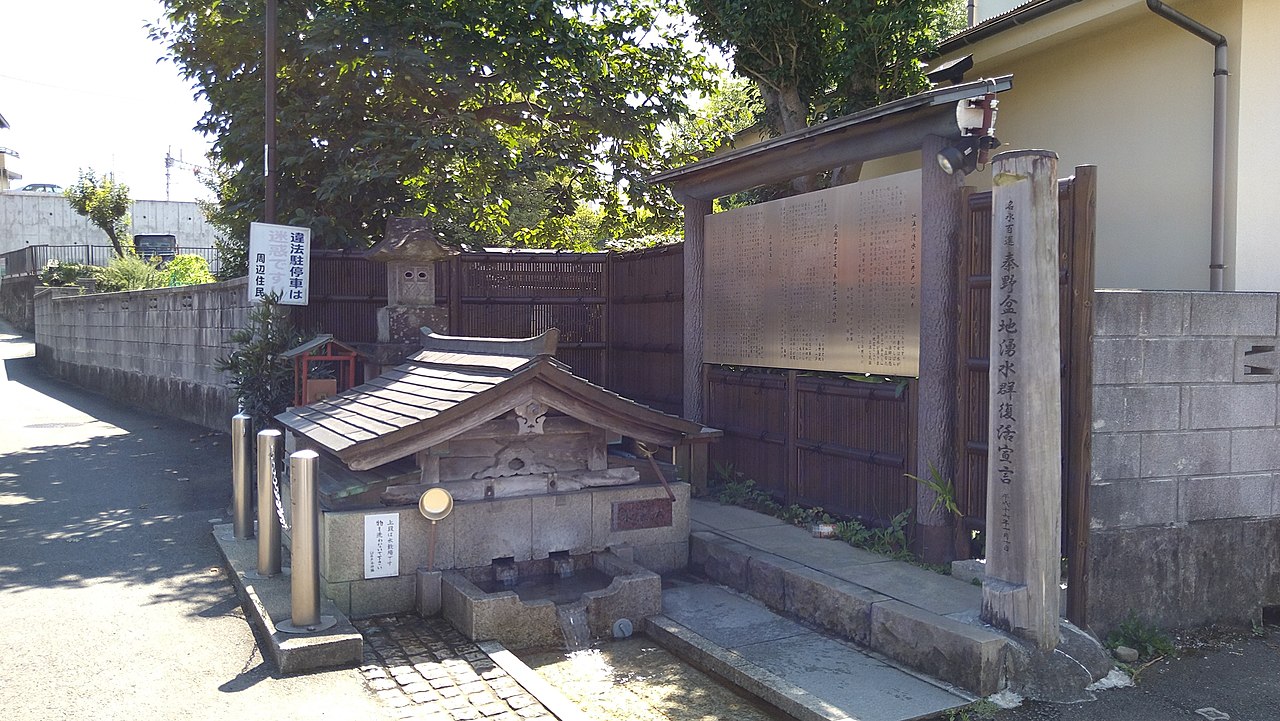
The city's folktale says that Kobo Daishi planted his staff in a yard, a girl dug there with a hoe, and clear water welled up. The tourism association writes that the well's shape resembles a mortar, so it is also called Usuido, a name that became a minor place name. It is one of the representative springs of the group chosen as one of the Hundred Famous Waters in 1985.

  • Hundred Famous Waters (selected 1985)
  • Name Usuido
  • Water about 16°C (tourism association)

03 / Great Zelkova of Tsurumaki

A zelkova recorded in the Shinpen Sagamino Kuni Fudokiko stands in Tsurumaki.

The zelkova at Ochihata in Tsurumaki is called the Great Zelkova of Tsurumaki and is a prefectural natural monument. In 1953, the year it was designated, it was a giant tree with a root circumference of 12.5 m, a trunk girth of 10 m at eye level, and a height of 30 m. It is also recorded in the Shinpen Sagami no Kuni Fudokiko of 1842.

  • Prefectural natural monument (1953)
  • Root circumference 12.5 m (1953)
  • Height 30 m (1953)

Hadano City from the sky

Now and 1974–78. Tap a photo to zoom in.

Wide (about 6 km across)

Close (about 1.5 km across)

Now (shot October 2019)Shot 1974–78

Source: Geospatial Information Authority of Japan (GSI) GSI Tiles(全国最新写真(シームレス)/国土画像情報(第一期:1974〜1978年撮影))

Open in GSI Maps (now)Open in GSI Maps (1974–78)

Living here

The prefecture's only basin stores water underground.

  • about 160,000 people
  • 60 min to a city centre

The Hadano Basin, ringed by the Tanzawa Mountains and the Oiso (Shibusawa) Hills, is the only basin in Kanagawa Prefecture. The city writes that its underground structure serves as a natural water tank holding about 750 million tons of groundwater. Springs can be seen throughout the city.

People living here
162,439people
19952020

−3% since 2015

164,722 → 162,439

Area
103.76km²

49.74km² of it habitable

2024

Households
70,478households

2.3 people per household

2020

Rent (average for rentals)
50,799yen

National average 60,630 yen

2023

Healthcare
8 hospitals / 101 clinics

6.7 per 10,000 people

2023

Area103.76km²Habitable land49.74km² / 48%
Area and habitable land at the same scalee-Stat B1101 / B1103
Children waiting for childcare
—24 nurseries and similar
Home purchase subsidy
—
Average annual temperature
—

These 3 items are waiting on a nationwide data source. We do not fill them with estimates.

ACCESS

Where you can go from here.

Hadano City in Japan35.375°N 139.220°E
OsakaHadano City
Hadano Station
秦野駅2026
  • to ShinjukuLtd. exp. Mt. Fuji55min

Travel times follow 小田急電鉄公式「ロマンスカー時刻表」(2026年3月14日改正)の下り・平日(weekday_down2026.pdf)と下り・土休日(holiday_down2026.pdf)のPDF。新宿発と秦野着の行を読んだ (checked 2026-10-21). They vary by time of day.

Shape

Borders 8 municipalities.

Territory of Hadano City
Boundaries: National Land Numerical Information (Administrative Area Data), MLIT. Processed by Machigatari.Lakes: National Land Numerical Information (Lake Data), MLIT. Processed by Machigatari. Prepared with the approval of the Director-General of the Geospatial Information Authority of Japan, using its Digital Map 25000 (Spatial Data Framework) and Digital Map 25000 (Place Names and Public Facilities). (承認番号 平27情使、第585号)

Hadano City isthis kind of town.

  1. 01Soya Park is the former Soya waterworks; remains of the Soya Waterworks, completed in March 1890, were registered in 2017 as a nationally registered monument (archaeological site), and the city writes that Taisho-era reservoir and pump house and a Showa-era reservoir survive overlapping
  2. 02The Sakuradote Tumulus Cluster is a city historic site with 35 round tombs over 200 m by 500 m, and Kobo no Shimizu, where water is said to have welled up when a staff was planted, is one of the representative springs of the Hadano Basin springs, one of the Hundred Famous Waters
  3. 03The Great Zelkova of Tsurumaki, a prefectural natural monument, had a root circumference of 12.5 m and a height of 30 m in 1953 when designated, and the city writes that the Hadano Basin, the prefecture's only basin, holds about 750 million tons of groundwater

If something caught your eye, ask the town itself.