Masugata Pond Springs, Kokubunji City
Article

13214 / こくぶんじし

Tokyo

Kokubunji City

A pond said to have restored her form.

Masugata Pond Springs

Photo by ブルーノ・プラス (CC BY-SA 4.0)

01 / Musashi Kokubunji Temple site

Of a pagoda thought to be about 60 m tall,seven foundation stones remain.
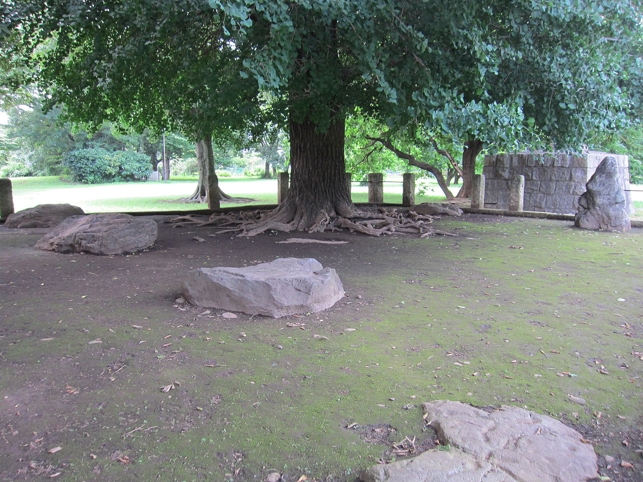
Musashi Kokubunji Temple site in Kokubunji City
Photo by Saigen Jiro (CC0)

The pagoda site lies about 200 m east of the Main Hall site. It was a stone-base building 3 bays (about 10 m) square, thought to be about 60 m tall, and seven foundation stones remain, including the core stone with its socket for the central pillar. Lightning burned it in 835; its rebuilding is recorded as permitted in the Shoku Nihon Koki.

  • 7 foundation stones
  • Estimated height about 60 m
  • National Historic Site (1922)

02 / Pencil Rocket

A 23 cm rocket's test firing pausedwhenever a train drew near.

On April 12, 1955, the horizontal firing test of the 23 cm, 18 mm Pencil Rocket was held in Kokubunji. JAXA's history of its institute says that a Chuo Line train ran beyond the wall, and the countdown was halted whenever one approached.

  • April 12, 1955
  • 23 cm long, 18 mm in diameter
  • Aerospace Technology Heritage (certified by the Japan Society for Aeronautical and Space Sciences, 2024)

03 / Tosando Musashi Road site

To keep an ancient road 12 m wide,the present road was planned anew.

Tosando Musashi Road site in Kokubunji City
Photo by Saigen Jiro (Public domain)

The Tosando Musashi Road ran south from Kozuke Province to the Musashi provincial capital. In Izumi-cho a 12 m wide road trace was confirmed over 490 m; the remains were preserved underground and the present road built over them. About 300 m is kept as a walkway.

  • Road trace 12 m wide, 490 m long
  • About 300 m kept as a walkway
  • Attached to the national Historic Site

Kokubunji City from the sky

Now and 1974–78. Tap a photo to zoom in.

Wide (about 6 km across)

Close (about 1.5 km across)

Now (shot June–November 2019)Shot 1974–78

Source: Geospatial Information Authority of Japan (GSI) GSI Tiles(全国最新写真(シームレス)/国土画像情報(第一期:1974〜1978年撮影))

Open in GSI Maps (now)Open in GSI Maps (1974–78)

Living here

35 minutes from Tokyo, 20 from Shinjuku.

  • about 130,000 people
  • 30 min to a city centre

On the JR Chuo Line, the Chuo Special Rapid takes 35 minutes from Tokyo Station to Kokubunji Station and 20 from Shinjuku (October 2026 timetable; weekday figures, with 32 and 18 minutes on Saturdays and holidays). The nearest station to City Hall is Nishi-Kokubunji on the Musashino Line, a 10-minute walk from the south exit.

People living here
129,242people
19952020

+5.3% since 2015

105,786 → 129,242

Area
11.46km²

11.43km² of it habitable

2024

Households
63,962households

2.0 people per household

2020

Rent (average for rentals)
78,179yen

National average 60,630 yen

2023

Healthcare
2 hospitals / 112 clinics

8.8 per 10,000 people

2023

Almost entirely flat.Almost all of it is habitable land (99.7%)
Area and habitable land at the same scalee-Stat B1101 / B1103
Children waiting for childcare
—28 nurseries and similar
Home purchase subsidy
—
Average annual temperature
—

These 3 items are waiting on a nationwide data source. We do not fill them with estimates.

ACCESS

Where you can go from here.

Kokubunji City in Japan35.710°N 139.463°E
OsakaKokubunji City
Nishi-Kokubunji Station
西国分寺駅2019
  • to TokyoJR Chuo Line (Rapid)35min
  • to ShinjukuJR Chuo Line (Rapid)20min

Travel times follow JR東日本 駅の時刻表(timetables.jreast.co.jp・2610版)の国分寺駅 中央本線・中央線快速 下り(八王子・大月方面)の平日・土曜休日と、中央特快・青梅特快・通勤快速の列車ごとの停車駅一覧ページ (checked 2026-10-23). They vary by time of day.

Shape

Borders 5 municipalities.

Territory of Kokubunji City
Boundaries: National Land Numerical Information (Administrative Area Data), MLIT. Processed by Machigatari.

Kokubunji City isthis kind of town.

  1. 01The Masugata Pond Springs lie below the Kokubunji Cliff Line and are a Tokyo Metropolitan place of scenic beauty. The pond is said to be named for a woman's illness lifting and her original form (masugata) returning
  2. 02The pagoda site of the Musashi Kokubunji Temple ruins keeps seven foundation stones, and the same national site includes the trace of an ancient highway 12 m wide, the Tosando Musashi Road
  3. 03The town where the Pencil Rocket's horizontal firing test took place in 1955; Hikari-cho is named after the Hikari bullet train, because the railway research institute stood there

If something caught your eye, ask the town itself.