Yawata Shirazu no Mori, Ichikawa City
Article

12203 / いちかわし

Chiba Prefecture

Ichikawa City

Facing City Hall, a grove said to trap.

Yawata Shirazu no Mori

Photo by Fred Cherrygarden (CC BY-SA 4.0)

01 / Mikoshi shop

A Gyotoku mikoshi shop's buildinghas a "stout, bold build."

Mikoshi shop in Ichikawa City
Photo by Suikotei (CC BY-SA 4.0)

The former Asako Mikoshi shop and residence is a two-story wooden building from 1929. The city describes it as stout and bold in construction. Valued together with a history of making mikoshi (portable shrines) said to date from the Muromachi period, it was registered as a national Registered Tangible Cultural Property in 2010. It is open to the public as the Gyotoku Fureai Denshokan.

  • Built in 1929
  • Two-story wooden building, tiled roof
  • Registered nationally in 2010

02 / Provincial temple

The tiles of Shimosa Kokubunjibear hosoge-mon, not lotus.

Provincial temple in Ichikawa City
Photo by Saigen Jiro (Public domain)

Shimosa Kokubunji was built under the edict of 741 ordering provincial temples. Its roof tiles carry hosoge-mon, a design of scrollwork that looks like flowers, rather than the lotus design then widely used. The temple site and the Kitashita tile kiln site, where its tiles are thought to have been fired, are national historic sites.

  • Built under the 741 edict
  • Hosoge-mon, not lotus, on the tiles
  • National historic site, 1967

03 / Lantern

In 1812, devotee groups raised a lanternpraying for safe voyages.

It was built by devotee groups visiting Narita-san, from Nihombashi Nishi-gashi in Edo and the Narita-san storehouse residence. The stone lantern is 4.31 meters tall, and its side bears the names of those who helped. It is thought to have served as a landmark for boats and people on the Edo River. It is the city's first designated tangible cultural property.

  • Built in 1812
  • Stone, 4.31 meters tall
  • City's first designated tangible cultural property

Ichikawa City from the sky

Now and 1974–78. Tap a photo to zoom in.

Wide (about 6 km across)

Close (about 1.5 km across)

Now (shot June–November 2019)Shot 1974–78

Source: Geospatial Information Authority of Japan (GSI) GSI Tiles(全国最新写真(シームレス)/国土画像情報(第一期:1974〜1978年撮影))

Open in GSI Maps (now)Open in GSI Maps (1974–78)

Living here

Tokyo in 17 minutes at best on the JR Sobu Line.

  • about 500,000 people
  • 30 min to a city centre

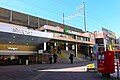
Rapid trains of the JR Sobu Line stop at Ichikawa Station. The fastest daily train takes 17 minutes from Tokyo, and daytime rapids take 18 to 19 minutes (October 2026 timetable). City Hall is about a 10-minute walk from the north exit of Motoyawata Station.

People living here
496,676people
19952020

+3.1% since 2015

440,555 → 496,676

Area
57.44km²

56.21km² of it habitable

2024

Households
242,970households

2.0 people per household

2020

Rent (average for rentals)
72,904yen

National average 60,630 yen

2023

Healthcare
12 hospitals / 321 clinics

6.7 per 10,000 people

2023

Almost entirely flat.Almost all of it is habitable land (97.9%)
Area and habitable land at the same scalee-Stat B1101 / B1103
Children waiting for childcare
—84 nurseries and similar
Home purchase subsidy
—
Average annual temperature
—

These 3 items are waiting on a nationwide data source. We do not fill them with estimates.

ACCESS

Where you can go from here.

Ichikawa City in Japan35.722°N 139.931°E
OsakaIchikawa City
Motoyawata Station
本八幡駅2019
  • to TokyoJR Sobu Line (Rapid)17min

Travel times follow JR東日本 駅の時刻表(2610版・2026年10月ダイヤ)の市川駅(駅コード0136)の下り・平日(0136010)と土曜・休日(0136011)。docs/handoff/tools/jr_count.py(毎日だけに絞る改造版)で、東京・品川の発→市川の発(通過せず停車する駅の時刻)を列車ごとに数えた (checked 2026-10-22). They vary by time of day.

Shape

Borders 6 municipalities across 1 prefectures.

Territory of Ichikawa City
Boundaries: National Land Numerical Information (Administrative Area Data), MLIT. Processed by Machigatari.Lakes: National Land Numerical Information (Lake Data), MLIT. Processed by Machigatari. Prepared with the approval of the Director-General of the Geospatial Information Authority of Japan, using its Digital Map 25000 (Spatial Data Framework) and Digital Map 25000 (Place Names and Public Facilities). (承認番号 平27情使、第585号)

North to south

13.3km

Chiba Prefecture
Matsudo City, Funabashi City, Urayasu City, Kamagaya City, 所属未定地

Ichikawa City isthis kind of town.

  1. 01The small bamboo grove Yawata Shirazu no Mori, opposite City Hall, is said to be a place where those who enter cannot get out and where a curse awaits; the Kojien dictionary has an entry for it. The name is also said to possibly derive from its past as common land of Gyotoku
  2. 02The former Asako Mikoshi shop and residence, built in 1929, is a national registered tangible cultural property. The Shimosa Kokubunji site is a national historic site, with tiles bearing hosoge-mon rather than lotus
  3. 03The Gyotoku lantern, a 4.31-meter stone lantern built in 1812, is the city's first designated tangible cultural property

See the town as it is now.

Source: Wikidata (P2002, P2003, P2013, P2397)

If something caught your eye, ask the town itself.